|
Navigation
LakesnWoods.com
Home
Page
Contact Us
Privacy
Minnesota History Shop
Visit The Minnesota History Shop
www.minnesotahistoryshop.com
Historic maps
Historic books
Historic framed art
Historic
postcards
Clothing with historic
images
And much more!!! |
Virginia Guide:
Photo Gallery
Location
Geography
Demographics
History
Government
Post Office
News
Weather
Street Map
Events
Attractions
Recreation
Lakes
Health Care
Schools
Churches
Media
Motels
Resorts
Campgrounds
Businesses A-M
Businesses N-Z
Aerial Photo
Topographic Map Nearby Communities
Angora
Aurora
Babbitt
Biwabik
Buhl
Chisholm
Cook
Embarrass
Ely
Eveleth
Gilbert
Hibbing
Hoyt Lakes
Kinney
McKinley
Mountain
Iron
Soudan
Tower © 2004-2024
LakesnWoods LLC
All Rights Reserved
DCMA, Defamation, Copyright and Trademark Infingement Policy
|
WANTED! Do you have photos, historical accounts or
other items pertaining to the Virginia area? Would you like to
share this historical information with the world?
LakesnWoods.com would like to publish your Virginia photos
(current or historical) or historical accounts on this website.
Original materials can be returned and your privacy will be
respected.
Contact us |
|
Virginia Minnesota Community Guide
Location:
Population:
Virginia
(city) |
1970 |
1980 |
1990 |
2000 |
2010 |
2000-2010
Change |
| Actual |
Percent |
| Population |
12,450 |
11,056 |
9,410 |
9,157 |
8,712 |
-445 |
-4.86 |
| Land Area (sq. mile) |
8.50 |
18.31 |
16.83 |
18.84 |
19.18 |
+0.34 |
+1.80 |
| Density (persons per sq. mile) |
1,464.7 |
603.8 |
559.1 |
486.1 |
462.2 |
-23.68 |
-4.87 |
| Housing Units |
4,805 |
5,025 |
4,706 |
4,692 |
4,738 |
+46 |
+0.98 |
| Households |
-- |
4,757 |
4,338 |
4,333 |
4,242 |
-91 |
-2.10 |
| Persons Per Household |
-- |
2.26 |
2.09 |
2.00 |
2.05 |
+0.05 |
+2.50 |
Geography:
According to the United States Census
Bureau, the city has a total area of 19.18 square miles (49.68
km2); 18.85 square miles (48.82 km2) is land and 0.33 square
miles (0.85 km2) is water. U.S. Highway 53, U.S. Highway 169,
and State Highway 135 (MN 135) are three of the main routes in
Virginia. The elevation is 1,437.37 feet (438 M). Virginia
is located on the Mesabi Range, one of sub-regions within
Minnesota's Iron Range.
From
Wikipedia, the free
encyclopedia.
Demographics:
As of the
census of 2010, there were 8,712 people,
4,242 households, and 2,019 families
residing in the city. The population
density was 462.2 inhabitants per square
mile (178.5 /km2). There were 4,738
housing units at an average density of
251.4 per square mile (97.1 /km2). The
racial makeup of the city was 91.7%
White, 1.6% Africa American, 3.0% Native
American, 0.5% Asian, 0.3% from other
races, and 2.9% from two or more races.
Hispanic or Latino of any race were 1.5%
of the population. There were
4,242 households of which 21.8% had
children under the age of 18 living with
them, 31.7% were married couples living
together, 12.0% had a female householder
with no husband present, 4.0% had a male
householder with no wife present, and
52.4% were non-families. 46.3% of all
households were made up of individuals
and 20% had someone living alone who was
65 years of age or older. The average
household size was 1.95 and the average
family size was 2.74. The median
age in the city was 44.9 years. 18.9% of
residents were under the age of 18; 9.3%
were between the ages of 18 and 24;
21.8% were from 25 to 44; 27.9% were
from 45 to 64; and 22% were 65 years of
age or older. The gender makeup of the
city was 47.9% male and 52.1% female.
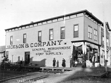
History:
Ore was discovered in the Virginia area in March 1892.
Ore was discovered in Mountain Iron by Leonidas Merritt in 1890. Virginia
was settled to accommodate the Iron Ore Mining in the area. Lumbering came
later to take care of the settlement in building the town. Both turned out
to be big businesses. At one time Virginia had both the largest White Pine
Mill in the world and the biggest ore producing mine-Mesaba Mountain. Virginia
got its name "Queen City Mesaba" because of it's progressiveness. Virginia
has fifteen buildings on the National Register of Historic Places and the
downtown commercial district is also on the register. Mountain Iron is the
birthplace of the Mesabi Iron Range. Courtesy Minnesota
Historical Society
Government:
Virginia City Hall
327 1st Street S
Virginia, MN 55792
Phone: (218) 748-7500
Fax: (218) 748-3580Regular
Business Hours:
Monday - Friday 8:00 am - 4:30 pm
City Council Meetings:
2nd and
4th Tuesday of the month at 6:30 pm


 |
 |
| Title |
Terms Ends |
Name |
|
Phone |
| Mayor |
12/31/2022 |
Larry A. Cuffe Jr.
717 Bourgin Road
Virginia, MN 55792 |
|
(218) 748-3560
(218) 780-9941 |
| City Administrator |
appointed |
Britt See-Benes
327 1st Street S
Virginia, MN 55792 |
|
(218) 748-7500 |
| Clerk |
appointed |
Pamela LaBine
327 1st Street S
Virginia, MN 55792 |
|
(218) 748-7500 |
| Councilor |
12/31/2022 |
Gary Friedlieb
606 3rd Street S
Virginia, MN 55792 |
|
(218) 748-7500
(218) 742-7721 |
| Councilor |
12/31/2022 |
Charlie Baribeau
909 11th
Street S
Virginia, MN 55792 |
|
(218) 748-7500
(218) 741-0677 |
| Councilor |
12/31/2022 |
Maija Biondich
303 Chestnut Street
Virginia, MN 55792 |
|
(218) 748-7500
(218) 780-6221 |
| Councilor |
12/31/2024 |
Carl Baranzelli
210 11th Street S
Virginia, MN 55792 |
|
(218) 748-7500
(218) 741-9336 |
| Councilor |
12/31/2024 |
Steven B. Johnson
325 8th Street S
Virginia, MN 55792 |
|
(218) 748-7500
(218)
994-2094 |
| Councilor |
12/31/2024 |
Julianne Paulsen
525 12th
Street S
Virginia, MN 55792 |
|
(218) 748-7500
(218)
929-2100 |
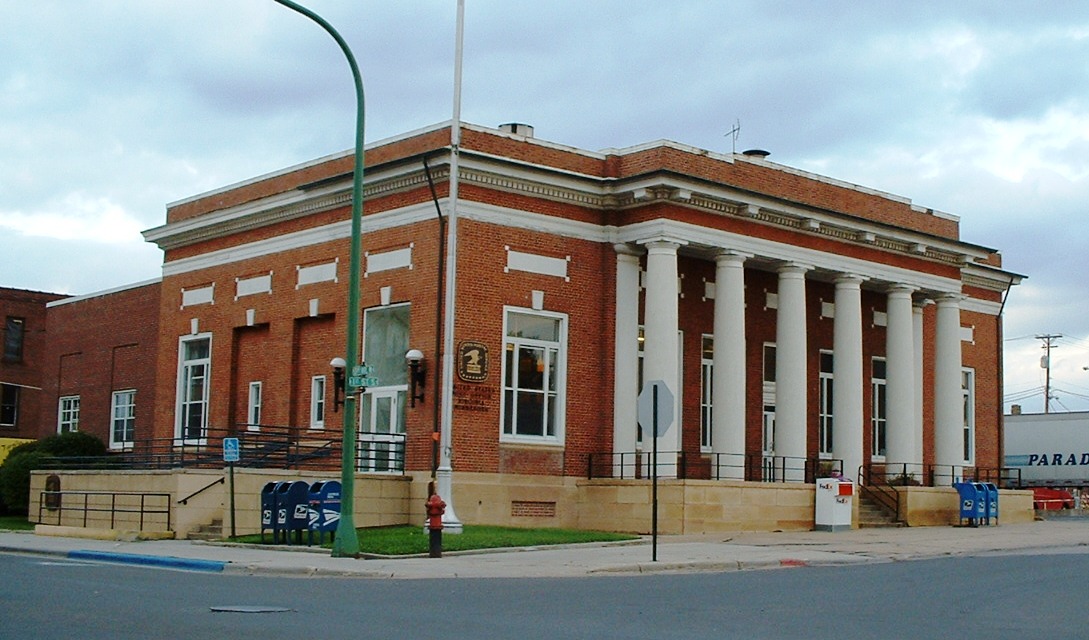
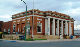
Post
Office:
US Post Office
231 1st Street S
Virginia, MN 55792-5050
Phone: (218) 741-4919
Regular Business Hours:
Week Days
8:30 am - 5:00 pm
Saturday
9:30 am - 11:30 am
|
 |
Utilities:
Major
Employers:
|
Employer |
Products/Services |
Employees |
|
Minntac |
Support Activities for
Mining |
1,600 |
|
Essentia Health-Virginia |
General Medical &
Surgical Hospitals |
650 |
|
St. Louis County |
Executive, Legislative,
& Other Gen. Govt. Support |
486 |
|
Arrowhead Economic Opportunity Agency |
Vocational
Rehabilitation Services |
340 |
|
Virginia Public
Schools |
Elementary & Secondary
Schools |
320 |
|
Target |
Department Stores |
150 |
|
St. Michael’s
Health & Rehab Center |
Community Care
Facilities for the Elderly |
134 |
|
City of Virginia |
Executive, Legislative,
& Other Gen. Govt. Support |
109 |
|
Mesabi Range Community College -
Virginia Campus |
Colleges, Universities,
& Professional Schools |
95 |
|
Mesabi Daily News |
Newspaper, Periodical,
Book, & Directory Publishers |
70 |
|
Department of Public Utilities |
Electric Power
Generation, Transmission & Dist. |
67 |
News:
Weather:
Map:
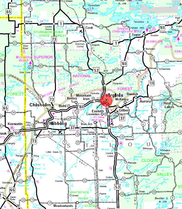
Minnesota State
Highway Map of the Virginia Minnesota area
Events:
|
Land of the Loon Festival |
3rd Weekend in June |
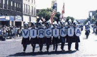 The
two-day festival kicks off on the third full weekend of June on
Saturday morning with a Parade along Chestnut Street in downtown
Virginia. This year’s parade will start at 9:00 AM. Then follow
the crowd to beautiful Olcott Park to sample the ethnic food, dance
to the continuous music, see the hundreds of arts and crafts booths
and celebrate the weekend long entertainment. The
two-day festival kicks off on the third full weekend of June on
Saturday morning with a Parade along Chestnut Street in downtown
Virginia. This year’s parade will start at 9:00 AM. Then follow
the crowd to beautiful Olcott Park to sample the ethnic food, dance
to the continuous music, see the hundreds of arts and crafts booths
and celebrate the weekend long entertainment. |
Attractions:
|
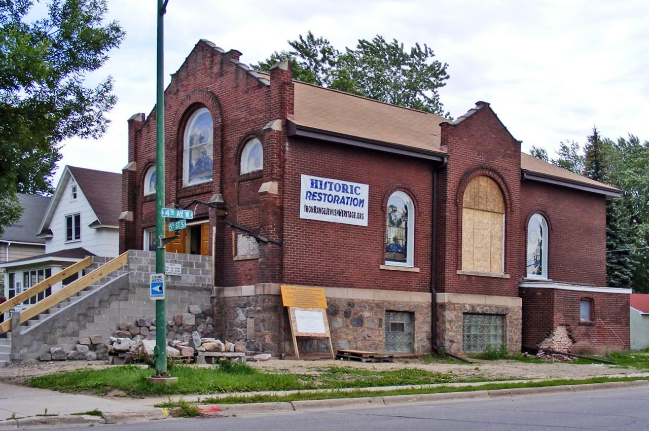
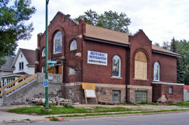
B'nai Abraham
Museum and Cultural Arts Center The
B'nai Abraham, located in Virginia MN on the Iron Range, is
nearly 100 years old, and registered on the National Register of
Historic Places. Since the Jewish population has mostly left the
area, and it can no longer be a functioning synagog...ue, the
FRIENDS of B'NAI ABRAHAM is restoring it as a museum and
cultural center. For more information, please go to
www.ironrangejewishheritage.org THANKS, and come to
visit! |
 |
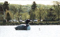
| Giant Loon
Centerpiece
of the annual Land of the Loon Festival, this loon floats on Silver
Lake in the heart of Virginia. |
 |
Heritage Museum
800 9th Avenue North
Virginia, MN
Phone: (218)
741-1136This museum complex
consists of the former park superintendent's residence, a Finnish
log house, a depression-era tourist cabin and permanent exhibits
of Virginia's history. |
|
Laurentian Chamber of Commerce
403 First Street North
Virginia, MN 55792
Phone: (218) 741-2717The
Laurentian Chamber of Commerce is an information and referral center
serving businesses in Virginia, Eveleth, Mountain Iron, Gilbert,
and surrounding communities. The Chamber office is located at 403
First Street North (next to Bailey's Lake) in downtown Virginia.
Our trained Hospitality Hosts at Mineview in the Sky Visitors' Information
Center & Overlook welcome thousands of visitors from May-October
on Highway 53 South of Virginia. |
 |
Oldtown Fintown Mineview Overlook
East end of 3rd Street North
Virginia, MNThis overlook provides
a panoramic view of the Missabe Mountain Pit, which features red-colored
walls and lush greenery. Peregrine falcons nest on the pit's east
wall. |
|
Recreation:
|
Mesabi Trail
 The
Taconite State Trail stretches 165 miles from Grand Rapids to Ely
and intersects with the Arrowhead State Trail just west of Lake
Vermillion. Portions are paved for biking and in-line skating. The
remainder of the natural surface trail is used primarily for snowmobiling
in the winter. The trail goes through a few areas that have standing
water in the summer, however portions of the trail are suitable
for horseback riding, hiking, and mountain biking. The
Taconite State Trail stretches 165 miles from Grand Rapids to Ely
and intersects with the Arrowhead State Trail just west of Lake
Vermillion. Portions are paved for biking and in-line skating. The
remainder of the natural surface trail is used primarily for snowmobiling
in the winter. The trail goes through a few areas that have standing
water in the summer, however portions of the trail are suitable
for horseback riding, hiking, and mountain biking. The Taconite Trail winds through forests of birch
and aspen intertwined with pine, leading the visitor by many isolated
lakes and streams. From Grand Rapids heading north, you see the
impact of the taconite and iron mining industry. The northern portion
of the trail terrain is rolling and tree covered as it winds through
state and national forest land. Eight trail waysides and picnic facilities offer
scenic vistas of the hills, lakes and rivers of this area. The trail
also links three state parks: Bear Head Lake, Soudan Underground
Mine, and McCarthy Beach. The landscape in and around Bear Head
Lake State Park is very rolling and rocky. |
Virginia Golf Course
1308 18th Street N
Virginia, MN
Phone: (218)
748-7530 |
|
Lakes:
|
Lake Name |
Size
(acres) |
Lake info |
Lake Map |
Rec Map |
Topo Map |
| Sand |
701 |
 |
|
|
|
| Silver |
44 |
|
|
|
|
| Virginia |
32 |
|
|
|
|
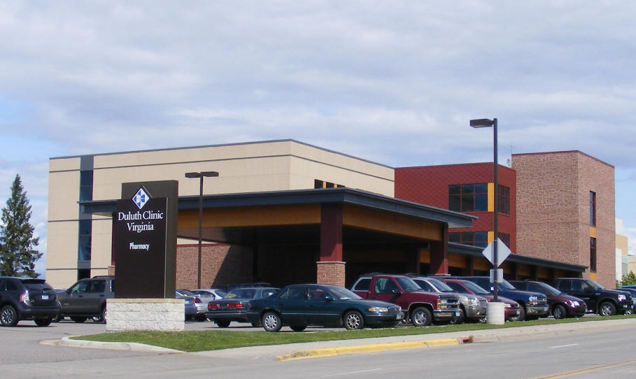
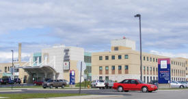
Health Care:
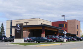
Duluth Clinic Virginia
910 N 6th Avenue
Virginia, MN
Phone: (218)
741-0150 |
 |
Virginia Regional Medical Center
901 N 9th Street
Virginia, MN
Phone: (218)
741-3340 |
 |
Schools:
Mesabi Range Community & Technical
College
1001 Chestnut Street W
Virginia, MN
Phone: (218)
741-3095
Toll Free:
(800) 657-3860 |
|
Virginia Minnesota Public Schools - Independent School District
#706
411 5th Avenue S
Virginia, Minnesota, 55792
Phone: (218) 749-5437
Fax: (218) 741-8522
Web: www.vmps.org
Grades: PK-23
Students: 1,658 |
|
Virginia High School
411 5th Avenue S
Virginia, Minnesota, 55792
Phone: (218) 749-5437
Fax: (218) 741-8522Grades: 7-12
Students: 751 |
|
Roosevelt Elementary
411 5th Avenue S
Virginia, Minnesota, 55792
Phone: (218) 749-5437
Fax: (218) 741-8522Grades: 4-6
Students: 328 |
|
Parkview Elementary School
506 N 9th Avenue
Virginia, MN 55792
Phone: (218) 749-5437
Fax: (218) 742-3802Grades: PK-3
Students: 563 |
|
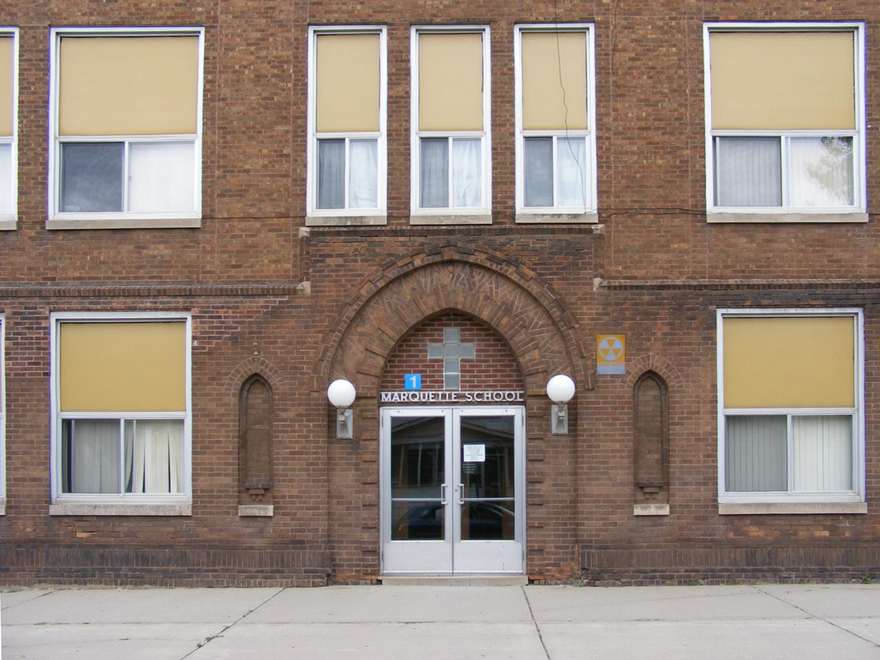
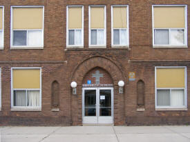
Marquette Catholic School
311 3rd Street S
Virginia, MN
55792
Phone: (218) 741-6811
Grades: K-7
Students: 111 |
 |
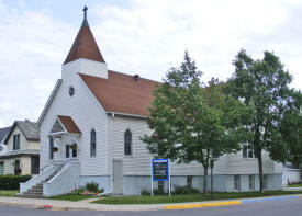
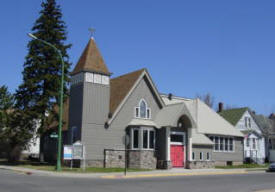
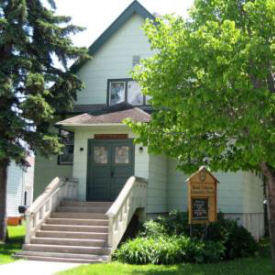
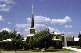
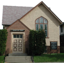
Churches:
Bible Chapel
702 S 5th Avenue
Virginia, MN 55792
Phone: (218)
741-4833
Web:
www.mybiblechapel.com Pastor:
n/a
Sunday Worship: 9:30 am |
|
Church of Jesus Christ
of Latter Day Saints
600 13th Street S
Virginia, MN 55792
Phone: (218)
749-2490Pastor:
Sunday Worship: |
|
Cornerstone Family Church
415 Chestnut Street
Virginia, MN 55792
Phone: (218)
741-6134
Web:
www.cornerstonefamilychurch.info Pastor:
Rev. Hartikka
Sunday Worship: 10:30 am |
 |
Emmanuel Baptist Church
93 Midway Drive
Virginia, MN 55792
Phone: (218)
741-4446
Fax: (218) 741-8650
Web:
www.ebcvirginia.org Pastor:
Sunday Worship: |
|
First Apostolic Lutheran
Church
5 Laurentian Drive
Virginia, MN 55792
Phone: (218)
749-6416Pastor:
Sunday Worship: |
|
First Covenant Church
231 5th Street S
Virginia, MN 55792
Phone: (218)
741-7117
Web:
www.virginiafirstcov.org
Pastor: Roger Johnson
Sunday Worship: 9:30 am |
 |
Gethsemane Evangelical
Lutheran Church
901 S 4th Street
Virginia, MN 55792-3074
Phone: (218)
741-4961
Web:
www.gelc.info
Pastor: Nathan Sager
Sunday Worship: 8:30 am & 10:45 am |
|
Gloria Dei Lutheran
Church
(Missouri Synod)
6959 Highway 169
Virginia, MN 55792
Phone: (218)
741-1977Pastor:
Sunday Worship: |
|
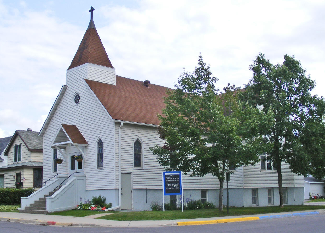
Good Shepherd Lutheran
Church AFLC
230 S 3rd Street
Virginia, MN 55792
Phone: (218)
741-9003Pastor: Don Nore
Sunday Worship: 9:30 am |
 |
Grace Baptist Church
705 3rd Avenue S
Virginia, MN 55792
Phone: (218)
741-043Pastor:
Sunday Worship: |
|
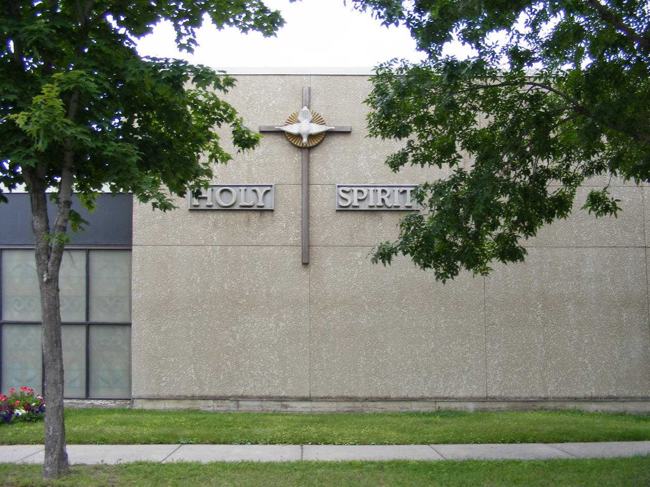
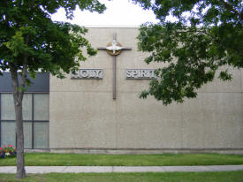
Holy Spirit
Catholic Church
306 2nd Street S
Virginia, MN 55792-2628
Phone: (218)
741-6344
Fax: (218) 741-6345Pastor: Rev.
John O'Donnell
Saturday: 4:30 pm
Sunday Mass: 10:30 am |
 |
Hope Community Presbyterian
Church
212 5th Avenue W
Virginia, MN 55792
Phone: (218)
741-7336
Web:
www.hopecommunitypc.org
Pastor: Rev. Nathan Williams
Sunday Worship: 10:30 am |
 |
Hosanna Christian
Fellowship Church
1016 S 6th Avenue
Virginia, MN 55792
Phone: (218)
741-6301Pastor:
Sunday Worship: |
|
Mesabi Unitarian Universalist
Church
230 S 7th Street
Virginia, MN 55792
Phone: (218) 741-8849
Web:
www.mesabiuu.org
Pastor: n/a
Sunday Worship: 10:30 am We are a lay-led congregation drawing from the
surrounding 50 mile radius of Virginia, Minnesota. We do enjoy
the services of two ordained ministers. Our Mission Statement:
Nurturing the spirit, honoring the earth, celebrating all life,
fostering peace and social justice. |
 |
Messiah Lutheran Church
8950 Enterprise Drive
S
Virginia, MN 55792
Phone: (218)
741-7057Pastor: n/a
Sunday Worship: |
|
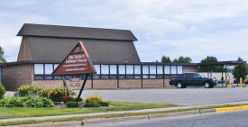
Our Savior's Lutheran
Church - ELCA
1111 S 8th Street
Virginia, MN 55792
Phone: (218)
741-6207
Web: www.oslcmn.com Pastor:
Rev. Robert Simensen
Sunday Worship: 9:30 am |
 |
Pike Apostolic Lutheran
Church
6997 Oberg Road
Virginia, MN 55792
Phone: (218)
741-8354Pastor:
Sunday Worship: |
|
Sacred Heart Church
603 N 12th Street
Virginia, MN 55792
Phone: (218)
741-2322Pastor:
Sunday Worship: |
|
Saint Paul's Episcopal
Church
231 3rd Street S
Virginia, MN 55792
Phone: (218)
741-1379
Web:
www.speravi.com/stpaulPastor:
Rev. Douglas Morrison-Cleary
Sunday Worship: 11:00 am |
 |
Seventh Day Adventist
Church
2nd Street & 3rd Avenue
S
Virginia, MN 55792
Phone: (218)
741-9070Pastor:
Sunday Worship: |
|
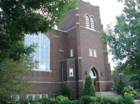
Trinity Lutheran Church
Missouri Synod
900 13th Street S
Virginia, MN 55792
Phone: (218)
741-1911Pastor:
Sunday Worship: |
|
True Hope Fellowship
1 Sunrise Drive
Virginia, MN 55792
Phone: (218) 741-2124
Fax: (218) 741-4634
Pastor: Rev. Joel Kallberg
Sunday Worship: 9:15 am |
|
Unitarian Mesabi Church
230 7th Street
Virginia, MN 55792
Phone: (218) 741-8849
Web:
www.mesabiuu.orgPastor: n/a
Sunday Worship: 10:30 am |
 |
United Methodist Church
of Virginia
303 9th Avenue S
Virginia, MN 55792
Phone: (218)
741-7738
Web:
www.umcvirginiamn.org Pastor:
n/a
Sunday Worship: 10:30 am |
 |
Virginia Church of Christ
702 5th Avenue S
Virginia, MN 55792
Phone: (218)
741-5205
Web:
www.virginiachurchofchrist.com
Pastor: Edward Clark
Sunday Worship: 10:00 am & 6:00 pm |
 |
Virginia Gospel Church
711 5th Avenue S
Virginia, MN 55792
Phone: (218)
741-2513Pastor:
Sunday Worship: |
|
Media:
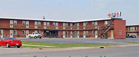
Motels:
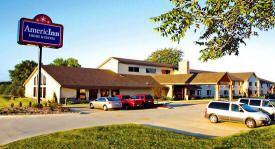
Americinn
Lodge & Suites
5480 Mt. Iron Drive
Virginia, MN 55792
Phone: (218) 741-7839
Toll Free: (888) 741-7839
Web:
www.americinn.com
Our Virginia hotel offers a variety of room
types, including spacious suites with whirlpools and fireplaces,
that are perfect for business or leisure travelers in
Minnesota. Come to our Virginia MN hotel and be treated to an
inviting pool, great service, free breakfast, and quiet nights! |
 |
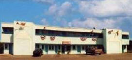
Budget
Host Inn Virginia
1 Midway Drive
Virginia, MN 55792
Phone: (218) 741-6145
Toll Free: (800) BUD-HOST
Web:
www.budgethost.com
23 Rooms
Cable TV witih movie channels
Direct-dial phones
Continental breakfast
Nonsmoking rooms
Family rooms
Kitchenettes |

 |
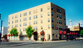
Coates Plaza Hotel
502 Chestnut Street
Virginia, MN 55792
Phone: (218) 749-1000
Toll Free: (800) 777-4699
Fax: (218) 749-6934
Web:
www.coatesplazahotel.com
We are pleased to offer 70
guest rooms arranged in two connected buildings with a three
story glass atrium pool area with swimming pool, whirlpool and
sauna. Our friendly and professional staff will make your stay
memorable one. |

 |
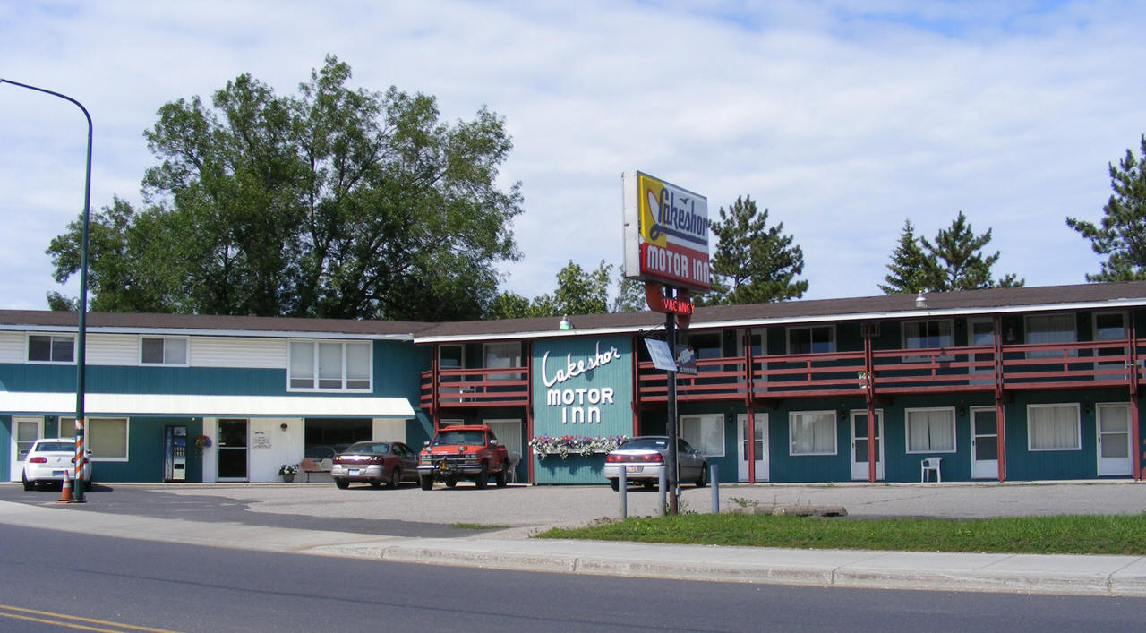
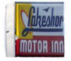
Lakeshor Motor Inn
404 N Sixth Avenue
Virginia, MN 55792
Phone: (218) 741-3360
Toll Free: (800) 569-8131
Fax: (218) 741-3363
Web:
www.lakeshor.com
Located between two beautiful lakes in
historic downtown Virginia, Minnesota. We are a family owned &
operated motel, where a warm welcome & relaxed atmosphere awaits
you. We have exceptionally clean affordable rooms with AAA
rating. |
 |
Pine View Inn
903 N 17th Street
Virginia, MN 55792
Phone: (218) 741-8918
Toll Free: (866) 263-0535
Fax: (218) 749-3279
Web:
www.pineviewinnmotel.com
We are proud to deliver the best value in
lodging accommodations on the Iron Range in the city of Virginia
"The Queen City of the North". We are a AAA approved lodging
facility so you are assured of a clean, quiet updated room. |
  |
Resorts:
Voyageur's Sand Lake Resort
7449 Highway 53
Virginia, MN 55792
Phone: (218) 749-3057 |
|
Campgrounds:
Business Directory:
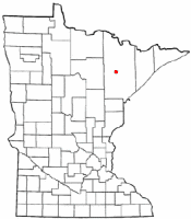
Aerial Photo:
Topographic Map:
[click map to enlarge, zoom in or zoom out]
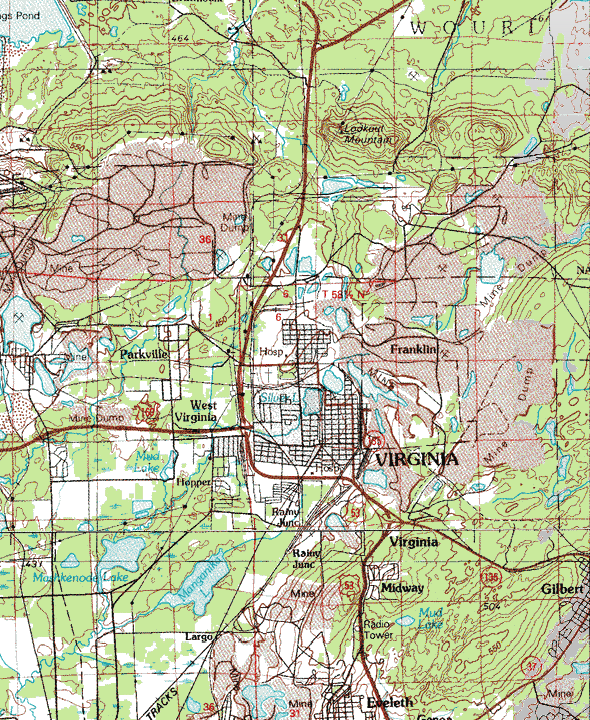
Topographic map is courtesy of the Minnesota DNR
- click map to zoom or enlarge
|
|