|
|
|
|
|
Navigation
LakesnWoods.com
Nearby Communities: © 2004-2025 DCMA, Defamation, Copyright and Trademark Infingement Policy
|
|
||||||||||||||||||||||||||||||||||||||||||||||||||||||||||||||||||||||||||||||||||||||||||||||||||||||||||||||||||||||||||||||||||
 |
|
| South Koochiching (unorganized teritory) |
1970 | 1980 | 1990 | 2000 | 2010 | 2000-2010 Change | |
|---|---|---|---|---|---|---|---|
| Actual | Percent | ||||||
| Population | 267 | 189 | -78 | -29.21 | |||
| Land Area (sq. mile) | 844.4 | 844.4 | 0 | 0.00 | |||
| Density (persons per sq. mile) | 0.32 | 0.22 | -0.10 | -29.21 | |||
| Housing Units | 408 | 385 | -23 | -5.64 | |||
| Households | 121 | 97 | -24 | -19.83 | |||
| Persons Per Household | 2.21 | 1.95 | -0.26 | -11.76 | |||
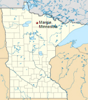
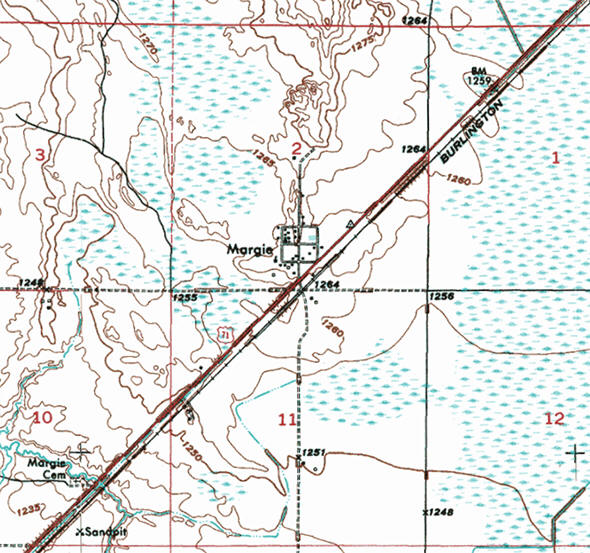
Margie is an unincorporated community in Koochiching
County located near Big Falls. Margie is located in the South
Koochiching unorganized territory. Dinner Creek flows through the
community. Margie is located within the Pine Island State Forest.
South Koochiching is an unorganized
territory in Koochiching County. According to the United States Census
Bureau, the unorganized territory has a total area of 845.5 square miles
(2,189.7 km²), of which 844.4 square miles (2,186.9 km²) of it is land
and 1.1 square miles (2.8 km²) of it (0.13%) is water.
From Wikipedia, the free encyclopedia.
As of the census of 2000, there were 267 people, 121 households, and 86 families residing in the unorganized territory. The population density was 0.3 people per square mile (0.1/km²). There were 408 housing units at an average density of 0.5/sq mi (0.2/km²). The racial makeup of the unorganized territory was 94.76% White, 3.75% Native American, and 1.50% from two or more races. Hispanic or Latino of any race were 0.37% of the population.
There were 121 households out of which 22.3% had children under the age of 18 living with them, 58.7% were married couples living together, 5.0% had a female householder with no husband present, and 28.9% were non-families. 26.4% of all households were made up of individuals and 12.4% had someone living alone who was 65 years of age or older. The average household size was 2.21 and the average family size was 2.60.
In the unorganized territory the population was spread out with 18.0% under the age of 18, 4.9% from 18 to 24, 21.3% from 25 to 44, 33.7% from 45 to 64, and 22.1% who were 65 years of age or older. The median age was 49 years. For every 100 females, there were 118.9 males. For every 100 females age 18 and over, there were 119.0 males.
The median income for a household in the unorganized territory was $33,250, and the median income for a family was $35,417. Males had a median income of $37,188 versus $15,938 for females. The per capita income for the unorganized territory was $16,295. About 2.2% of families and 6.5% of the population were below the poverty line, including 2.4% of those under the age of 18 and 17.3% of those 65 or over.
Visit The
Minnesota History Shop! |
MARGIE, a station of the Northern Pacific Railroad in T. 153N, R. 26W (Dinner Creek), section 2, with a post office established in 1903 and named for the daughter of postmaster Westley Horton, the post office being located in their store. It was located at a site on high land between two swamps; there were several stores and a sawmill.
Courtesy Minnesota Historical Society
|
|
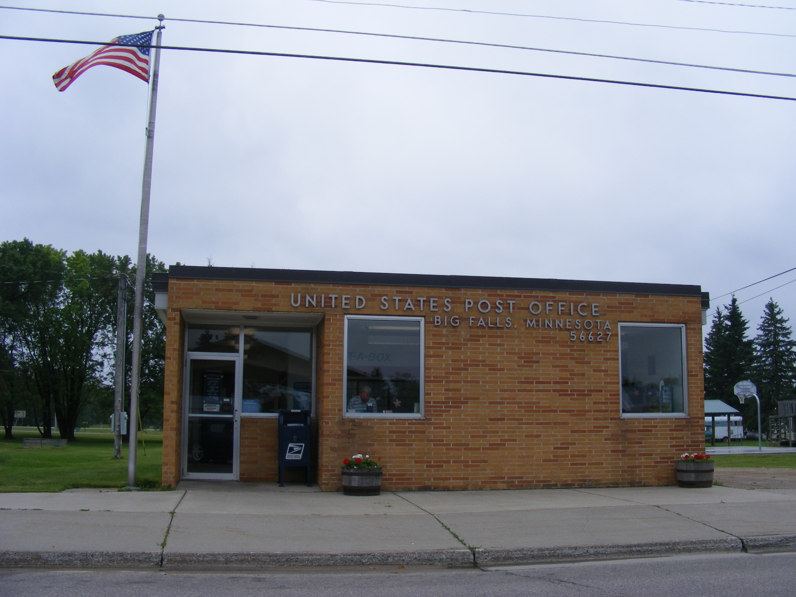
| Margie is unincorporated; services provided by Koochiching County |
| US Post Office 305 2nd Street NW Big Falls, MN 56627-9725 Phone: (218) 276-2301 Toll Free: (800) ASK-USPS
Regular Business Hours:  
|
|
| Utility Type | Utility Name | Utility Phone |
| Electricity | North Star Electric Co-op | (888) 634-2202 |
| Natural Gas | n/a | -- |
| Wastewater | n/a | -- |
| Water | n/a | -- |
| Telephone | Frontier Communication | (800) 435-1504 |
| Cable TV | n/a | -- |
| Employer | Products/Services | Employees |
|
n/a |
||
| MARGIE WEATHER |
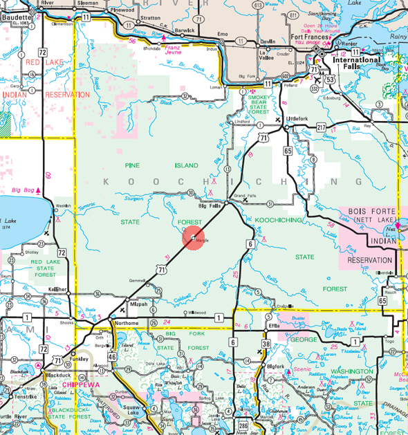
Minnesota State
Highway Map of the Margie Minnesota area
|
none |
Check Out
The Minnesota
History Shop! Good Goods and
Great Gifts! |
|
none |
|
none |
| Lake Name | Size (acres) |
Location | Lake info | Lake Map | Rec Map | Topo Map |
|---|---|---|---|---|---|---|
|
none in the immediate area |
||||||
|
none |
|
none |
|
none |
|
none |
|
none |
|
none |
|
none |
|
|
|
|
© 2004-2025
LakesnWoods LLC All Rights Reserved |
|
|
|
|
|||