|
|
|
|
|
|
Navigation LakesnWoods.com
© 2004-2025 DCMA, Defamation, Copyright and Trademark Infingement Policy
|
|
|||||||||||||||||||||||||||||||||||||||||||||||||||||||||||||||||||||||||||||||||||||||||||||||||||||||||||||||||||||||||||||||||||||||||||||||||||||||||||||||||||||||||||||||||||||||||||||||||||||||||||||||||||||||||||||||||||||||||
 |
 |
| Vermillion (city) | 1970 | 1980 | 1990 | 2000 | 2010 | 2000-2010 Change | |
|---|---|---|---|---|---|---|---|
| Actual | Percent | ||||||
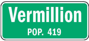
| Population | 359 | 438 | 510 | 437 | 419 | -18 | -4.12 |
| Land Area (sq. mile) | 1.00 | 0.99 | 1.00 | 1.00 | 1.00 | 0 | 0.00 |
| Density (persons per sq. mile) | 359.0 | 442.4 | 510.0 | 437.0 | 419.0 | -18 | -4.12 |
| Housing Units | 81 | 126 | 161 | 161 | 162 | +1 | +0.62 |
| Households | -- | 123 | 157 | 160 | 156 | -4 | -2.50 |
| Persons Per Household | -- | 3.56 | 3.25 | 2.73 | 2.69 | -0..4 | -1.47 |
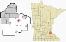
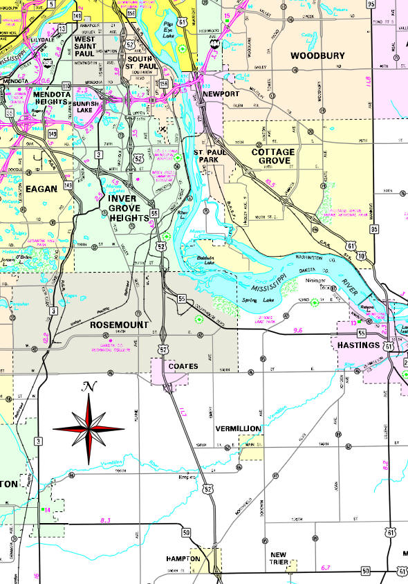
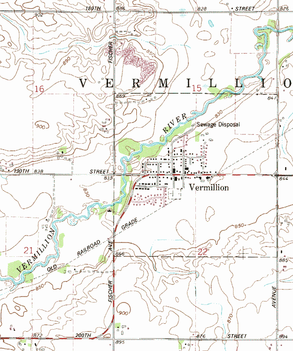
VeAccording to the United States Census Bureau, the city has a total area of 0.97 square miles (2.51 km2), of which 0.96 square miles (2.49 km2) is land and 0.01 square miles (0.03 km2) is water. The main routes include Main Street (190th Street East / County 62), Fischer Avenue (County 66), and Goodwin Avenue (County 85). U.S. Highway 52 and Northfield Boulevard (County 47) are both nearby. The Vermillion River flows through the community. The elevation is 843 ft (257 m) above sea level.
From Wikipedia, the free encyclopedia.
As of the census of 2010, there were 419 people, 156 households, and 121 families living in the city. The population density was 436.5 inhabitants per square mile (168.5/km2). There were 162 housing units at an average density of 168.8 per square mile (65.2/km2). The racial makeup of the city was 96.4% White, 0.2% African American, 1.4% Asian, and 1.9% from two or more races. Hispanic or Latino of any race were 0.2% of the population.
There were 156 households, of which 32.7% had children under the age of 18 living with them, 67.3% were married couples living together, 5.8% had a female householder with no husband present, 4.5% had a male householder with no wife present, and 22.4% were non-families. 18.6% of all households were made up of individuals, and 10.3% had someone living alone who was 65 years of age or older. The average household size was 2.67 and the average family size was 3.03.
The median age in the city was 40.6 years. 22.2% of residents were under the age of 18; 8.1% were between the ages of 18 and 24; 26.3% were from 25 to 44; 31.8% were from 45 to 64; and 11.7% were 65 years of age or older. The gender makeup of the city was 52.5% male and 47.5% female.
Visit The
Minnesota History Shop! |
The lower parts of the
Courtesy Minnesota Historical Society
| Vermillion City Hall 105 Main Street East PO Box 67 Vermillion, MN 55085 Phone: (651) 437-8163 Regular Business Hours: |
||||
| Title | Term Ends | Name and Address | Phone | |
| Mayor | 12/31/2022 | Brian Mann 203 Minnesota Avenue S Vermillion, MN 55085 |
(651) 437-9533
(651) 829-5689 |
|
| Clerk/Treasurer | appointed | Lisa Rowan PO Box 67 Vermillion, MN 55085 |
 |
(612) 230-7435 |
| Council Member | 12/31/2022 | Joe Munson 112 East Oak Street Vermillion, MN 55085 |
(651) 815-1401 | |
| Council Member | 12/31/2022 | Adam Kasel 203 Shady Avenue Vermillion, MN 55085 |
(651) 587-6586 | |
| Council Member | 12/31/2024 | Aaron Rother 302 Evergreen Street W Vermillion, MN 55085 |
(651) 270-1151 | |
| Council Member | 12/31/2024 | Travis John 120 Park Avenue N Vermillion, MN 55085 |
(651) 238-3964 | |
|
US Post Office 108 Park Avenue Vermillion, MN 55085-6500 Phone: (651) 437-7944 Toll Free: (800) ASK-USPS   |
|
||
|
|||
| Utility Type | Utility Name | Utility Phone |
| Electricity | n/a | n/a |
| Natural Gas | n/a | n/a |
| Wastewater | n/a | n/a |
| Water | n/a | n/a |
| Telephone | n/a | n/a |
| Cable TV | n/a | n/a |
| Employer | Products/Services | Employees |
|
n/a |
||
Minnesota State
Highway Map of the Vermillion Minnesota area
Check Out
The Minnesota
History Shop! Good Goods and
Great Gifts! |
| Lake Name | Size (acres) |
Lake info | Lake Map | Rec Map | Topo Map |
|---|---|---|---|---|---|
|
|
|
|
|
|
Hastings Public
Schools Independent School District #200 1000 West 11th Street Hastings, MN 55033 Phone: (651) 480-7000 The Hastings School District encompasses over 170 square miles and is, geographically, one of the largest school districts in the Twin Cities metropolitan area. The school system has a Kindergarten through grade twelve enrollment of approximately 4,300 students and a total district population of about 28,000 residents. Independent School District #200 serves the cities of Hampton, Hastings, Miesville, New Trier, and Vermillion, and portions of Denmark, Douglas, Hampton, Marshan, Nininger, Ravenna, and Vermillion townships. While most of the school district is located in Dakota County, parts of ISD #200 are in Washington and Goodhue Counties. Grades: K-12 Students: 4,300


|
 |
|
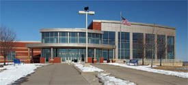
Hastings High School 200 General Sieben Drive Hastings, MN 55033 Phone: (651) 480-7470 Grades: 9-12 Students: 1,460
|
 |
|
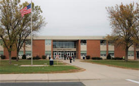
Hastings Middle
School 1000 West 11th Street Hastings, MN 55033 Phone: (651) 480-7060 Grades: 5-8 Students: 1,340
|
 |
|
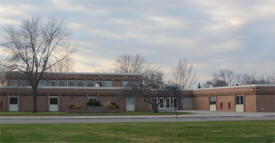
Pinecrest
Elementary School 975 West 12th Street Hastings, MN 55033 Phone: (651) 480-7280 Grades: K-4 Students: 500
|
 |
| Local | |
| Metro | |
|
see the Twin Cities Media Guide page for Twin Cities metro area newspapers, radio and TV |
|
|
|
|
|
© 2004-2025 LakesnWoods LLC All Rights Reserved |
|
|
|
||