|
|
|
|
|
|
Navigation LakesnWoods.com
© 2004-2025 DCMA, Defamation, Copyright and Trademark Infingement Policy
|
|
||||||||||||||||||||||||||||||||||||||||||||||||||||||||||||||||||||||||||||||||||||||||||||||||||||||||||||||||||||||||||||||||||||||||||||||||||||||||||||||||||||||||||||||
 |
|
| Westport (city) | 1970 | 1980 | 1990 | 2000 | 2010 | 2000-2010 Change | |
|---|---|---|---|---|---|---|---|
| Actual | Percent | ||||||
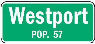
| Population | 65 | 50 | 47 | 72 | 57 | -15 | -20.83 |
| Land Area (sq. mile) | 0.30 | 0.25 | 0.28 | 0.28 | 0.28 | 0 | 0.00 |
| Density (persons per sq. mile) | 216.67 | 200.00 | 167.86 | 257.37 | 203.57 | -53.80 | -20.90 |
| Housing Units | 20 | 26 | 19 | 25 | 23 | -2 | -8.00 |
| Households | -- | 16 | 13 | 23 | 22 | -1 | -4.35 |
| Persons Per Household | -- | 3.13 | 3.62 | 3.13 | 2.59 | -0.64 | -20.45 |
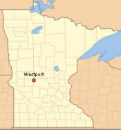
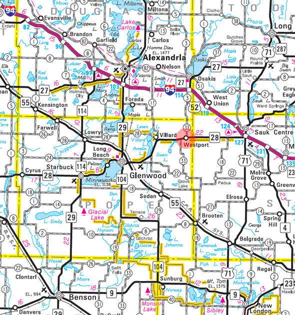
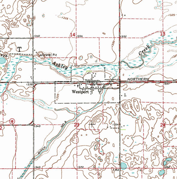
Westport is a city in Pope County, Minnesota. Minnesota Highway 28 serves as a main route in the community.According to the United States Census Bureau, the city has a total area of 0.28 square miles (0.73 km2), all of it land. The elevation is 1,332 ft (406 m) above sea level.
From Wikipedia, the free encyclopedia.
As of the census of 2010, there were 57 people, 22 households, and 13 families residing in the city. The population density was 203.6 inhabitants per square mile (78.6/km2). There were 23 housing units at an average density of 82.1 per square mile (31.7/km2). The racial makeup of the city was 80.7% White, 3.5% African American, and 15.8% from other races. Hispanic or Latino of any race were 15.8% of the population.
There were 22 households of which 36.4% had children under the age of 18 living with them, 50.0% were married couples living together, 4.5% had a female householder with no husband present, 4.5% had a male householder with no wife present, and 40.9% were non-families. 36.4% of all households were made up of individuals and 9% had someone living alone who was 65 years of age or older. The average household size was 2.59 and the average family size was 3.31.
The median age in the city was 39.8 years. 29.8% of residents were under the age of 18; 0% were between the ages of 18 and 24; 31.6% were from 25 to 44; 31.6% were from 45 to 64; and 7% were 65 years of age or older. The gender makeup of the city was 54.4% male and 45.6% female.
Visit The
Minnesota History Shop! |
WESTPORT Township and its city in sections 14 and 23, which was incorporated as a village on March 13, 1926, have a name that is borne by townships and villages in Maine, Massachusetts, Connecticut, New York, Wisconsin, and ten other states. The city was first platted in 1866 by D. M. Durkey on the northeast bank of Lake Westport, where he built a log two-story way station for travelers on the Red River trail; the city was replatted in October 1882; growth of the village was encouraged when the Little Falls and Dakota Railroad came through. The post office began as Belcher, 1883-88, changing its name in 1888, and serving as a rural branch, 1966-1970.
Courtesy Minnesota Historical Society
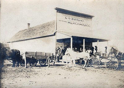 E.C. Bunday General Store,Westport Minnesota, 1908 LakesnWoods.com Postcard and Postcard Image Collection Visit The Westport Photo Gallery for more recent and historic area photos |
| Westport City Hall 428 Commercial Street Villard, MN 56385 Phone: (320) 554-7323 Regular Business Hours: unknown City Council Meetings: 1st Tuesday of March, May, August and December at 6:00 pm 

 |
||||
| Title | Term Ends | Name and Address | Phone | |
| Mayor | 12/31/2024 | Tim Rechkemmer 416 Abercrombie Street Villard, MN 56385 |
(515) 490-9453 | |
| City Clerk | 12/31/2024 | Sally Kirckof 107 Livingston Street Villard, MN 56385 |
(320) 491-0322 | |
| Treasurer | 12/31/2024 | Sheri Rechkemmer 416 Abercrombie Street Villard, MN 56385 |
(320) 808-4924 | |
| Council Member | 12/31/2022 | not available | -- | |
| Council Member | 12/31/2022 | not available | -- | |
| Council Member | 12/31/2024 | Sharon Bisson 208 Abercrombie Street Villard, MN 56385 |
(320) 761-6880 | |
|
US Post Office 602 Lake Street Villard, MN 56385-4400 Phone: (320) 554-3444 Toll Free: (800) ASK USPS Regular Business Hours:  |
|
| Utility Type | Utility Name | Utility Phone |
| Electricity | Xcel Energy | (800) 895-4999 |
| Natural Gas | n/a | -- |
| Wastewater | n/a | -- |
| Water | n/a | -- |
| Telephone | CenturyLink | (800) 603-6000 |
| Cable TV | n/a | -- |
| Employer | Products/Services | Employees |
|
not available |
||
|
none |
Check Out
The Minnesota
History Shop! Good Goods and
Great Gifts! |
|
none |
|
none |
| Lake Name | Size (acres) |
Lake info | Lake Map | Rec Map | Topo Map |
|---|---|---|---|---|---|
| Burroughs | 100 |
|
|
||
| East Ellen | 88 |
|
|
||
| Westport | 203 |
|
|
|
|
none |
|
none |
|
none |
|
none |
|
none |
|
see Villard |
|
|
|
|
© 2004-2025 LakesnWoods LLC
All Rights Reserved
|
|
|
|
||