|
Navigation LakesnWoods.com
Home
Page
Contact Us
Privacy
Minnesota History Shop
Visit The Minnesota History Shop
www.minnesotahistoryshop.com
Historic maps
Historic books
Historic framed art
Historic
postcards
Clothing with historic
images
And much more!!! |
Wales Guide:
Photo Gallery
Location
Geography
Demographics
History
Government
Post Office
News
Weather
Street Map
Events
Attractions
Recreation
Lakes
Health Care
Schools
Churches
Media
Motels
Resorts
Campgrounds
Businesses
Aerial Photo
Topographic
Map © 2004-2025
LakesnWoods LLC
All Rights Reserved
DCMA, Defamation, Copyright and Trademark Infingement Policy
|
WANTED! Do you have photos, historical accounts or
other items pertaining to the Wales area? Would you like to
share this historical information with the world?
LakesnWoods.com would like to publish your Wales photos
(current or historical) or historical accounts on this website.
Original materials can be returned and your privacy will be
respected.
Contact us |
|
Wales Minnesota Community Guide
Location:
Population:
unincorporated
| Lake County Unorganized
Territory 2 |
1970 |
1980 |
1990 |
2000 |
1990-2000
Change |
| Actual |
Percent |
| Population |
-- |
-- |
1,856 |
1,955 |
99 |
5.33 |
| Land Area (sq. mile) |
0.00 |
0.00 |
268.44 |
268.42 |
-0.02 |
-0.01 |
| Density (persons per sq. mile) |
-- |
-- |
6.91 |
7.28 |
0.37 |
5.34 |
| Housing Units |
0 |
0 |
1,069 |
1,096 |
27 |
2.53 |
| Households |
-- |
0 |
689 |
800 |
111 |
16.11 |
| Persons Per Household |
-- |
-- |
2.69 |
2.43 |
-0.26 |
-9.79 |
Geography:
According to the United States Census Bureau, the unorganized territory
has a total area of 705.2 km² (272.3 mi²). 695.2 km² (268.4 mi²) of it
is land and 10.0 km² (3.9 mi²) of it (1.42%) is water.
From
Wikipedia, the free
encyclopedia.
Demographics:
As of the
census of 2000, there
were 1,955 people, 800
households, and 571
families residing in the
unorganized territory.
The population density
was 2.8/km² (7.3/mi²).
There were 1,096 housing
units at an average
density of 1.6/km²
(4.1/mi²). The racial
makeup of the
unorganized territory
was 98.93% White, 0.36%
Native American, 0.15%
Asian, 0.26% from other
races, and 0.31% from
two or more races.
Hispanic or Latino of
any race were 0.51% of
the population.
There
were 800 households out
of which 28.0% had
children under the age
of 18 living with them,
64.9% were married
couples living together,
4.3% had a female
householder with no
husband present, and
28.6% were non-families.
23.4% of all households
were made up of
individuals and 10.4%
had someone living alone
who was 65 years of age
or older. The average
household size was 2.43
and the average family
size was 2.90.
In the
unorganized territory
the population was
spread out with 22.3%
under the age of 18,
6.2% from 18 to 24,
25.3% from 25 to 44,
30.8% from 45 to 64, and
15.4% who were 65 years
of age or older. The
median age was 43 years.
For every 100 females
there were 107.1 males.
For every 100 females
age 18 and over, there
were 112.0 males.
The
median income for a
household in the
unorganized territory
was $48,098, and the
median income for a
family was $50,921.
Males had a median
income of $42,917 versus
$24,803 for females. The
per capita income for
the unorganized
territory was $23,436.
About 4.5% of families
and 5.2% of the
population were below
the poverty line,
including 3.8% of those
under age 18 and 8.3% of
those age 65 or over.
History:
WALES, a village in section 21 of T. 55N, R. 11W (Two
Harbors), which had a station of the Duluth, Missabe and Iron Range
Railroad, and a post office named Emetta, 1919-23, changing to Wales,
1923-65. Courtesy of the Minnesota
Historical Society
Government:
|
administered by Lake County |
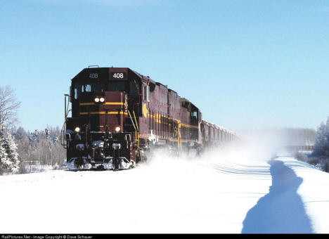
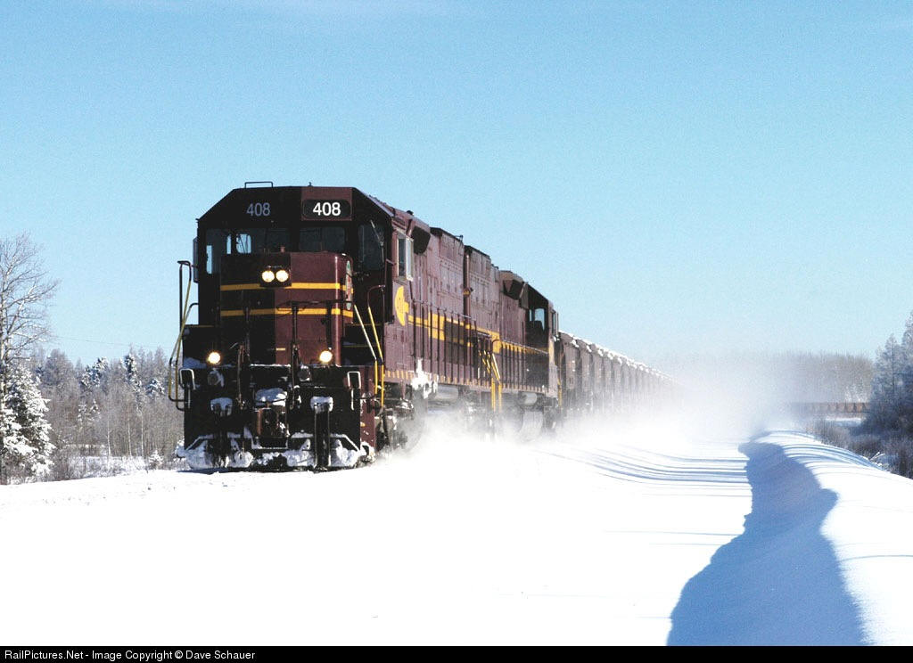
Duluth, Missabe & Iron Range Railway train near Wales,
Minnesota. Courtesy of
RailPictures.net
Post Office:
News:
Weather:
Map:

Minnesota State
Highway Map of the Wales Minnesota area
Events:
Attractions:
Recreation:
Lakes:
|
Lake Name |
Size
(acres) |
Location |
Lake info |
Lake Map |
Rec Map |
Topo Map |
| |
|
|
 |
|
|
|
Health
Care:
Schools:
Churches:
Media:
Motels:
Resorts:
Campgrounds:
Businesses:
Aerial Photo:
Topographic Map:
[click map to enlarge, zoom in or zoom out]

Topographic map is courtesy of the Minnesota DNR
- click map to zoom or enlarge

Topographic map is courtesy of the Minnesota DNR
- click map to zoom or enlarge
|
|