|
|
|
|
|
|
Navigation
LakesnWoods.com
© 2004-2024 DCMA, Defamation, Copyright and Trademark Infingement Policy
|
|
||||||||||||||||||||||||||||||||||||||||||||||||||||||||||||||||||||||||||||||||||||||||||||||||||||||||||||||||||||||||||||||||||||||||||||||||||||||||||||||||||||||||||||||||||||||||||||||||||||||||||||||||||||||
 |
|
| Trommald (city) | 1970 | 1980 | 1990 | 2000 | 2010 | 2000-2010 Change | |
|---|---|---|---|---|---|---|---|
| Actual | Percent | ||||||
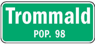
| Population | 82 | 84 | 80 | 125 | 98 | -27 | -21.60 |
| Land Area (sq. mile) | 4.00 | 3.99 | 3.70 | 3.70 | 3.70 | 0 | 0.00 |
| Density (persons per sq. mile) | 20.50 | 21.05 | 21.62 | 33.77 | 26.49 | -7.28 | -23.20 |
| Housing Units | 31 | 37 | 35 | 52 | 55 | +3 | +5.77 |
| Households | -- | 30 | 30 | 47 | 46 | -1 | -2.13 |
| Persons Per Household | -- | 2.80 | 2.67 | 2.66 | 2.13 | -0.53 | -19.92 |
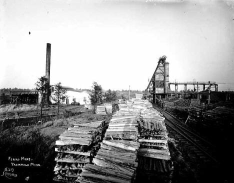
Trommald is a city in Crow Wing County, Minnesota. Trommald was founded as a mining town on the western end of the Cuyuna Range, just north of Ironton. According to the United States Census Bureau, the city has a total area of 3.93 square miles (10.18 km2), of which 3.65 square miles (9.45 km2) is land and 0.28 square miles (0.73 km2) is water County Roads 30 and 34, and Iverson Road are the main routes in the community. The elevation is 1,220 ft (372 m) above sea level.
From Wikipedia, the free encyclopedia.
As of the census of 2010, there were 98 people, 46 households, and 26 families residing in the city. The population density was 26.8 inhabitants per square mile (10.3/km2). There were 55 housing units at an average density of 15.1 per square mile (5.8/km2). The racial makeup of the city was 96.9% White, 2.0% Native American, and 1.0% from two or more races. Hispanic or Latino of any race were 1.0% of the population.
There were 46 households of which 19.6% had children under the age of 18 living with them, 43.5% were married couples living together, 4.3% had a female householder with no husband present, 8.7% had a male householder with no wife present, and 43.5% were non-families. 30.4% of all households were made up of individuals and 10.8% had someone living alone who was 65 years of age or older. The average household size was 2.13 and the average family size was 2.65.
The median age in the city was 45 years. 19.4% of residents were under the age of 18; 7.2% were between the ages of 18 and 24; 23.5% were from 25 to 44; 40.8% were from 45 to 64; and 9.2% were 65 years of age or older. The gender makeup of the city was 57.1% male and 42.9% female.
Visit The
Minnesota History Shop! |
TROMMALD, a mining city in Wolford Township, named for A. G. Trommald, county registrar of deeds, 1904-30. It was incorporated on August 9, 1917. The community had a post office, 1917-67, and a station of the Northern Pacific Railroad.
Courtesy Minnesota Historical Society
|
Visit The Trommald Photo Gallery for more recent and historic area photos |
| Trommald City Hall 24124 Cardinal Avenue Trommald, MN 56441 Phone: (218) 546-6543 Regular Business Hours:
|
||||
| Title | Term Ends | Name and Address | Phone | |
| Mayor | 12/31/2022 | Jim Hiller 19976 Hiller Lane Trommald, MN 56441 |
(218)
546-8268 (218) 316-2673 |
|
| Clerk/Treasurer | appointed | Mona R. Geske 24124 Cardinal Avenue Trommald, MN 56441 |
 |
(218) 546-6543 |
| Council Member | 12/31/2022 | Eugene Wgeishofski 17832 S Black Bear Road Trommald, MN 56441 |
(218) 546-3666 | |
| Council Member | 12/31/2022 | Amanda Peka 17832 S Black Bear Road Trommald, MN 56441 |
(218) 545-0072 | |
| Council Member | 12/31/2024 | Spindy Chamberlin 17907 Fawn Street Trommald, MN 56441 |
(218) 838-7376 | |
| Council Member | 12/31/2024 | Ginny Savaloja 18733 County Road 34 Trommald, MN 56441 |
(218) 851-4179 | |
|
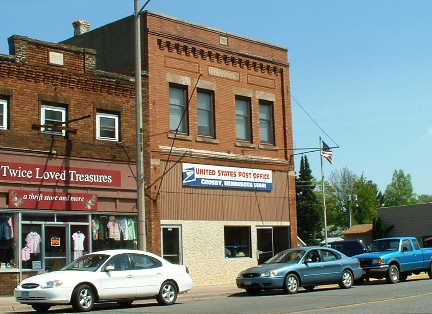
US Post Office
207 W Main Street Crosby, MN 56441-1324 Phone: (218) 546-5152 Toll Free: (800) ASK-USPS
Regular Business Hours:   |
|
| Utility Type | Utility Name | Utility Phone |
| Electricity | Minnesota Power | (218) 546-5172 |
| Natural Gas | n/a | -- |
| Wastewater | n/a | -- |
| Water | n/a | -- |
| Telephone | CenturyLink | (888) 723-8010 |
| Cable TV | n/a | -- |
| Employer | Products/Services | Employees |
|
n/a |
||
|
View Larger Map |
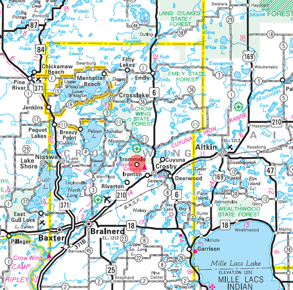
Minnesota State
Highway Map of the Trommald Minnesota area
|
none |
Check Out
The Minnesota
History Shop! Good Goods and
Great Gifts! |
|
none |
|
none |
| Lake Name | Size (acres) |
Lake info | Lake Map | Rec Map | Topo Map |
|---|---|---|---|---|---|
| Black Bear | 218 |
|
|
|
|
| Half Moon | 42 |
|
|
|
|
| Island | 126 |
|
|
|
|
| June | 100 |
|
|
|
|
| Mahnomen | 238 |
|
|
|
|
| Miller | 105 |
|
|
|
|
| Morroco Mine | 78 |
|
|
|
|
| Pascoe | 68 |
|
|
|
|
| Section 6 Mine Pit Lake | 15 |
|
|
|
none |
|
none |
|
none |
|
none |
|
none |
|
none |
|
none |
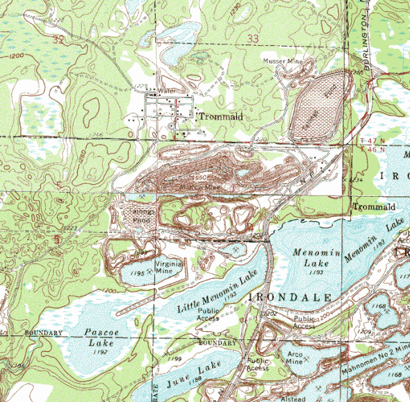
Topographic map is courtesy of the Minnesota DNR
- click map to zoom or enlarge
|
|
|
|
© 2004-2024 Lakeweb1 Internet Services All Rights Reserved |
|
|
|
||