|
|
|
|
|
|
Navigation LakesnWoods.com
Nearby Communities: © 2004-2025 DCMA, Defamation, Copyright and Trademark Infingement Policy
|
|
|||||||||||||||||||||||||||||||||||||||||||||||||||||||||||||||||||||||||||||||||||||||||||||||||||||||||||||||||||||||||||||||||||||||||||||||||||||||||||||||||||||||||||||||||||||||||||||||||||||
|
|
|
| Trail (city) | 1970 | 1980 | 1990 | 2000 | 2010 | 2000-2010 Change | |
|---|---|---|---|---|---|---|---|
| Actual | Percent | ||||||
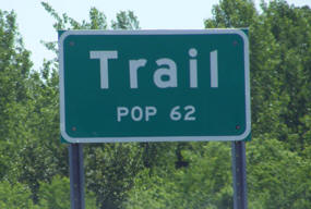
| Population | 99 | 97 | 67 | 62 | 46 | -16 | -25.81 |
| Land Area (sq. mile) | 1.00 | 0.96 | 0.99 | 0.99 | 0.99 | 0 | 0.00 |
| Density (persons per sq. mile) | 99.00 | 101.04 | 67.68 | 62.45 | 46.46 | -15.99 | -25.60 |
| Housing Units | 34 | 48 | 36 | 35 | 36 | +1 | +2.86 |
| Households | -- | 41 | 32 | 26 | 26 | 0 | 0.00 |
| Persons Per Household | -- | 2.37 | 2.09 | 2.38 | 1.77 | -0.61 | -25.63 |
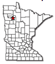
Trail is a city in Polk County, Minnesota. State Highway 92 serves as an main route in the community. According to the United States Census Bureau, the city has a total area of 0.99 square miles (2.56 km2), all of it land. The elevation is 1,211 ft (369 m) above sea level.
From Wikipedia, the free encyclopedia.
As of the census of 2010, there were 46 people, 26 households, and 12 families residing in the city. The population density was 46.5 inhabitants per square mile (18.0/km2). There were 36 housing units at an average density of 36.4 per square mile (14.1/km2). The racial makeup of the city was 100.0% White.
There were 26 households of which 7.7% had children under the age of 18 living with them, 34.6% were married couples living together, 7.7% had a female householder with no husband present, 3.8% had a male householder with no wife present, and 53.8% were non-families. 46.2% of all households were made up of individuals and 19.2% had someone living alone who was 65 years of age or older. The average household size was 1.77 and the average family size was 2.42.
The median age in the city was 52.5 years. 6.5% of residents were under the age of 18; 17.3% were between the ages of 18 and 24; 10.9% were from 25 to 44; 50% were from 45 to 64; and 15.2% were 65 years of age or older. The gender makeup of the city was 56.5% male and 43.5% female.
Visit The
Minnesota History Shop! |
TRAIL, a city in section 30 of Gully Township, was named for its location where a former trail between the Red River valley and the Red Lake Agency was crossed by the railway. The city was incorporated as a village on April 17, 1950; it had a station of the Minneapolis, St. Paul and Sault Ste. Marie Railroad (Soo Line), and the post office was established in 1910.
Courtesy Minnesota Historical Society
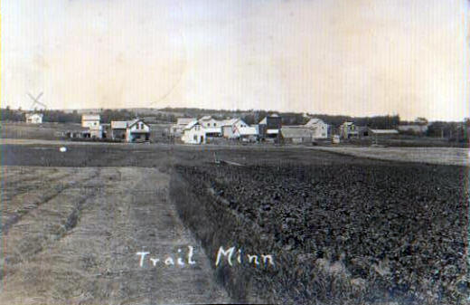 General View, Trail Minnesota, 1914 LakesnWoods.com Postcard and Postcard Image Collection - click to enlarge Visit The Trail Photo Gallery for more recent and historic area photos |
| Trail City Hall 109 N Main Street Trail, MN 56684 Phone: (218) 688-1921 Regular Business Hours: unknown City Council Meetings: 2nd Monday of each month, call for time 


 |
||||
| Title | Term Ends | Name and Address | Phone | |
| Mayor | 12/31/2022 | Frank Buer 27107 370th Avenue SE Trail, MN 56684 |
(218) 268-5053 | |
| Clerk | appointed | Lori Wollman 109 N Main Street Trail, MN 56684 |
|
(218) 268-4465 |
| Treasurer | appointed | Kandys White 109 2nd Avenue W Trail, MN 56684 |
(218) 268-4007 | |
| Council Member | 12/31/2022 | Kandys White 109 2nd Avenue W Trail, MN 56684 |
(218) 268-4007 | |
| Council Member | 12/31/2022 | Dallas Stine 103 Stine Drive Trail, MN 56684 |
(218) 268-4284 | |
| Council Member | 12/31/2024 | Lois Klema 109 Elm Street Trail, MN 56684 |
(218) 268-4265 | |
| Council Member | 12/31/2024 | Judy Seyller 108 2nd Avenue W Trail, MN 56684 |
(218) 268-4520 | |
|
US Post Office 101 S Main Street Gully, MN 56646-2000 Phone: (218) 268-4150 Toll Free: (800) ASK-USPS
Regular Business Hours: 
|
 |
| Utility Type | Utility Name | Utility Phone |
| Electricity | Otter Tail Power Company | (800) 257-4044 |
| Natural Gas | n/a | n/a |
| Wastewater | n/a | n/a |
| Water | n/a | n/a |
| Telephone | Garden Valley Telephone Company | (218) 687-5251 |
| Cable TV | n/a | n/a |
| Employer | Products/Services | Employees |
| n/a | ||
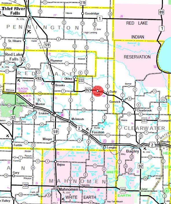
Minnesota State
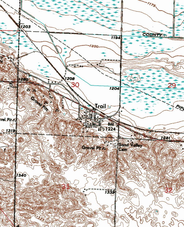
Highway Map of the Trail Minnesota area
| none |
Check Out
The Minnesota
History Shop! Good Goods and
Great Gifts! |
| none |
| none |
| Lake Name | Size (acres) |
Lake info | Lake Map | Rec Map | Topo Map |
|---|---|---|---|---|---|
|
none in the immediate area |
|||||
| none |
| none |
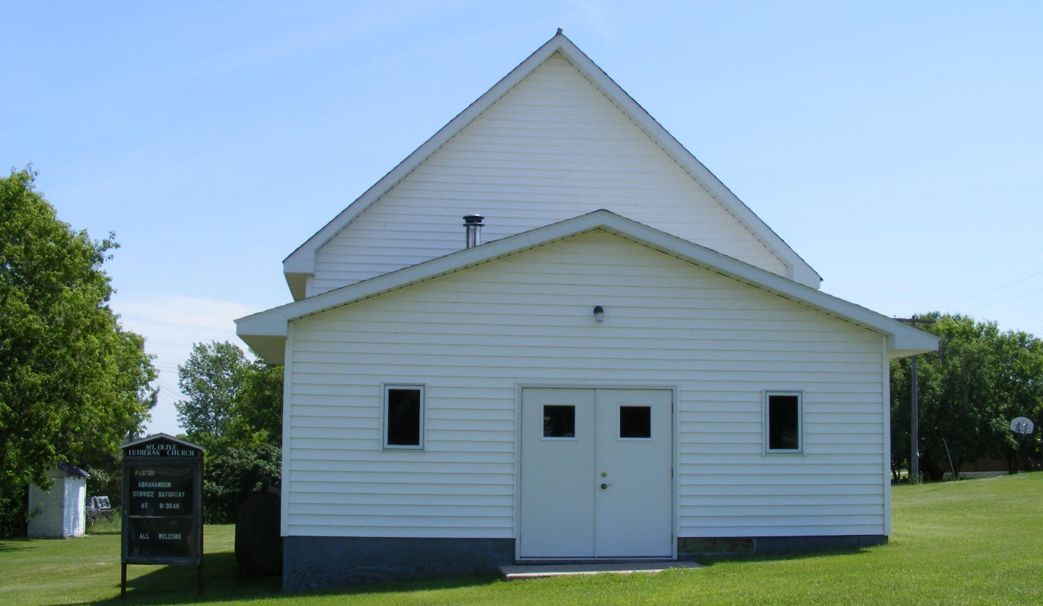
| Mount Olive Lutheran Church Trail, MN 56684 Phone: n/a |
 |
| Nazareth
Lutheran Church 14509 380th Avenue SE Trail, MN 56684 Phone: (218) 268-4476 |
|
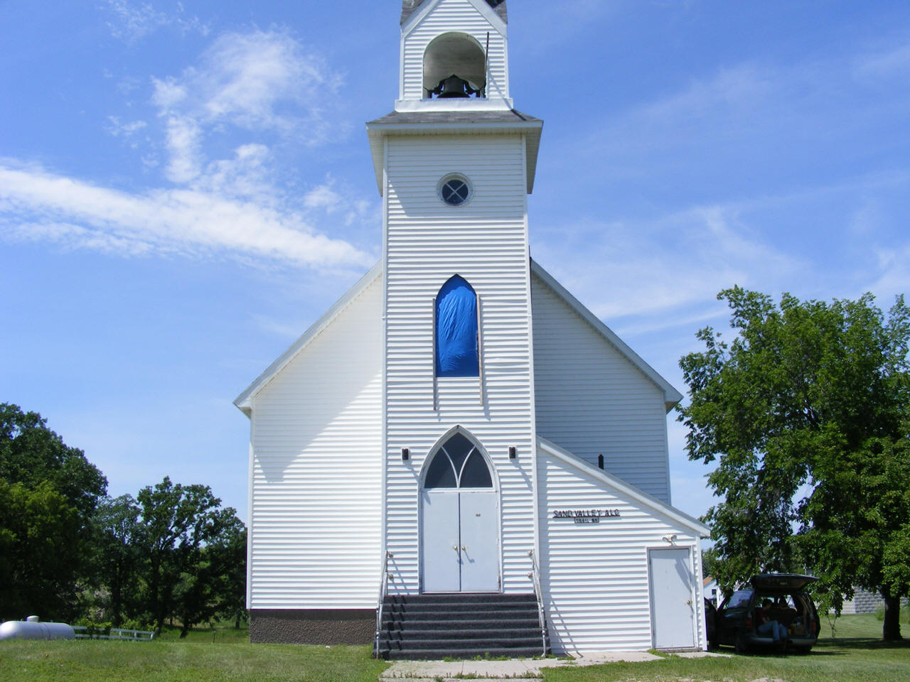
| Sand Valley Lutheran Church PO Box 27 Trail, MN 56684 Phone: (218) 268-4136 |
 |
| none |
| none |
| none |
| none |
| Carlson
Flying Service 26701 380th Avenue SE Trail, MN 56684 Phone: (218) 268-4277 |
|
| E & L of
Trail Inc 27129 310th Avenue SE Trail, MN 56684 Phone: (218) 796-5478 |
|
| Hanco Farms
Inc 34078 290th Street SE Trail, MN 56684 Phone: (218) 268-4425 |
|
| Julie's Hair
Care 39837 270th Street SE Trail, MN 56684 Phone: (218) 268-4125 |
|
| Kingtown
Farmers Mutual Insurance Company 30763 277th Street SE Trail, MN 56684 Phone: (218) 563-4155 |
|
| Mount Olive Lutheran Church Trail, MN 56684 Phone: n/a |
|
| Nazareth
Lutheran Church 14509 380th Avenue SE Trail, MN 56684 Phone: (218) 268-4476 |
|
| Northern Sand
& Gravel Co Highway 92 W Trail, MN 56684 Phone: (218) 268-4112 |
|
| Peatlands
Reds Inc 17017 390th Avenue SE Trail, MN 56684 Phone: (218) 268-4034 |
|
| Sand Valley Lutheran Church PO Box 27 Trail, MN 56684 Phone: (218) 268-4136 |
|
| Strata
Concrete 26371 360th Avenue SE Trail, MN 56684 Phone: (218) 268-4112 |
|
| Tasa Farm LLC 36560 140th Street SE Trail, MN 56684 Phone: (218) 796-5889 |
|
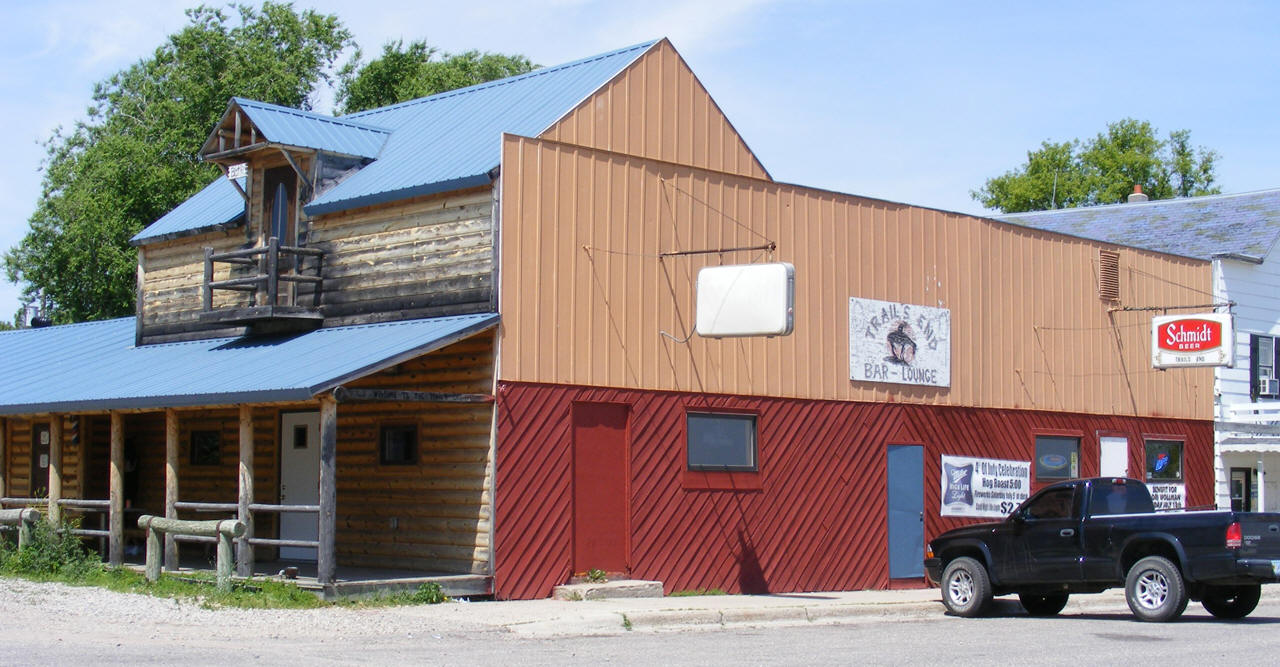
| Trail's End
Bar 108 N Main Street Trail, MN 56684 Phone: (218) 268-4481 |
 |
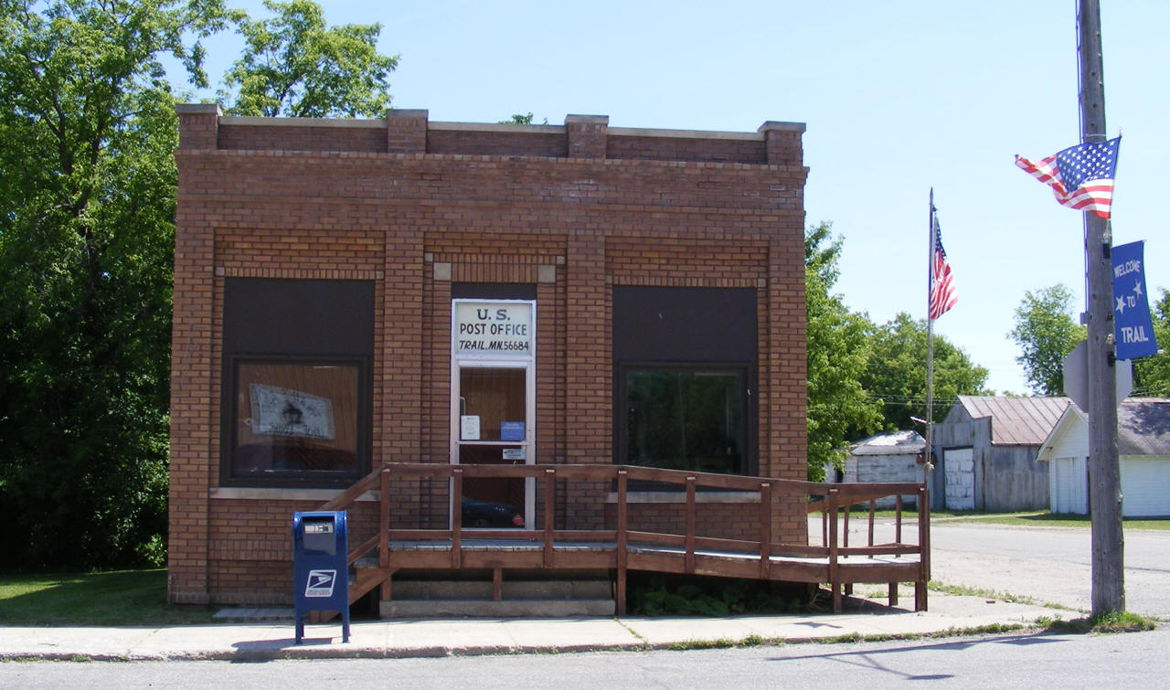
| US Post
Office 109 N Main Street Trail, MN 56684 Phone: (218) 268-4114 |
 |
|
|
|
|
© 2004-2025 LakesnWoods LLC All Rights Reserved |
|
|
|
||