|
|
|
|
|
|
Navigation LakesnWoods.com
© 2004-2025 DCMA, Defamation, Copyright and Trademark Infingement Policy
|
|
|||||||||||||||||||||||||||||||||||||||||||||||||||||||||||||||||||||||||||||||||||||||||||||||||||||||||||||||||||||||||||||||||||||||||||||||||||||||||||||||||||||||||||||||||||||||||||||||||||||||||
 |
 |
| St. Francis (city) | 1970 | 1980 | 1990 | 2000 | 2010 | 2000-2010 Change | |
|---|---|---|---|---|---|---|---|
| Actual | Percent | ||||||
| Population | 897 | 1,184 | 2,538 | 4,910 | 7,218 | 2,308 | +47.00 |
| Land Area (sq. mile) | 24.10 | 23.91 | 23.52 | 23.32 | 23.53 | +0.21 | +0.90 |
| Density (persons per sq. mile) | 37.22 | 49.52 | 107.91 | 210.57 | 306.76 | +96.19 | +45.68 |
| Housing Units | 250 | 378 | 800 | 1,686 | 2,650 | +964 | +57.18 |
| Households | -- | 355 | 760 | 1,638 | 2,520 | +882 | +53.85 |
| Persons Per Household | -- | 3.34 | 3.24 | 3.00 | 2.86 | -0.14 | -4.90 |
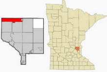
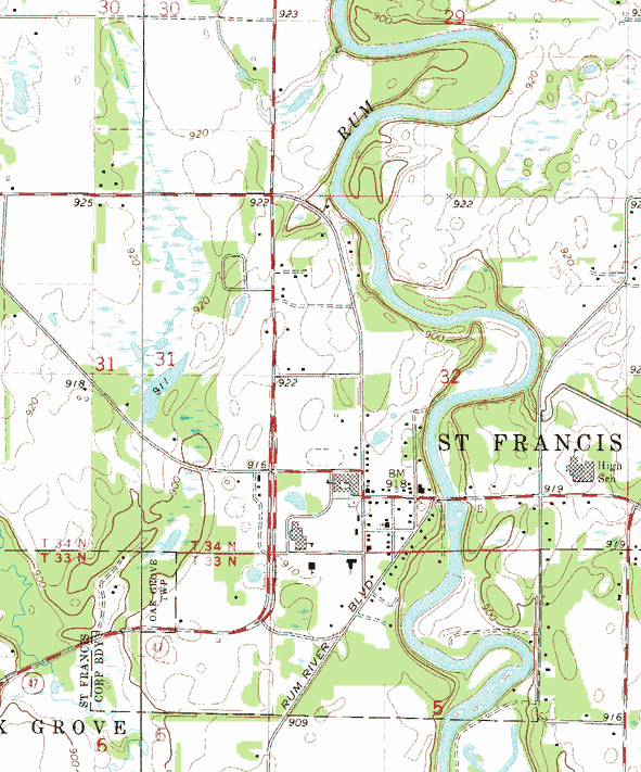
St. Francis is a city in Anoka and Isanti counties, Minnesota. Minnesota State Highway 47 serves as a main arterial route in the city. According to the United States Census Bureau, the city has a total area of 23.97 square miles (62.08 km2), of which, 23.53 square miles (60.94 km2) is land and 0.44 square miles (1.14 km2) is water. The elevation is 919 ft (280 m) above sea level.
From Wikipedia, the free encyclopedia.
As of the census of 2010, there were 7,218 people, 2,520 households, and 1,913 families residing in the city. The population density was 306.8 inhabitants per square mile (118.5/km2). There were 2,650 housing units at an average density of 112.6 per square mile (43.5/km2). The racial makeup of the city was 95.9% White, 0.6% African American, 0.4% Native American, 0.8% Asian, 0.2% from other races, and 2.0% from two or more races. Hispanic or Latino of any race were 1.4% of the population.
There were 2,520 households of which 46.7% had children under the age of 18 living with them, 55.6% were married couples living together, 13.8% had a female householder with no husband present, 6.5% had a male householder with no wife present, and 24.1% were non-families. 17.8% of all households were made up of individuals and 4% had someone living alone who was 65 years of age or older. The average household size was 2.86 and the average family size was 3.22.
The median age in the city was 31.5 years. 31.7% of residents were under the age of 18; 8.1% were between the ages of 18 and 24; 32.8% were from 25 to 44; 20.8% were from 45 to 64; and 6.5% were 65 years of age or older. The gender makeup of the city was 49.5% male and 50.5% female.
Visit The
Minnesota History Shop! |
Courtesy Minnesota Historical Society
|
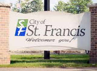
St. Francis City Hall 23340 Cree Street NW St. Francis, MN 55070 Phone: (763) 753-2630 Fax: (763) 753-9881 Business Hours: Monday - Thursday 7:00 am - 5:30 pm City Council Meetings: 1st and 3rd Monday of the month at 6:00 pm
|
 |
|||
| Title | Term Ends | Name and Address | Phone | |
| Mayor | 12/31/2022 | Steven D. Feldman 22766 Poppy Street NE St. Francis, MN 55070 |
 |
(763) 235-2310 (763) 670-6389 |
| City Administrator | appointed |
Joe Kohlmann 23340 Cree Street NW St. Francis, MN 55070 |
|
(763) 235-2301 |
| Council Member | 12/31/2022 | Kevin Robinson 23978 Redwood Street NW St. Francis, MN 55070 |
|
(763) 235-2313 (612) 760-2297 |
| Council Member | 12/31/2022 | Sarah Udvig 3709 229th Lane NW #3 St. Francis, MN 55070 |
|
(763) 235-2311 (612) 558-9914 |
| Council Member | 12/31/2024 | Joseph Muehlbauer 3459 228th Avenue NW St. Francis, MN 55070 |
|
(763)
235-2314 (763) 398-9533 |
| Council Member | 12/31/2024 | Robert Bauer 23246 Kerry Street NW St. Francis, MN 55070 |
|
(763) 235-2312 (763) 439-0694 |
|
US Post Office 3726 Bridge Street NW St. Francis, MN 55070-7703 Phone: (763) 753-3435 Toll Free: (800) ASK-USPS
Regular Business Hours:   |
|
| Utility Type | Utility Name | Utility Phone |
| Electricity | Connexus Energy | (763) 323-2650 |
| Natural Gas | CenterPoint Energy | (612) 372-4664 |
| Wastewater | City of St. Francis | (763) 753-2630 |
| Water | City of St. Francis | (763) 753-2630 |
| Telephone | CenturyLink Communications | (800) 244-1111 |
| Cable TV | Midco/Midcontinent Cable | (800) 888-1300 |
| Refuse | LePage & Sons | (763) 757-7100 |
| Refuse | Ace Solid Waste | (763) 427-3110 |
| Refuse | Waste Management | (888) 960-0008 |
| Employer | Products/Services | Employees |
|
n/a |
||
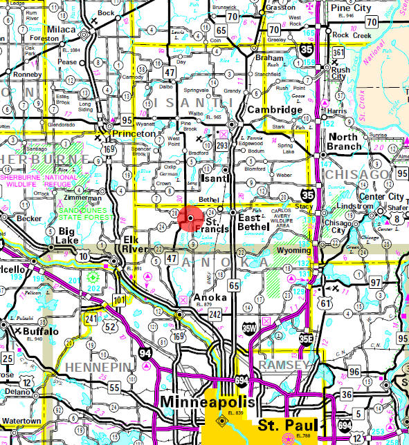
Minnesota State
Highway Map of the St. Francis Minnesota area
Check Out
The Minnesota
History Shop! Good Goods and
Great Gifts! |
| none |
|
The Ponds Golf Course 2771 229th Avenue NE St. Francis, MN 55070 Phone: (763) 753-1100
|
 |
| Lake Name | Size (acres) |
Lake info | Lake Map | Rec Map | Topo Map |
|---|---|---|---|---|---|
| none | |||||
| none |
|
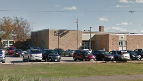
St. Francis Area Schools Independent School District #15 4115 Ambassador Boulevard NW St. Francis, MN 55070 Phone: (763) 753-7040 Fax: (763) 753-4693 Grades: PK-12 Students: 4,600


|
 |
|
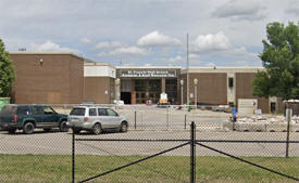
St. Francis High School
3325 Bridge Street St. Francis, MN 55070 Phone: (763) 213-1500 Grades: 9-12 Students: 1,350
|
 |
|
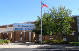
St. Francis Middle School
23026 Ambassador Boulevard NW St. Francis, MN 55070 Phone: (763) 213-8500 Grades: 6-8 Students: 950
|
 |
|
Cedar Creek Elementary
School 21108 Polk Street NE East Bethel, MN 55011 Phone: (763) 213-8780 Grades: K-5 Students: 700
|
 |
|
East Bethel Elementary
School 21210 Polk Street NE East Bethel, MN 55011 Phone: (763) 213-8900 Grades: K-5 Students: 550
|
 |
|
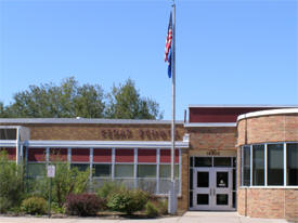
St. Francis Elementary
School 22919 St. Francis Boulevard St. Francis, MN 55070 Phone: (763) 213-8670 Grades: K-5 Students: 675
|
 |
|
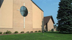
Trinity Lutheran
Church 3812 229th Avenue NW St. Francis, MN 55070 Phone: (763) 753-1234

|
|
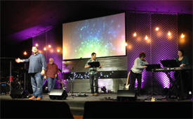
(The) Bridge Church 6443 Norris Lake Road Nowthen, MN 55330 Phone: (763) 753-2134 Pastor: Chris Vincent Sunday Worship: 10:30 am
|
 |
|
First Baptist
Church 22940 St. Francis Boulevard St. Francis, MN 55070 Phone: (763) 753-1230 Pastor: Sunday Service: 10:15 am, 6:00 pm
|
 |
|
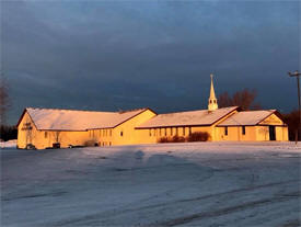
Living Hope
Evangelical Church 23038 Rum River Boulevard St. Francis, MN 55070 Phone: (763) 753-1718 Pastor: Lon Bjornrud Sunday Service: 10:00 am
|
 |
|
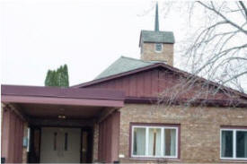
St. Francis
United Methodist Church 3914 229th Avenue NW St. Francis, MN 55070 Phone: (763) 753-2273 Pastor: Adam Roberts Sunday Service: 10:00 am
|
 |
|
Trinity Lutheran Church 3812 229th Avenue NW St. Francis, MN 55070 Phone: (763) 753-1234 Pastor: Rev. Timothy Vaughan Sunday Service: 8:00 am, 10:30 am
|
 |
| Local | |
| Metro | |
|
see the Twin Cities Media Guide page for Twin Cities metro area newspapers, radio and TV |
|
| none |
| none |
| none |
|
The St. Francis Business Directory is Coming Soon! |
|
|
|
|
© 2004-2025 LakesnWoods LLC All Rights Reserved |
|
|
|
||