|
|
|
|
|
|
Navigation
LakesnWoods.com
© 2004-2025 DCMA, Defamation, Copyright and Trademark Infingement Policy
|
|
||||||||||||||||||||||||||||||||||||||||||||||||||||||||||||||||||||||||||||||||||||||||||||||||||||||||||||||||||||||||||||||||||||||||||||||||||||||||||||||||||||||||||||||||||||||||||||||||||||||
 |
|
| Rutledge (city) | 1970 | 1980 | 1990 | 2000 | 2010 | 2000-2010 Change | |
|---|---|---|---|---|---|---|---|
| Actual | Percent | ||||||
| Population | -- | -- | 152 | 196 | 229 | +33 | +16.84 |
| Land Area (sq. mile) | 0.00 | 0.00 | 2.95 | 2.95 | 2.95 | 0 | 0.00 |
| Density (persons per sq. mile) | -- | -- | 51.53 | 66.47 | 77.63 | +11.16 | +16.84 |
| Housing Units | 0 | 0 | 95 | 110 | 130 | +20 | +18.18 |
| Households | -- | 0 | 61 | 78 | 94 | +16 | +20.51 |
| Persons Per Household | -- | -- | 2.49 | 2.51 | 2.44 | -.07 | -2.79 |
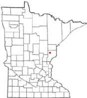
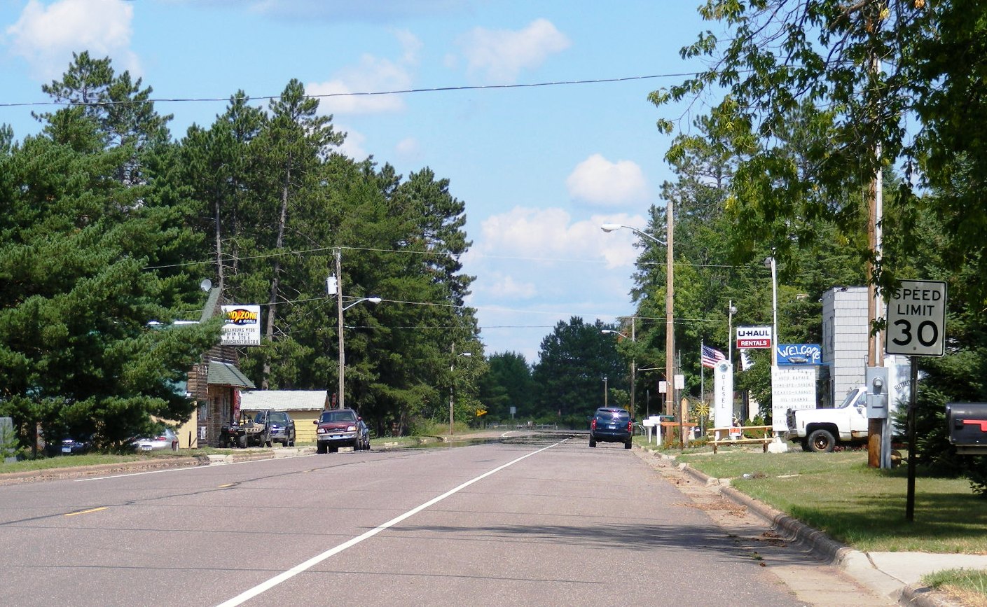
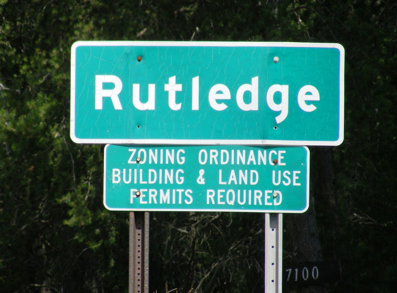
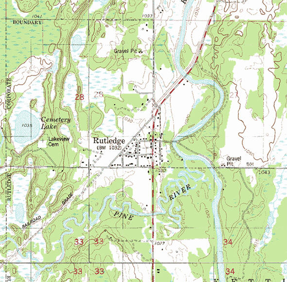
Rutledge is a city in Pine County, Minnesota, United States, at the confluence of the Kettle and Pine Rivers. County 61 serves as a main route in the community. The Willard Munger Bicycle/Snowmobile Trail passes through Rutledge. According to the United States Census Bureau, the city has a total area of 3.03 square miles (7.85 km2), of which 2.96 square miles (7.67 km2) is land and 0.07 square miles (0.18 km2) is water. The elevation is 1,030 ft (314 m) above sea level.
From Wikipedia, the free encyclopedia.
As of the census of 2010, there were 229 people, 94 households, and 65 families residing in the city. The population density was 77.4 inhabitants per square mile (29.9/km2). There were 130 housing units at an average density of 43.9 per square mile (16.9/km2). The racial makeup of the city was 96.9% White, 1.3% African American, 0.9% Native American, and 0.9% from two or more races. Hispanic or Latino of any race were 0.4% of the population.
There were 94 households of which 30.9% had children under the age of 18 living with them, 54.3% were married couples living together, 9.6% had a female householder with no husband present, 5.3% had a male householder with no wife present, and 30.9% were non-families. 24.5% of all households were made up of individuals and 7.4% had someone living alone who was 65 years of age or older. The average household size was 2.44 and the average family size was 2.89.
The median age in the city was 42.1 years. 21.8% of residents were under the age of 18; 6.2% were between the ages of 18 and 24; 28.4% were from 25 to 44; 31.5% were from 45 to 64; and 12.2% were 65 years of age or older. The gender makeup of the city was 51.1% male and 48.9% female.
Visit The
Minnesota History Shop! |
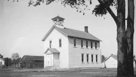
Long before it ever became an incorporated village, a group of Native Indians lived along the banks of the Kettle River from where the community is today to a point about 5 miles downstream. The Government Road between St. Paul, MN and Superior, WI came through that area in the 1860s. A bridge was constructed across the Kettle River at what was called the Rock Dam. On the south side of the river a station was built. There stagecoaches stopped to change horses and allow passengers to get out and stretch their legs and have a lunch. It was at this location where the first Europeans settled. In 1870 the Lake Superior and Mississippi Railroad was completed in this region. A depot was built about two and one half miles upstream from the Rock Dam. The depot was named Kettle River Station. The community began to grow near the railroad station. On February 14, 1893 an election was held at the school house to decide if the settlement should be incorporated as a village. A total of 22 votes were cast, 19 favoring incorporation. The Village of Rutledge was named after a local lumberman Edward Rutledge who had built several mills in the area. James D. McCormack served as the first Mayor.
From Wikipedia, the free encyclopedia
RUTLEDGE, a city in sections 28, 33, and 34 of Kettle River Township, was incorporated as a village on February 17, 1893. It was first called Kettle River when the post office opened in 1881, changing to Rutledge in 1892. Located on the Kettle River, it had a sawmill by 1870 and a station of the Northern Pacific Railroad.
Courtesy Minnesota Historical Society
|
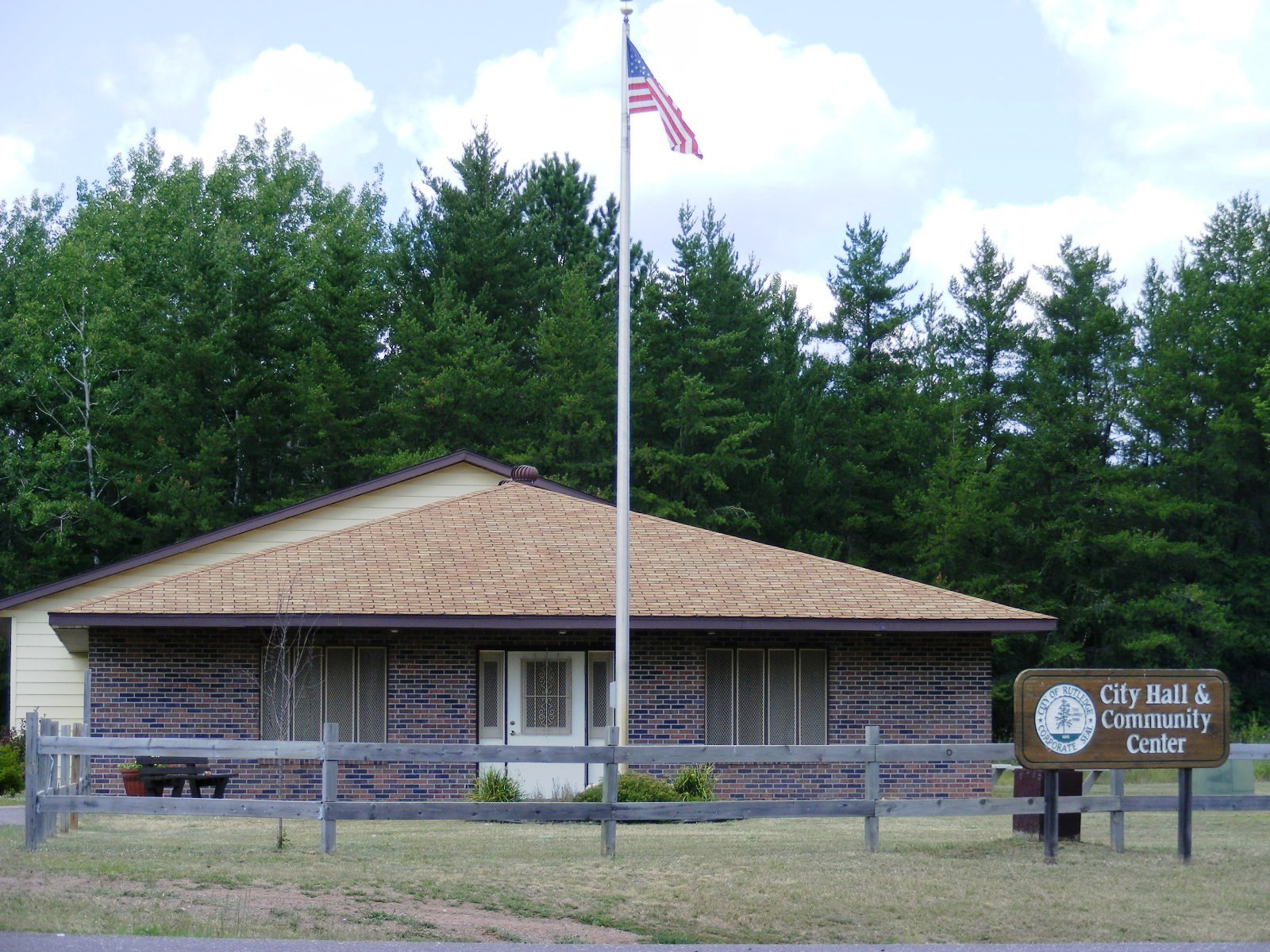
Rutledge City Hall PO Box 124 Rutledge, MN 55795 Phone: (218) 380-2970 Regular Business Hours: unknown City Council Meetings: 1st Wednesday of the month at 5:00 pm 


|
 |
|||
| Title | Term Ends | Name and Address | Phone | |
| Mayor | 12/31/2022 | Jeff Kiminski 2671 County Road 39 Rutledge, MN 55795 |
(218)
372-4331 (218) 565-0736 |
|
| Clerk | 12/31/2022 | Lynette Hischer 7246 Rock Dam Road Willow River, MN 55795 |
|
(218) 380-2970 |
| Treasurer | 12/31/2020 | Amie Johnson 7322 2nd Street Rutledge, MN 55795 |
(218) 380-9072 | |
| Council Member | 12/31/2022 | Darryl Herzog 8045 Park Drive Rutledge, MN 55795 |
not available | |
| Council Member | 12/31/2024 | Timothy M. Johnson
2602 W 2nd Avenue Rutledge, MN 55795 |
(218) 372-3760 | |
| Council Member | 12/31/2024 | Angela Eckerman 7283 County Highway 61 Willow River, MN 55795 |
(218) 355-8892 | |
|
US Post Office 3002 Main Street Willow River, MN 55795-5000 Phone: (218) 372-3595 Toll Free: (800) ASK-USPS
Regular Business Hours:  |
|
| Utility Type | Utility Name | Utility Phone |
| Electricity | Minnesota Power | (218) 722-2641 |
| Electricity | East Central Energy | (800) 254-7944 |
| Natural Gas | n/a | n/a |
| Wastewater | n/a | n/a |
| Water | n/a | n/a |
| Telephone | Frontier Communications | (888) 241-2548 |
| Cable TV | n/a | n/a |
| Employer | Products/Services | Employees |
|
n/a |
||
|
|
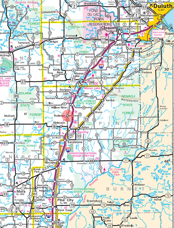
Minnesota State
Highway Map of the Rutledge Minnesota area
|
none |
Check Out
The Minnesota
History Shop! Good Goods and
Great Gifts! |
|
none |
|
none |
| Lake Name | Size (acres) |
Lake info | Lake Map | Rec Map | Topo Map |
|---|---|---|---|---|---|
| Clear | 26 |
|
|
|
|
| Little Mud | 17 |
|
|
|
|
| Long | 77 |
|
|
|
|
none |
|
none, served by Willow River schools |
|
|
| Rutledge
Community Church Rutledge, MN 55795 |
 |
|
none |
|
none |
|
none |
|
none |
|
|
| DWR Investments 7333 County Highway 61 Rutledge, MN 55795 Phone: (218) 372-4481 |
|
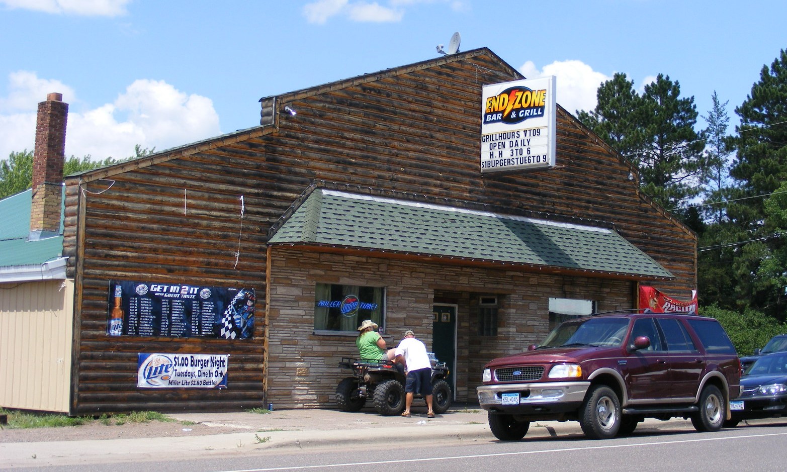
| End Zone Bar &
Grill 7333 County Highway 61 Rutledge, MN 55795 Phone: (218) 372-4481 |
 |
| Hair Shoppe On
Main 7359 Main Street Rutledge, MN 55795 Phone: (218) 372-3093 |
|
| M & S Automotive 7326 County Highway 61 Rutledge, MN 55795 Phone: (218) 372-3803 |
|
| Mille Lacs Band
Of Ojibwe Misizahga'igani Anishinahbay Language and Cultural Grounds 7201 County Highway 61 Rutledge, MN 55795 Phone: (320) 233-6169 |
 |
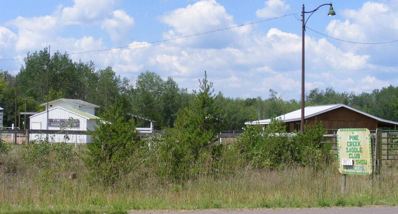
| Pine Creek Saddle
Club Rutledge, MN 55795 |
 |
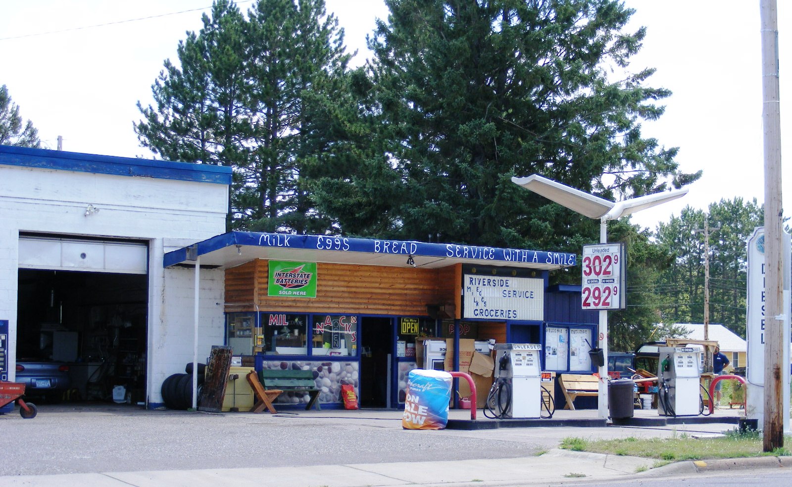
| Riverside Service 7326 County Highway 61 Rutledge, MN 55795 Phone: (218) 372-3400 |
 |
| U-Haul Company 7326 County Highway 61 Rutledge, MN 55795 Phone: (218) 372-4420 |
|
|
|
|
|
|
© 2004-2025 LakesnWoods LLC All Rights Reserved |
|
|
|
|||