|
|
|
|
|
|
Navigation LakesnWoods.com
© 2004-2024 DCMA, Defamation, Copyright and Trademark Infingement Policy
|
|
||||||||||||||||||||||||||||||||||||||||||||||||||||||||||||||||||||||||||||||||||||||||||||||||||||||||||||||||||||||||||||||||||||||||||||||||||||||||||||||||||||||||||||||||||||||||||||||||||||||||||||||||||||||||||||||
 |
| Richfield (city) | 1970 | 1980 | 1990 | 2000 | 2008 (est) |
1990-2000 Change | |
|---|---|---|---|---|---|---|---|
| Actual | Percent | ||||||
| Population | 47,231 | 37,851 | 35,710 | 34,439 | 33,676 | -1,271 | -3.56 |
| Land Area (sq. mile) | 9.70 | 7.07 | 6.88 | 6.90 | -- | 0.02 | 0.23 |
| Density (persons per sq. mile) | 4,869.2 | 5,353.8 | 5,190.4 | 4,994.0 | -- | -196.46 | -3.79 |
| Housing Units | 14,983 | 15,434 | 16,094 | 15,357 | -- | -737 | -4.58 |
| Households | -- | 15,258 | 15,551 | 15,073 | 15,014 | -478 | -3.07 |
| Persons Per Household | -- | 2.46 | 2.29 | 2.25 | 2.22 | -0.04 | -1.58 |
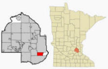
Richfield is a city in Hennepin County, Minnesota, United States. An inner-ring suburb of the Minneapolis-St. Paul region, it is bordered by Minneapolis on the north, Minneapolis-St. Paul International Airport to the east, Bloomington to the south, and Edina to the west. Interstates 35W and 494 and Minnesota State Highways 62 and 77 are four of the main arterial routes in the city. According to the United States Census Bureau, the city has a total area of 7.1 square miles (18.3 km²), of which, 6.9 square miles (17.9 km²) of it is land and 0.2 square miles (0.5 km²) of it (2.55%) is water. The elevation is 840 ft (256 m) above sea level.
From Wikipedia, the free encyclopedia.
There were 15,073 households out of which 24.4% had children under the age of 18 living with them, 43.4% were married couples living together, 10.5% had a female householder with no husband present, and 42.1% were non-families. 33.7% of all households were made up of individuals and 12.0% had someone living alone who was 65 years of age or older. The average household size was 2.25 and the average family size was 2.89.
In the city the population was spread out with 20.2% under the age of 18, 9.3% from 18 to 24, 33.4% from 25 to 44, 20.7% from 45 to 64, and 16.4% who were 65 years of age or older. The median age was 37 years. For every 100 females there were 96.2 males. For every 100 females age 18 and over, there were 93.0 males.
The median income for a household in the city was $45,519, and the median income for a family was $56,434. Males had a median income of $38,417 versus $29,909 for females. The per capita income for the city was $24,709. About 3.9% of families and 6.3% of the population were below the poverty line, including 8.3% of those under age 18 and 3.8% of those age 65 or over.
Visit The
Minnesota History Shop! |
The beginnings of Richfield date back to the 1850s, when it was still a small farming community. Close to Minneapolis and Fort Snelling, it was on the edge of a growing and expanding city with business and commerce not far away. One of the first settlers was Riley Bartholomew, a former General in the Ohio Militia who became a Richfield Justice of the Peace and a Minnesota State Senator. Bartholomew built a house on the east shore of Wood Lake in 1852, and the restored Riley Lucas Bartholomew House is listed on the National Register of Historic Places. Today, the house and site are maintained by the Richfield Historical Society. In the early days, Richfield extended as far north as Lake Street, and included present day Edina on the west, and extended to the Mississippi and the Minnesota Rivers on the east, and to Bloomington on the south. On May 11, 1858 as Congress was admitting Minnesota into the Union, the early residents of Richfield had their first town meeting. That same year Richfield was named for the fertile farm land it encompassed. By 1879, the community's first town hall was constructed. Early residents were German, Irish and families from the New England area. These residents were soon joined by immigrants from Sweden, Norway and Denmark.
It was not until 1908 that Richfield became a village. From 1908 until 1950, Richfield's local government consisted of a President, three trustees, and a clerk. On November 7, 1950 residents voted for a village manager form of government, meaning the City had a Mayor, four council members, and one City Manager. This is still the form of government used today. Richfield's first Mayor was Clarence Christian who began serving in 1951 but served as President under the old format dating back to 1948. By the late 1940s, the city's population started increasing rapidly as farmland was sold to developers who were building homes for veterans returning from World War II. In 1955 the Richfield Chamber of Commerce was formed and has been deeply involved in the development, as well as the redevelopment, of the community since that time.
The first half of the 20th century also saw the boundaries of Richfield change, as annexations decreased the size of the city. Three annexations by Minneapolis brought the village to 62nd Street, its present north boundary. In 1888, Edina formed a separate community and in 1905 a section of the east to 34th Avenue was requisitioned by Fort Snelling. In 1941 another section of East Richfield went to the Minneapolis-Saint Paul International Airport, and by 1955 all of the Wold-Chamberlain Field (municipal airport) was separated from the village.
Over the years, populations of all nearby communities increased and after World War II, Richfield flourished with commuters to Twin Cities jobs. Today, Richfield has a population of about 35,000 residents who live within seven square miles of neighborhoods, parks and shops.
From Wikipedia, the free encyclopedia.
Courtesy Minnesota Historical Society
|
Richfield City Hall 6700 Portland Avenue S Richfield, MN 55423 Phone: (612) 861-9700 Fax: (612) 861-9749 Regular Business Hours: Monday - Friday 8:00 am - 4:30 pm City Council Meetings: 2nd and 4th Tuesday of the month at 7:00 pm 


 |
||||
| Title | Term Ends | Name and Address | Phone | |
| Mayor | 12/31/2022 |
Maria Regan Gonzalez 7227 11th Avenue S Richfield, MN 55423 |
|
(612) 500-3862 |
| City Manager | appointed |
Katie Rodriguez 6700 Portland Avenue S Richfield, MN 55423 |
|
(612) 861-9702 |
| Council Member Ward 1 |
12/31/2024 | Simon Trautmann
6618 Humboldt Avenue S Richfield, MN 55423 |
|
(612) 205-6822 |
| Council Member Ward 2 |
12/31/2024 | Sean Hayford Oleary
7229 2nd Avenue S Richfield, MN 55423 |
|
(612)
605-8837 (612) 325-8348 |
| Council Member Ward 3 |
12/31/2024 | Ben Whalen
7533 Clinton Avenue S Richfield, MN 55423 |
|
(612) 361-1563 |
| Council Member At-Large |
12/31/2022 | Mary Supple
7300 Oakland Avenue S Richfield, MN 55423 |
|
(612) 866-8829 |
|
US Post Office 825 W 65th Street Richfield, MN 55423-9998 Phone: (612) 869-3479 Toll Free: (800) ASK-USPS |
|
||
|
|||
| Utility Type | Utility Name | Utility Phone |
| Electricity | Xcel Energy | (800) 895-4999 |
| Natural Gas | CenterPoint Energy | (800) 269-1114 |
| Wastewater | Metropolitan Council Environmental Svc | (651) 222-8423 |
| Water | City of Richfield | (612) 861-9700 |
| Telephone | CenturyLink Communications | (800) 603-6000 |
| Cable TV | Comcast Cable | (612) 522-5200 |
| Employer | Products/Services | Employees |
| Best Buy | Electronics & Appliance Stores | 6,000 |
| Richfield Public Schools-ISD #280 | Elementary & Secondary Schools | 588 |
| Richfield, City of | Executive, Legislative, & Other Gen. Govt. Support | 550 |
| Copy Duplicating Products | Office Supplies, Stationery, & Gift Stores | 450 |
| M & I Bank | Depository Credit Intermediation | 237 |
| Rainbow Foods | Grocery Stores | 200 |
| Metro Sales | Office Supplies, Stationery, & Gift Stores | 185 |
| Richfield Health Ctr | Nursing Care Facilities | 120 |
| Chi Chi's Mexican Restaurant | Full-Service Restaurants | 118 |
| Champps | Full-Service Restaurants | 115 |
| K Mart | Department Stores | 115 |
| Menards | Building Material & Supplies Dealers | 100 |
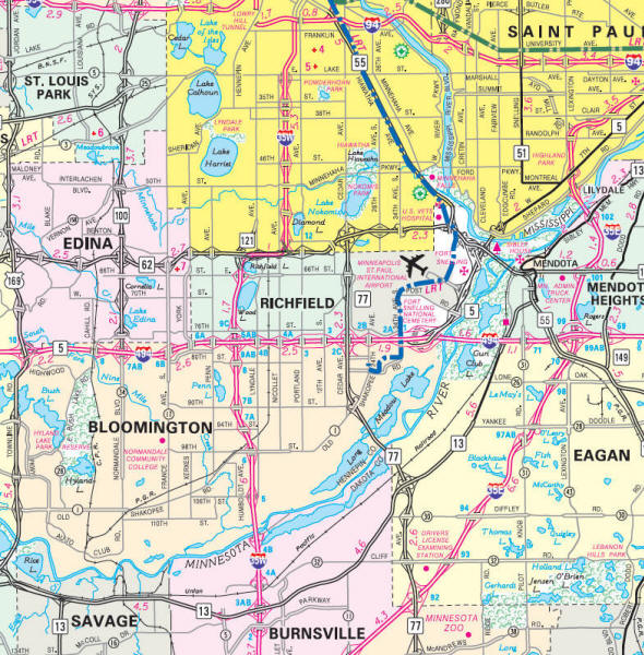
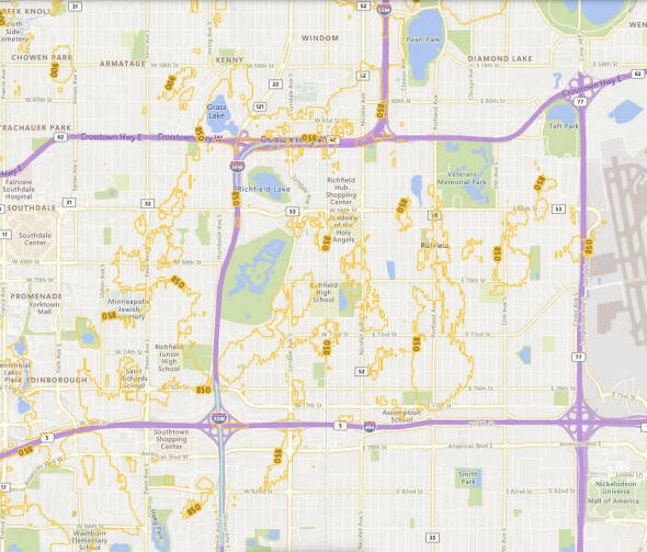
Minnesota State
Highway Map of the Richfield Minnesota area
Check Out
The Minnesota
History Shop! Good Goods and
Great Gifts! |
| Lake Name | Size (acres) |
Lake info | Lake Map | Rec Map | Topo Map |
|---|---|---|---|---|---|
|
|
|
|
|
|
|
|
|
|
|
© 2004-2024 LakesnWoods LLC All Rights Reserved |
|
|
|
||