|
|
|
|
|
|
Navigation LakesnWoods.com
© 2004-2024 DCMA, Defamation, Copyright and Trademark Infingement Policy
|
|
|||||||||||||||||||||||||||||||||||||||||||||||||||||||||||||||||||||||||||||||||||||||||||||||||||||||||||||||||||||||||||||||||||||||||||||||||||||||||||||||||||||||||||||||||||||||
 |
 |
| Lexington (city) | 1970 | 1980 | 1990 | 2000 | 2010 | 2000-2010 Change | |
|---|---|---|---|---|---|---|---|
| Actual | Percent | ||||||
| Population | 2,165 | 2,150 | 2,279 | 2,214 | 2,049 | -165 | -7.45 |
| Land Area (sq. mile) | 0.70 | 0.66 | 0.69 | 0.69 | 0.69 | 0.00 | 0.00 |
| Density (persons per sq. mile) | 3,092.9 | 3,257.6 | 3,302.9 | 3,196.1 | 2,969.6 | -226.5 | -7.45 |
| Housing Units | 645 | 777 | 874 | 879 | 861 | -18 | -2.09 |
| Households | -- | 746 | 829 | 847 | 787 | -60 | -7.08 |
| Persons Per Household | -- | 2.88 | 2.75 | 2.61 | 2.60 | -0.01 | -0.38 |
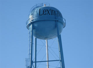
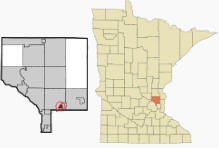
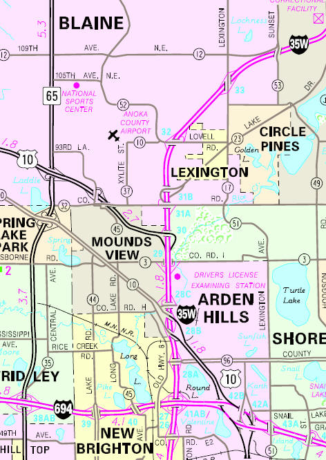
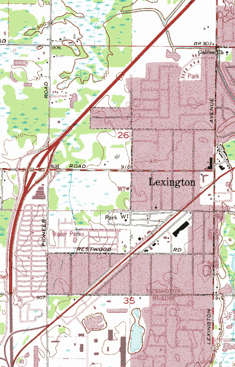
Lexington is a city in Anoka County, Minnesota. The city borders Blaine, Circle Pines, and Lino Lakes. The landscape in Lexington is uniformly flat because the city sits entirely on the Anoka Sand Plain. Lake Drive / County 23 serves as a main route in the community. Other routes include Lexington Avenue and Lovell Road. Interstate 35W is in close proximity to the city. According to the United States Census Bureau, the city has a total area of 0.69 square miles (1.79 km2), all of it land. The elevation is 909 ft (277 m) above sea level.
From Wikipedia, the free encyclopedia.
As of the census of 2010, there were 2,049 people, 787 households, and 519 families living in the city. The population density was 2,969.6 inhabitants per square mile (1,146.6/km2). There were 861 housing units at an average density of 1,247.8 per square mile (481.8/km2). The racial makeup of the city was 87.8% White, 2.7% African American, 1.1% Native American, 3.0% Asian, 0.1% Pacific Islander, 2.6% from other races, and 2.5% from two or more races. Hispanic or Latino of any race were 5.7% of the population.
There were 787 households of which 34.4% had children under the age of 18 living with them, 43.6% were married couples living together, 15.1% had a female householder with no husband present, 7.2% had a male householder with no wife present, and 34.1% were non-families. 25.7% of all households were made up of individuals and 4.3% had someone living alone who was 65 years of age or older. The average household size was 2.60 and the average family size was 3.13.
The median age in the city was 34.6 years. 25.5% of residents were under the age of 18; 9.8% were between the ages of 18 and 24; 28.9% were from 25 to 44; 29.1% were from 45 to 64; and 6.5% were 65 years of age or older. The gender makeup of the city was 52.0% male and 48.0% female.
Visit The
Minnesota History Shop! |
Courtesy Minnesota Historical Society
|
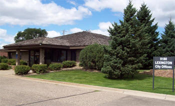
Lexington City Hall 9180 Lexington Avenue Lexington MN 55014-3531 Phone: (763) 784-2792 Fax: (763) 785-8951 Business Hours: Council Meetings:
|
 |
|||
| Title |
Term Ends |
Name & Address | Phone | |
| Mayor | 12/31/2022 | Mike Murphy 3882 Edith Lane Lexington MN 55014 |
 |
(612) 990-6767 (763) 432-9092 |
| City Administrator | appointed | Bill Petracek 9180 Lexington Avenue Lexington MN 55014 |
|
(763) 784-2792 |
| Council Member | 12/31/2022 | Kim Jay DeVries 8941 Syndicate Avenue Apt 208 Lexington MN 55014 |
|
(612) 518-6028 |
| Council Member | 12/31/2022 | John Hughes 9200 Syndicate Avenue Lexington MN 55014 |
|
(612) 919-5690 |
| Council Member | 12/31/2024 | Brandon Winge 4034 Lovell Road Lexington MN 55014 |
|
(651) 785-3476 |
| Council Member | 12/31/2024 | Diane Harris 3781 Centerwood Road Lexington MN 55014 |
|
(763) 213-7111 |
|
US Post Office 300 Civic Heights Drive Circle Pines, MN 55014-1793 Phone: (763) 717-0595 Toll Free: (800) ASK-USPS
Regular Business Hours:   |
|
| Utility Type | Utility Name | Utility Phone |
| Electricity | Connexus Energy | (763) 323-2650 |
| Natural Gas | CenterPoint Energy | (800) 245-2377 |
| Wastewater | City of Lexington | (763) 784-2792 |
| Water | City of Lexington | (763) 784-2792 |
| Telephone | CenturyLink Communications | (800) 244-1111 |
| Cable TV | Comcast/Xfinity | (651) 483-9999 |
| Employer | Products/Services | Employees |
| n/a | ||
Minnesota State
Highway Map of the Lexington Minnesota area
Check Out
The Minnesota
History Shop! Good Goods and
Great Gifts! |
| none |
|
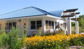
Rice Creek Chain of Lakes Park 7373 Main Street Lino Lakes, MN 55038 Phone: (763) 324-3300 The 5,500-acre Rice Creek Chain of Lakes Park Reserve is one of the largest in the seven-county metropolitan area and contains some of the most significant native wildlife habitat and water resources in the regional area. The park offers a wide variety of amenities, including the Wargo Nature Center, Chomonix Golf Course, Rice Creek Campground, and Centerville Lake Beach. Other amenities include picnic areas, boat launch facilities, biking and hiking trails, playgrounds and a fishing pier. A unique partnership with the YMCA Day Camp Heritage offers another day camp opportunity for the community.

|
 |
| Lake Name | Size (acres) |
Lake info | Lake Map | Rec Map | Topo Map |
|---|---|---|---|---|---|
|
|
|
|
| none |
|
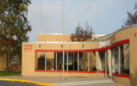
Centennial Schools Independent School District #12 4707 North Road Circle Pines, MN 55014 Phone: (763) 792-6000 Fax: (763) 792-7174 Grades: K-12 Students: 6,900


|
 |
|
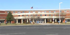
Centennial High School 4757 North Road Circle Pines, MN 55014 Phone: (763) 792-5000 Fax: (763) 392-7174 Grades: 9-12 Students: 2,000
|
 |
|
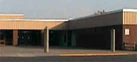
Centennial Middle School 399 Elm Street Lino Lakes, MN 55014 Phone: (763) 792-5400 Fax: (763) 3927281 Grades: 6-8 Students: 1515
|
 |
|
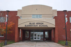
Blue Heron Elementary School 405 Elm Street Lino Lakes, MN 55014 Phone: (763) 792-6200 Fax: (763) 392-7534 Grades: K-5 Students: 860
|
 |
|
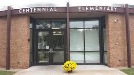
Centennial Elementary School 4657 North Road Circle Pines, MN 55014 Phone: (763) 792-5300 Fax: (763) 392-7516 Grades: K-5 Students: 510
|
 |
|
Centerville Elementary School 1721 Westview Avenue Centerville, MN 55038 Phone: (763) 792-5800 Fax: (763) 392-7296 Grades: K-5 Students: 535
|
 |
|
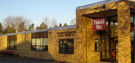
Golden Lake Elementary School 1 School Road Circle Pines, MN 55014 Phone: (763) 792-5900 Fax: (763) 392-7295 Grades: K-5 Students: 380
|
 |
|
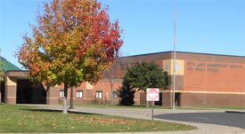
Rice Lake Elementary School 575 Birch Street Lino Lakes, MN 55014 Phone: (763) 792-5700 Fax: (763) 392-7282 Grades: K-5 Students: 605
|
 |
|
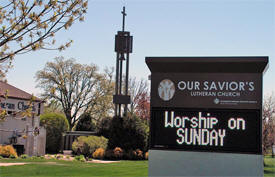
Our Savior's
Lutheran Church - ELCA 9185 Laxington Avenue North Circle Pines, MN 55014 Phone: (763) 784-1971 Pastor: Rev. Steve Sylvester Sunday Service: 10:00 am


|
 |
|
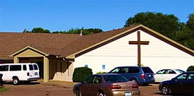
Tree of Life Assembly of God Church 3905 Woodland Road Lexington, MN 55014 Phone: (651) 340-2857 Pastor: n/a Sunday Service: 10:30 am, 6:00 pm
|
 |
|
Quad Community
Press 4779 Bloom Avenue White Bear Lake, MN 55110 Phone: (651) 407-1200 The Quad Community Press is published by Press Publications, located in White Bear Lake. It is distributed to homes in Circle Pines, Lexington, Lino Lakes and Blaine.
|
 |
| none |
| none |
| none |
|
|
|
|
|
|
© 2004-2024 LakesnWoods LLC All Rights Reserved |
|
|
|
||