|
|
|
|
|
|
Navigation LakesnWoods.com
© 2004-2025 DCMA, Defamation, Copyright and Trademark Infingement Policy
|
|
||||||||||||||||||||||||||||||||||||||||||||||||||||||||||||||||||||||||||||||||||||||||||||||||||||||||||||||||||||||||||||||||||||||||||||||||||||||||||||||||||||||||||||||||||||||||||||||
 |
| Leota (township) | 1970 | 1980 | 1990 | 2000 | 2007 (est) |
1990-2000 Change | |
|---|---|---|---|---|---|---|---|
| Actual | Percent | ||||||
| Population | 671 | 589 | 504 | 463 | 404 | -41 | -8.13 |
| Land Area (sq. mile) | 36.10 | 36.27 | 36.17 | 36.17 | -- | -0.00 | -0.00 |
| Density (persons per sq. mile) | 18.59 | 16.24 | 13.93 | 12.80 | -- | -1.13 | -8.13 |
| Housing Units | 192 | 204 | 194 | 204 | -- | 10 | 5.15 |
| Households | -- | 186 | 182 | 191 | 185 | 9 | 4.95 |
| Persons Per Household | -- | 3.17 | 2.77 | 2.42 | 2.18 | -0.35 | -12.61 |
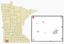
Leota is a census-designated place (CDP) in Leota Township, Nobles County, Minnesota. According to the United States Census Bureau, the CDP has a total area of 1.4 square miles (3.5 km²), all of it land. The elevation is 1,722 ft (525 m) above sea level.
From Wikipedia, the free encyclopedia.
There were 113 households out of which 17.7% had children under the age of 18 living with them, 64.6% were married couples living together, 1.8% had a female householder with no husband present, and 31.9% were non-families. 31.9% of all households were made up of individuals and 23.9% had someone living alone who was 65 years of age or older. The average household size was 2.04 and the average family size was 2.52.
In the CDP the population was spread out with 15.7% under the age of 18, 4.3% from 18 to 24, 17.0% from 25 to 44, 24.3% from 45 to 64, and 38.7% who were 65 years of age or older. The median age was 58 years. For every 100 females there were 91.7 males. For every 100 females age 18 and over, there were 86.5 males.
The median income for a household in the CDP was $30,568, and the median income for a family was $35,625. Males had a median income of $27,019 versus $30,714 for females. The per capita income for the CDP was $15,664. About 10.6% of families and 8.5% of the population were below the poverty line, including 7.0% of those under the age of eighteen and 16.5% of those sixty five or over.
Visit The
Minnesota History Shop! |
Courtesy Minnesota Historical Society
| Leota Township Leota, MN 56153 |
||
| Clerk | Brent Feikema 15344 120th Street Lismore, MN 56155 |
n/a |
| Treasurer | Glenn Kooiman 10717 110th Street Edgerton, MN 56128 |
n/a |
| Chairman | Kenneth Bolkema 10962 Behrens Avenue Edgerton, MN 56128 |
n/a |
| Supervisor | Anthony Van’t Hof 11006 Birkett Avenue Edgerton, MN 56128 |
n/a |
| Supervisor | Jeff Tweet 13398 160th Street Lismore, MN 56155 |
n/a |
|
US Post Office 11815 110th Street Leota, MN 56153-2000 Phone: (507) 443-5060 Toll Free: (800) ASK-USPS Web: www.usps.com |
|
||
|
|||
| Utility Type | Utility Name | Utility Phone |
| Electricity | n/a | n/a |
| Natural Gas | n/a | n/a |
| Wastewater | n/a | n/a |
| Water | n/a | n/a |
| Telephone | n/a | n/a |
| Cable TV | n/a | n/a |
| Employer | Products/Services | Employees |
| n/a | ||
|
|
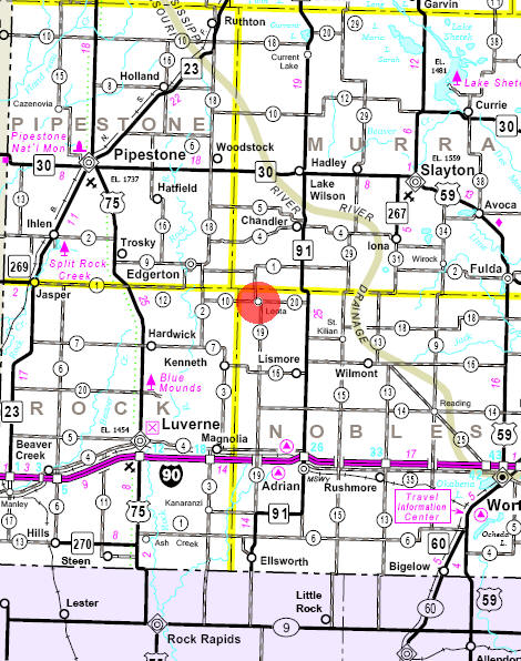
Minnesota State
Highway Map of the Leota Minnesota area
Check Out
The Minnesota
History Shop! Good Goods and
Great Gifts! |
| Lake Name | Size (acres) |
Lake info | Lake Map | Rec Map | Topo Map |
|---|---|---|---|---|---|
|
|
|
|
|
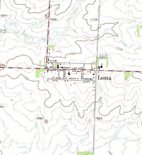
Topographic map is courtesy of the Minnesota DNR - click map to zoom or enlarge
|
|
|
|
© 2004-2025 LakesnWoods LLC All Rights Reserved |
|
|
|
||