 Navigation LakesnWoods.com
Home Page
Contact Us
Privacy
|
Lake of the Woods County Minnesota
Lake of the Woods County is a county located in the U.S. state of Minnesota. As of 2000, the population is 4,522. Its county seat is Baudette6. The county contains the Northwest Angle, the northernmost point of the Lower 48 States, and includes the U.S. portion of Lake of the Woods, shared with Canada. Since Alaska has no counties (its territory is comprised entirely of boroughs, census areas, and a municipality), Lake of the Woods is the northernmost county in the United States, by definition.
According to the U.S. Census Bureau, the county has a total area of 4,597 km² (1,775 mi²). 3,358 km² (1,297 mi²) of it is land and 1,239 km² (478 mi²) of it (26.95%) is water. | 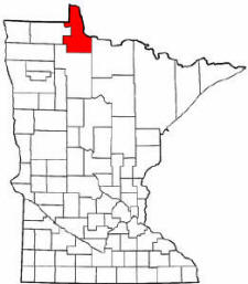 | | |
Lake of the Woods County Communities
Minnesota State Highway Map 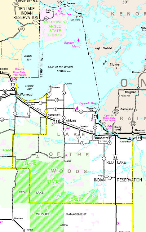
| Department | Department Head/Address | Phone: | | Assessor | Wayne Bendickson
206 8th Avenue SE, Suite #296
Baudette, MN 56623 | (218) 634-2536 | | Attorney | Michelle Moren
206 8th Avenue SE, Suite #240
Baudette, MN 56623 | (218) 634-1190 | | Auditor/Purchasing Agent | John W. Hoscheid
206 8th Avenue SE, Suite #260
Baudette, MN 56623 | (218) 634-2836 | | Court Administrator | Carol Clauson
206 8th Avenue SE, Suite #250
Baudette, MN 56623 | (218) 634-1451 | | Engineer | Bruce Hasbargen
County Highway Department
306 8th Avenue SE
Baudette, MN 56623 | (218) 634-1767 | | Extension/4H Educator | Sunny Dorrow
206 8th Avenue SE, Suite #232
Baudette, MN 56623 | (218) 634-1511 | | Homeland Security/Emergency Mgt. | Holly House
206 8th Avenue SE, Suite #230
Baudette, MN 56623 | (218) 634-4567 | | Information Systems | Brent Birkeland
206 8th Avenue SE, Suite #210
Baudette, MN 56623 | (218) 634-4519 | | Land Commissioner | Wayne Bendickson
206 8th Avenue SE, Suite #296
Baudette, MN 56623 | (218) 634-2536 | | Land & Water Planning | Josh Stromlund
206 8th Avenue SE, Suite #290
Baudette, MN 56623 | (218) 634-1945 | | Medical Examiner | Dr. Robert Dayer
206 8th Avenue SE
Baudette, MN 56623 | (218) 634-1655 | | Public Health Nursing Director | Michelle Brown
206 8th Ave SE
Baudette, MN 56623 | (218) 634-2120 | | Recorder | Susan Ney
206 8th Avenue SE, Suite #280
Baudette, MN 56623 | (218) 634-1902 | | Sheriff | Dallas Block
206 8th Avenue SE, Suite #300
Baudette, MN 56623 | (218) 634-1143 | | Social Services | Nancy Wendler
206 8th Avenue SE, Suite #200
Baudette, MN 56623 | (218) 634-2642 | | Treasurer | Mark Hall
206 8th Avenue SE, Suite #270
Baudette, MN 56623 | (218) 634-2361 | | Veterans Services Officer | Rodrick Rone, Jr.
311 Third Avenue SE
Baudette, MN 56623 | (218) 634-2219 |
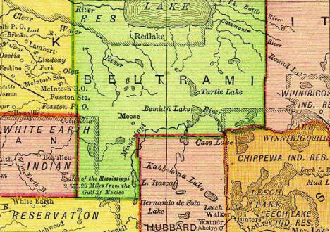
1895 Map of Lake of the Woods County [Note: In 1895, Lake of the Woods County had not yet been formed.
This area was then part of Beltrami County] 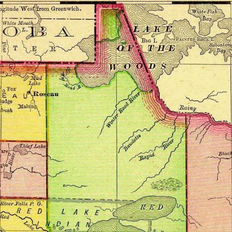
| |

