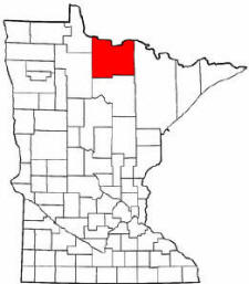
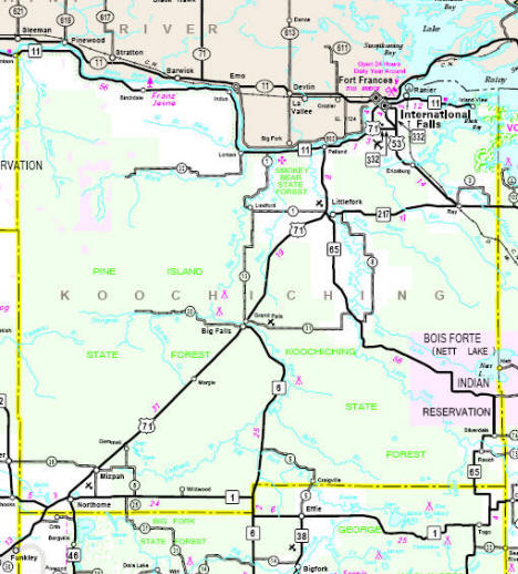
According to the U.S. Census Bureau, the county has a total area of 8,170 km˛ (3,154 mi˛). 8,035 km˛ (3,102 mi˛) of it is land and 135 km˛ (52 mi˛) of it (1.65%) is water.
|
|
![]() |
|
|
Navigation
LakesnWoods.com
|
|
|
Koochiching County
is a
county located in the
U.S. state of
Minnesota. As of
2000, the population is 14,355. Its
county seat is
International Falls6.
A portion of the
Bois Forte Indian Reservation is in the
county.
According to the U.S. Census Bureau, the county has a total area of 8,170 km˛ (3,154 mi˛). 8,035 km˛ (3,102 mi˛) of it is land and 135 km˛ (52 mi˛) of it (1.65%) is water. |
|
Koochiching County Communities
| Big Falls | Ericsburg | Margie | Ray |
| Birchdale | Indus | Mizpah | Wildwood |
| Craig | International Falls | Nett Lake | |
| Gemmell | Littlefork | Northome | |
| Grand Falls | Loman | Ranier City |
Minnesota State Highway Map

1895 Map of Koochiching County
[Note: In 1895, Itasca County included what is now Koochiching County]

|
|
|
|
||||||||||||
|
||||||||||||
|
|
© 2004
Lakeweb1 Internet Services All Rights Reserved |
|||||||||||
|
|
||||||||||||