|
|
|
|
|
|
Navigation LakesnWoods.com
© 2004-2025 DCMA, Defamation, Copyright and Trademark Infingement Policy
|
|
|||||||||||||||||||||||||||||||||||||||||||||||||||||||||||||||||||||||||||||||||||||||||||||||||||||||||||||||||||||||||||||||||||||||||||||||||||||||||||||||||||||||||||||
 |
 |
| Kent (city) | 1970 | 1980 | 1990 | 2000 | 2010 | 2000-2010 Change | |
|---|---|---|---|---|---|---|---|
| Actual | Percent | ||||||
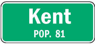
| Population | 139 | 121 | 131 | 120 | 81 | -39 | -32.50 |
| Land Area (sq. mile) | 0.30 | 0.25 | 0.26 | 0.19 | 0.19 | 0 | 0.00 |
| Housing Units | 49 | 43 | 50 | 47 | 39 | -8 | -17.02 |
| Households | -- | 42 | 45 | 41 | 36 | -5 | -19.20 |
| Persons Per Household | -- | 2.88 | 2.91 | 2.93 | 2.25 | -0.68 | -23.21 |
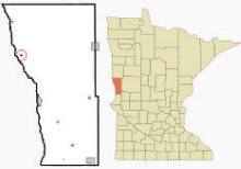
Kent is a city in Wilkin County, Minnesota. US Highway 75 is a major route in the community. According to the United States Census Bureau, the city has a total area of 0.19 square miles (0.49 km2), all of it land. The elevation is 945 ft (288 m) above sea level.
From Wikipedia, the free encyclopedia.
As of the census of 2010, there were 81 people, 36 households, and 24 families residing in the city. The population density was 426.3 inhabitants per square mile (164.6/km2). There were 39 housing units at an average density of 205.3 per square mile (79.3/km2). The racial makeup of the city was 100.0% White.
There were 36 households of which 25.0% had children under the age of 18 living with them, 55.6% were married couples living together, 11.1% had a male householder with no wife present, and 33.3% were non-families. 25.0% of all households were made up of individuals and 8.4% had someone living alone who was 65 years of age or older. The average household size was 2.25 and the average family size was 2.75.
The median age in the city was 42.3 years. 22.2% of residents were under the age of 18; 2.6% were between the ages of 18 and 24; 30.8% were from 25 to 44; 33.3% were from 45 to 64; and 11.1% were 65 years of age or older. The gender makeup of the city was 54.3% male and 45.7% female.
Visit The
Minnesota History Shop! |
Courtesy Minnesota Historical Society
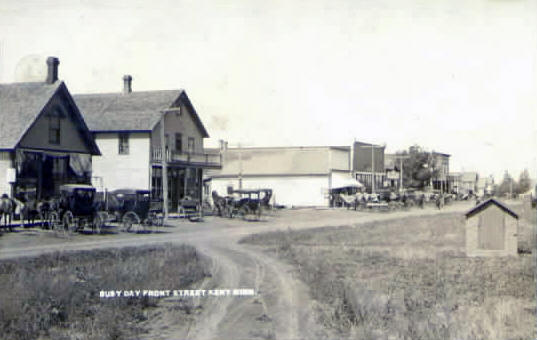 Front Street, Kent Minnesota, 1910s LakesnWoods.com Postcard and Postcard Image Collection - click to enlarge Visit The Kent Photo Gallery for more recent and historic area photos |
| Kent City Hall PO Box 58 Kent, MN 56553 Phone: (218) 557-8313 Regular Business Hours: not available City Council Meetings: 2nd Monday of the month at 6:00 pm 

 |
||||
| Title | Term Ends | Name and Address | Phone | |
| Mayor | 12/31/2022 | Anthony Olson 211 5th Street SW Kent, MN 56553 |
(701) 640-8066 | |
| Clerk/Treasurer | appointed | Jessi Kappes PO Box 58 Kent, MN 56553 |
|
(218) 557-8313 |
| Council Member | 12/31/2022 | Carol Tschakert 206 4th Street Kent, MN 56553 |
(218) 557-8772 | |
| Council Member | 12/31/2022 | name not available address not available Kent, MN 56553 |
not available | |
| Council Member | 12/31/2024 | Mark Kappes 220 Main Street Kent, MN 56553 |
(701) 640-3417 | |
| Council Member | 12/31/2024 | Greg Goerdt 101 Harris Street Kent, MN 56553 |
(701) 367-5500 | |
|
US Post Office 216 Main Street Kent, MN 56553-9998 Phone: (218) 557-8713 Toll Free: (800) ASK-USPS
Regular Business Hours:   |
|
| Utility Type | Utility Name | Utility Phone |
| Electricity | Otter Tail Power Company | (218) 739-8200 |
| Natural Gas | n/a | n/a |
| Wastewater | n/a | n/a |
| Water | n/a | n/a |
| Telephone | Red River Communications | (701) 553-8309 |
| Cable TV | n/a | n/a |
| Employer | Products/Services | Employees |
| n/a | ||
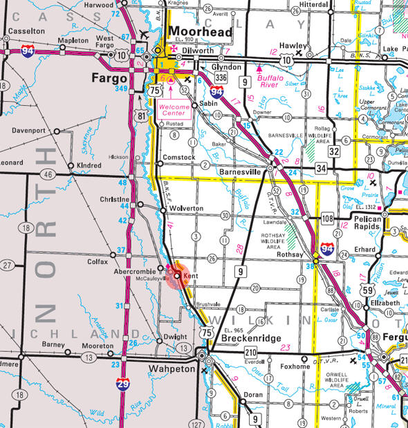
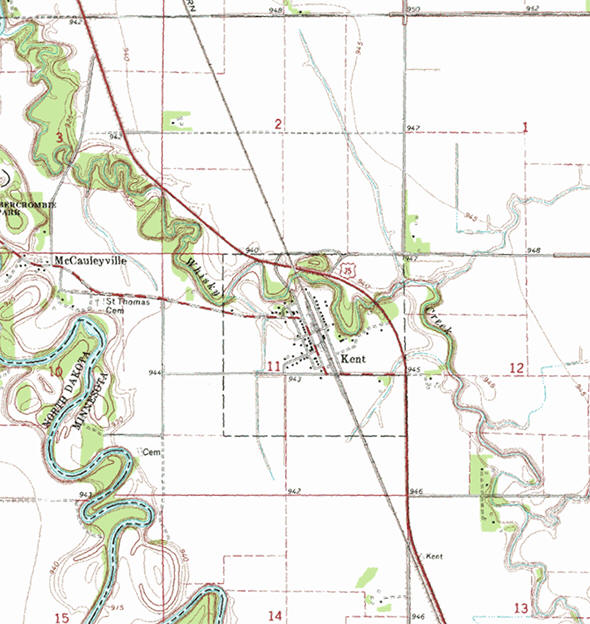
Minnesota State
Highway Map of the Kent Minnesota area
|
none |
Check Out
The Minnesota
History Shop! Good Goods and
Great Gifts! |
|
none |
|
none |
| Lake Name | Size (acres) |
Lake info | Lake Map | Rec Map | Topo Map |
|---|---|---|---|---|---|
|
none in the immediate area |
|||||
|
none |
| St. Thomas Catholic Church 114 Harris Street Kent, MN 56553 Phone: (218) 557-8312 |
|
none |
|
none |
|
none |
| Beyer Seed Farm 2665 170th Avenue Kent, MN 56553 Phone: (218) 643-5126 |
|
| Kent Insurance 202 Main Street Kent, MN 56553 Phone: (218) 557-8381 |
|
| Kent State Bank 202 Main Street Kent, MN 56553 Phone: (218) 557-8381 |
|
| Minn-KOTA Ag Products Inc Highway 75 Main Street # 211 Kent, MN 56553 Phone: (218) 557-8327 |
|
| Rezac Construction 1652 250th Street Kent, MN 56553 Phone: (218) 557-9178 |
|
| St. Thomas Catholic Church 114 Harris Street Kent, MN 56553 Phone: (218) 557-8312 |
|
| Tight Line Trucking 1341 235th Street Kent, MN 56553 Phone: (218) 557-8350 |
|
| Travel Lite Trailer Sales 1341 235th Street Kent, MN 56553 Phone: (218) 557-8350 |
|
| US Post Office 216 Main Street Kent, MN 56553 Phone: (218) 557-8713 |
|
| Zimmerman Woodcrafts 220 Main Street Kent, MN 56553 Phone: (218) 557-9260 |
|
|
|
|
© 2004-2025 LakesnWoods LLC All Rights Reserved |
|
|
|
||