|
|
|
|
|
|
Navigation LakesnWoods.com
© 2004-2024 DCMA, Defamation, Copyright and Trademark Infingement Policy
|
|
||||||||||||||||||||||||||||||||||||||||||||||||||||||||||||||||||||||||||||||||||||||||||||||||||||||||||||||||||||||||||||||||||||||||||||||||||||||||||||||||||||||||||||||||||||||||||||||||||||||||||||||||||||||
 |
 |
| Hilltop (city) | 1970 | 1980 | 1990 | 2000 | 2010 | 2000-2010 Change | |
|---|---|---|---|---|---|---|---|
| Actual | Percent | ||||||
| Population | 1,015 | 817 | 749 | 766 | 744 | -22 | -2.87 |
| Land Area (sq. mile) | 0.10 | 0.13 | 0.13 | 0.13 | 0.12 | -0.01 | -8.33 |
| Density (persons per sq. mile) | 10,150.00 | 6,284.62 | 5,761.54 | 6,111.28 | 6,200.00 | +88.72 | +1.45 |
| Housing Units | 483 | 469 | 431 | 426 | 414 | -12 | -2.82 |
| Households | -- | 453 | 410 | 400 | 380 | -20 | -5.00 |
| Persons Per Household | -- | 1.80 | 1.83 | 1.89 | 1.96 | +0.07 | +3.70 |
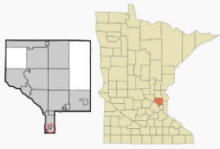
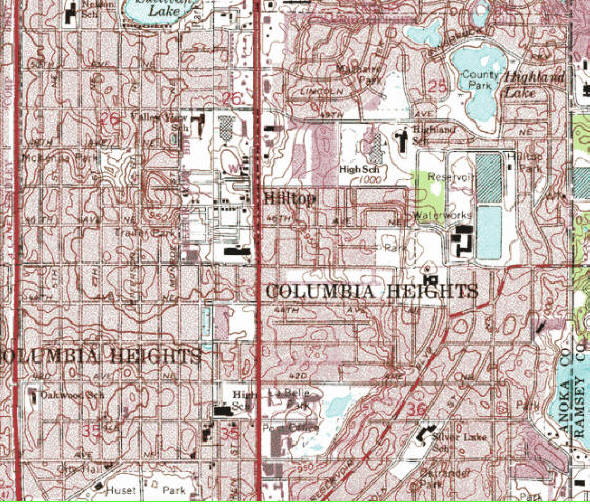
Hilltop is a city in Anoka County, Minnesota. Minnesota State Highway 65 (Central Avenue) serves as a main arterial route in the city. Hilltop is entirely surrounded on all borders by the city of Columbia Heights. According to the United States Census Bureau, the city has a total area of 0.12 square miles (0.31 km²), all of it land. The elevation is 948 ft (289 m) above sea level.
From Wikipedia, the free encyclopedia.
As of the census of 2010, there were 744 people, 380 households, and 151 families residing in the city. The population density was 6,200.0 inhabitants per square mile (2,393.8/km2). There were 414 housing units at an average density of 3,450.0 per square mile (1,332.1/km2). The racial makeup of the city was 71.0% White, 11.3% African American, 1.6% Native American, 2.7% Asian, 6.9% from other races, and 6.6% from two or more races. Hispanic or Latino of any race were 16.9% of the population.
There were 380 households of which 25.0% had children under the age of 18 living with them, 17.9% were married couples living together, 14.2% had a female householder with no husband present, 7.6% had a male householder with no wife present, and 60.3% were non-families. 47.4% of all households were made up of individuals and 11.3% had someone living alone who was 65 years of age or older. The average household size was 1.96 and the average family size was 2.82.
The median age in the city was 42.7 years. 20.3% of residents were under the age of 18; 7.7% were between the ages of 18 and 24; 25.4% were from 25 to 44; 35.9% were from 45 to 64; and 10.6% were 65 years of age or older. The gender makeup of the city was 53.2% male and 46.8% female.
Visit The
Minnesota History Shop! |
The land where Hilltop exists was originally an unincorporated part of the former Fridley Township, a civil township next to the city of Fridley. The land had a dairy farm and later was the Oak Grove Riding Academy and Stables. The first trailer park, Trailer City, opened on the land in the 1940s; another park, Sunnyside, soon opened next door. Residents of two trailer parks became concerned that the township was planning to remove the mobile homes. In 1956, led by Trailer City Park owner Les Johnson, they approached neighboring Columbia Heights and requested to be annexed by the city. Columbia Heights turned down their request, so Johnson circulated a petition to have the residents vote on incorporation. The petition for incorporation passed smoothly, 137 to 34, and Hilltop was created. The city was named after a nearby drive-in cinema.
Columbia Heights soon annexed all the land surrounding Hilltop, and began to make antagonistic moves towards the young town, at one point threatening to halt Hilltop's water and sewer service for punitive reasons. Another item of conflict was Hilltop's plan to issue liquor licenses, which would compete with Columbia Heights' own municipal liquor store that accounted for a third of the city's operating budget. Instead of initially contracting with Columbia Heights, Hilltop opted to contract its fire protection from Fridley and establish its own police department by hiring a retired highway patrolman as police chief and three part-time officers. By 1959, tensions rose to the point where the Metropolitan Municipalities Commission, a predecessor of the Twin Cities-wide Metropolitan Council, asked the then-State Attorney General Walter Mondale to contest the Hilltop charter to the Minnesota Supreme Court.
Hilltop's first mayor was William Wychor, who instituted ordinances prohibiting activities such as "fortune tellers and other such like imposters"; "a person known to be a pickpocket, thief, burglar, yeggman, or confidence man and having no visible or lawful means of support"; and anyone "procuring or attempting to solicit money or any other thing of value by falsely pretending and representing himself to be blind, deaf, dumb, without arms or legs, or to be otherwise physically deficient".
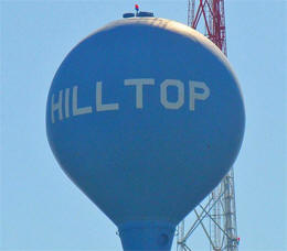
By 1961, Hilltop was growing in population and tax revenue after attracting construction of a strip mall including a supermarket, drugstore, and liquor store, in addition to a bowling alley (with liquor license) and motel. Media in Columbia Heights began insinuating that Hilltop's liquor licenses were illegal, but were unable to provide evidence. The town constructed its own water tower in the mid-1960s, which allowed it to tap the Minneapolis water supply and end its conflict with Columbia Heights. In 1967, the town's population had doubled from inception to 1,039. Tension between the rival cities began to abate in 1968, when Hilltop mayor Vivian Caesar and Columbia Heights mayor Bruce Nawrocki met alongside their respective city councils to discuss mutual issues. The city's police department closed in 1972, when one of its officers drove the town's only squad car into a tree and ruined their only source of transportation. Unable to afford a replacement, the police department was disbanded and the town instead paid the Columbia Heights Police Department for service; rescue services were also contracted to Columbia Heights on a per-incident fee.
The city led the Twin Cities area in population loss during the 1970s, going from a high of 1,015 to 817 in 1980. Due to the town's small size and the fascination with the trailer park stereotype, what were sometimes smaller incidents caused major headlines in the media of the area. In 1970, then-mayor George Reiter attempted to replace the female village clerk because he believed men were temperamentally better suited for the position, a view held by many of his supporters in the city. Murders were especially troubling for the residents. In 1976, there was a triple homicide in the city, perpetrated by Edwin Clay Hull and Ronald D. Gilbert – both received life sentences. In 1980, three prison escapees were captured hiding out in the trailer of one of their mothers; and in 1987, there was a murder-suicide involving a brother and sister.
In 1991, city manager Karen Danz, who had stood in the position for 20 years, was arrested and convicted of embezzling over $200,000 from the city treasury. With an annual budget of only $250,000 at the time, the crisis nearly drove the city to bankruptcy and jeopardized its police protection agreement with Columbia Heights. The city was ultimately saved by insurance and a fidelity bond. In 1995, the city received more unwanted attention when the Star Tribune carried a headline that "Tiny Hilltop is Crime Capital" due to its 131 serious crimes in 1994, which worked out to one for every six residents.
From Wikipedia, the free encyclopedia.
Courtesy Minnesota Historical Society
|
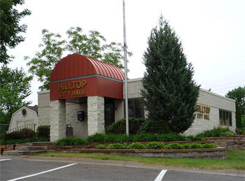
Hilltop City Hall 4555 Jackson Street NE Hilltop, MN 55421-2401 Phone: (763) 571-2024 Fax: (763) 571-4693 Regular Business Hours: Monday - Friday 8:00 am - 4:30 pm City Council Meetings: 1st and 3rd Monday of the month, time unknown 


|
 |
|||
| Title |
Term Ends |
Name & Address | Phone | |
| Mayor | 12/31/2022 |
Terry W. Wiggin 4550 Central Avenue #1628 Hilltop, MN 55421 |
(763) 360-5070 | |
| City Clerk/Treasurer | appointed | Ruth J.
Nelsen 4555 Jackson Street NE Hilltop, MN 55421 |
|
(763) 571-2024 |
| Council Member | 12/31/2022 |
James E. Shear 700 47th Avenue NE Hilltop, MN 55421 |
(763) 574-9333 | |
| Council Member | 12/31/2022 |
Linda Johnson 4550 Central Avenue NE #1424 Hilltop, MN 55421 |
(763) 571-5019 | |
| Council Member | 12/31/2024 |
Betty Risdahl 4550 Central Avenue NE #1331 Hilltop, MN 55421 |
(763) 571-2906 | |
| Council Member | 12/31/2024 |
Casey Gunter 4550 Central Avenue NE #1443 Hilltop, MN 55421 |
(763) 218-3755 | |
|
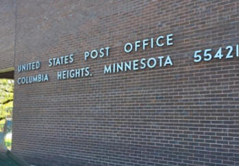
US Post Office 940 44th Avenue NE Columbia Heights, MN 55421-9998 Phone: (763) 781-3166 Toll Free: (800) ASK-USPS
Regular Business Hours: |
 |
| Utility Type | Utility Name | Utility Phone |
| Electricity | Xcel Energy | (612) 372-4727 |
| Natural Gas | CenterPoint Energy | (800) 245-2377 |
| Wastewater | City of Columbia Heights | (763) 706-3700 |
| Water | City of Columbia Heights | (763) 706-3700 |
| Telephone | CenturyLink Communications | (800) 244-1111 |
| Cable TV | Comcast/Xfinity | (651) 483-9999 |
| Employer | Products/Services | Employees |
| n/a | ||
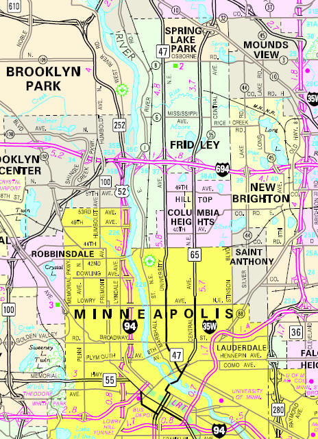
Minnesota State
Highway Map of the Hilltop Minnesota area
|
none |
Check Out
The Minnesota
History Shop! Good Goods and
Great Gifts! |
|
none |
|
none |
| Lake Name | Size (acres) |
Lake info | Lake Map | Rec Map | Topo Map |
|---|---|---|---|---|---|
| none | |||||
|
none |
|
Columbia Heights
Schools Independent School District #13 1440 49th Avenue NE Columbia Heights, MN 55421 Phone: (763) 528-4500 Grades: PK-12 Students: 3,200


|
 |
|
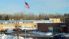
Columbia Heights High School 1400 49th Avenue NE Columbia Heights, MN 55421 Phone: (763) 528-4600 Grades: 9-12 Students: 950
|
 |
|
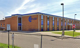
Columbia Academy 900 49th Avenue NE Columbia Heights, MN 55421 Phone: (763) 528-4700 Grades: 6-8 Students: 700
|
 |
|
Highland Elementary School 1500 49th Avenue NE Columbia Heights, MN 55421 Phone: (763) 528-4400 Grades: PK-5 Students: 550
|
|
|
North
Park Elementary School 5575 Fillmore Street NE Columbia Heights, MN 55421 Phone: (763) 528-4300 Grades: PK-5 Students: 550
|
|
|
Valley
View Elementary School 800 49th Avenue NE Columbia Heights, MN 55421 Phone: (763) 528-4200 Grades: K-5 Students: 550
|
|
|
Immaculate
Conception School (Catholic) 4030 Jackson Street NE Columbia Heights, MN 55421 Phone: (763) 788-9065 Grades: K-8 Students: 150
|
|
none |
|
Anoka County Union Herald 4095 Coon Rapids Blvd. Coon Rapids, MN 55421 Phone: (763) 412-2400
|
 |
|
Northeaster
Newspaper 2844 Johnson Street NE Minneapolis, MN 55418 Phone: (612) 788-9003 The Northeaster, the every-home-delivered community newspaper for Northeast Minneapolis, St. Anthony, Columbia Heights and Hilltop. Our Mission: Finding out stuff and putting it in the paper since 1978, and now also online.

|
 |
|
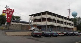
Starlite Motel
4720 Central Avenue NE Hilltop, MN 55421 Phone: (763) 571-8656 The Starlite Motel features 38 spacious and clean rooms for overnight lodging near Columbia Heights, MN. Our 2-story exterior design motel is located in 1 mile south of I-694 and just north of Minneapolis, with many restaurants nearby within walking distance. Whether you're traveling for business or pleasure, the Starlite Motel has daily and extended stay rates to fit your needs.

|
 |
|
none |
|
none |
| Best Wash Laundromat 785 45th Avenue NE Hilltop, MN 55421 Phone: (763) 571-9189 |
|
| Central Plaza Tobacco 825 45th Avenue NE Hilltop, MN 55421 Phone: (763) 276-9696 |
|
| Dollar General 865 45th Avenue NE Hilltop, MN 55421 Phone: (612) 263-6419 |
|
| Flameburger 4800 Central Avenue NE Hilltop, MN 55421 Phone: (763) 571-3267 |
|
| Happy Nails 765 45th Avenue Hilltop, MN 55421 Phone: (763) 571-0904 |
|
| Harbor Freight Tools 725 45th Avenue NE Hilltop, MN 55421 Phone: (763) 571-9390 |
|
| Kimberly Nybo State Farm Insurance 4634 Central Avenue NE Hilltop, MN 55421 Phone: (763) 571-6111 |
|
| Hilltop Mobile Home Community 4550 Central Avenue NE Hilltop, MN 55421 Phone: (763) |
|
| Lavanderia 4800 Central Avenue NE Hilltop, MN 55421 Phone: (763) 571-1500 |
|
| Little Caesar's Pizza 4872 Central Avenue NE Hilltop, MN 55421 Phone: (763) |
|
| Peace Market 923 45th Avenue NE Hilltop, MN 55421 Phone: (763) 205-6655 |
|
| Pro-Health Care 4710 Central Avenue NE Hilltop, MN 55421 Phone: (763) 746-8155 |
|
| Public Storage 4560 Central Avenue NE Hilltop, MN 55421 Phone: (763) 284-5544 |
|
|
Starlite Motel
4720 Central Avenue NE Hilltop, MN 55421 Phone: (763) 571-8656 The Starlite Motel features 38 spacious and clean rooms for overnight lodging near Columbia Heights, MN. Our 2-story exterior design motel is located in 1 mile south of I-694 and just north of Minneapolis, with many restaurants nearby within walking distance. Whether you're traveling for business or pleasure, the Starlite Motel has daily and extended stay rates to fit your needs.
|
|
| Skywood Barbers 4712 Central Avenue NE Hilltop, MN 55421 Phone: (763) 571-3585 |
|
| Tasty Pizza 875 45th Avenue NE Hilltop, MN 55421 Phone: (763) 571-2722 |
|
| Tri City Auto 4760 Central Avenue NE Hilltop, MN 55421 Phone: (763) 572-2277 |
|
| Walgreens 4880 Central Avenue NE Hilltop, MN 55421 Phone: (763) 571-7195 |
|
|
|
|
© 2004-2024 LakesnWoods LLC All Rights Reserved |
|
|
|
||