|
|
|
|
|
|
Navigation
LakesnWoods.com
Grasston Guide: © 2004-2025
DCMA, Defamation, Copyright and Trademark Infingement Policy
WANTED! Do you have photos, historical accounts or
other items pertaining to the Grasston area? Would you like to
share this historical information with the world?
LakesnWoods.com would like to publish your Grasston photos
(current or historical) or historical accounts on this website.
Original materials can be returned and your privacy will be
respected.
|
|
|||||||||||||||||||||||||||||||||||||||||||||||||||||||||||||||||||||||||||||||||||||||||||||||||||||||||||||||||||||||||||||||||||||||||||||||||||||||||||||||||||||||||||||||||||||||||||||||||||||||||||||||||||||
|
|
|
| Grasston (city) | 1970 | 1980 | 1990 | 2000 | 2010 | 1990-2000 Change | |
|---|---|---|---|---|---|---|---|
| Actual | Percent | ||||||
| Population | 132 | 123 | 119 | 105 | 158 | +53 | +50.48 |
| Land Area (sq. mile) | 0.40 | 0.67 | 0.95 | 0.95 | 0.95 | 0 | 0.00 |
| Density (persons per sq. mile) | 330.00 | 183.58 | 125.26 | 110.50 | 166.32 | +55.82 | +50.52 |
| Housing Units | 42 | 47 | 51 | 46 | 63 | +17 | +36.96 |
| Households | -- | 44 | 44 | 42 | 53 | +11 | +26.19 |
| Persons Per Household | -- | 2.80 | 2.70 | 2.50 | 2.98 | +0.48 | +19.20 |
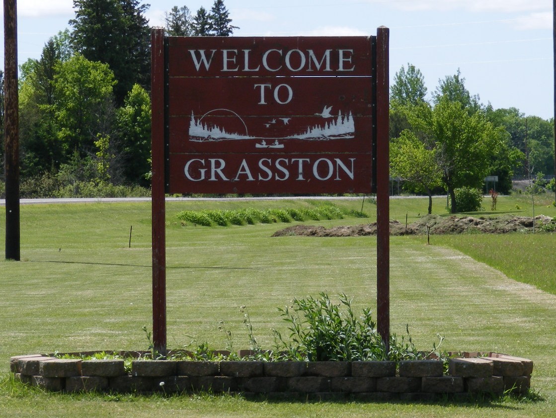
Grasston is a city in Kanabec County, Minnesota. Minnesota State Highways 70 and 107 are two of the main routes in the community. According to the United States Census Bureau, the city has a total area of 0.95 square miles (2.46 km2), of which 0.91 square miles (2.36 km2) of it is land and 0.04 square miles (0.10 km2) is water. The elevation is 968 ft (295 m) above sea level. The Snake River flows nearby.
From Wikipedia, the free encyclopedia.
As of the census of 2010, there were 158 people, 53 households, and 41 families residing in the city. The population density was 173.6 inhabitants per square mile (67.0/km2). There were 63 housing units at an average density of 69.2 per square mile (26.7/km2). The racial makeup of the city was 98.1% White, 0.6% African American, 0.6% from other races, and 0.6% from two or more races. Hispanic or Latino of any race were 1.3% of the population.
There were 53 households of which 47.2% had children under the age of 18 living with them, 62.3% were married couples living together, 9.4% had a female householder with no husband present, 5.7% had a male householder with no wife present, and 22.6% were non-families. 18.9% of all households were made up of individuals and 5.7% had someone living alone who was 65 years of age or older. The average household size was 2.98 and the average family size was 3.32.
The median age in the city was 34 years. 29.1% of residents were under the age of 18; 7.7% were between the ages of 18 and 24; 27.8% were from 25 to 44; 24.1% were from 45 to 64; and 11.4% were 65 years of age or older. The gender makeup of the city was 51.3% male and 48.7% female
Visit The
Minnesota History Shop! |
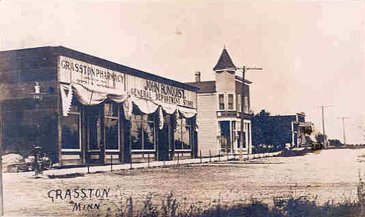
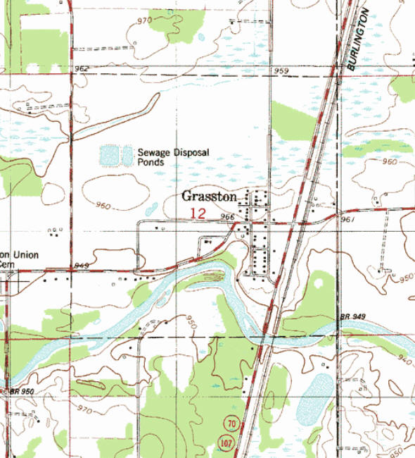
GRASSTON, a city in section 12 of Grass Lake Township, was incorporated on October 21, 1907, and separated from the township on April 8, 1908; it was established in 1898 on a side track of the Great Northern Railway and platted on June 6, 1899. John A. Swan owned the land and suggested Swanville, but the name was already in use in the state; also suggested was Oxenville, but the railroad selected Grasston, and Swan agreed. The post office began in 1899, with Annie Swan, first postmaster.
Courtesy Minnesota Historical Society
|
Visit The Grasston Photo Gallery for more recent and historic area images |
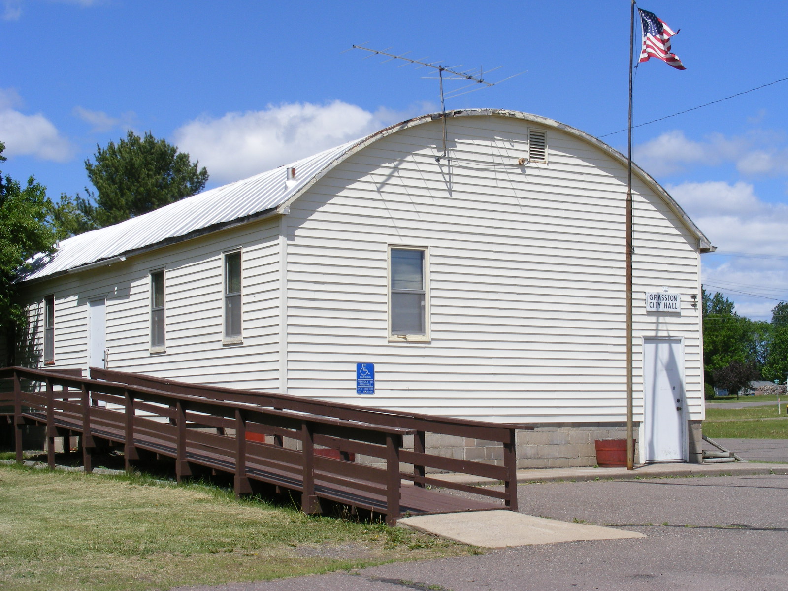
| City of Grasston PO Box 53 Grasston, MN 55030 Phone: (320) 396-2476 City Council Meetings: 2nd Tuesday of the month at 7:00 pm 


|
|
|||
| Title | Term Ends | Name and Address | Phone | |
| Mayor | 12/31/2022 |
Jeremy Miller 2758 140th Avenue Braham, MN 55006 |
(320) 376-1555 | |
| Clerk/Treasurer | appointed |
Roberta Folkstad PO Box 33 Grasston, MN 55030 |
|
(320) 396-2476 |
| Council | 12/31/2022 | Mark S.
Schneider 307 Rosabelle Street Grasston, MN 55030 |
(320) 280-0583 | |
| Council | 12/31/2022 | Darcy
Balvin 410 Oak Street Grasston, MN 55030 |
(320) 396-2212 | |
| Council | 12/31/2024 |
unknown address not available Grasston, MN 55030 |
not available | |
| Council | 12/31/2024 |
Marcetta Squires 110 Oak Street - PO Box 32 Grasston, MN 55030 |
(320) 396-3863 | |
|
|
|
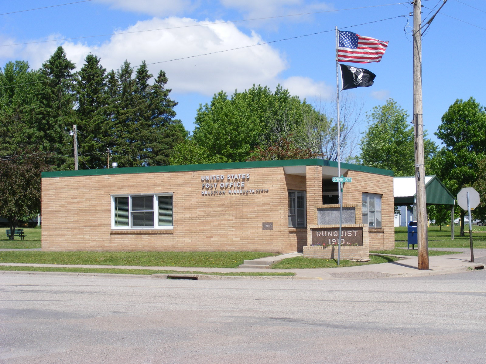
US
Post Office 200 Pine Street Grasston, MN 55030-9743 Phone:(320) 396-2065 Toll Free: (800) ASK-USPS Regular Business
Hours:
|
|
| Utility Type | Utility Name | Utility Phone |
| Electricity | East Central Energy | (800) 254-7944 |
| Natural Gas | Centerpoint Energy | (800) 245-2377 |
| Wastewater | n/a | -- |
| Water | n/a | -- |
| Telephone | CenturyLink Communications | (800) 603-6000 |
| Cable TV | n/a | -- |
| Employer | Products/Services | Employees |
| Grasston Co-op Feed Mill | Warehousing & Storage | 4 |
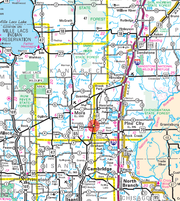
Minnesota State
Highway Map of the Grasston Minnesota area
|
none |
Check Out
The Minnesota
History Shop! Good Goods and
Great Gifts! |
|
none |
|
none |
|
|
| Lake Name | Size (acres) |
Lake info | Lake Map | Rec Map | Topo Map |
|---|---|---|---|---|---|
| Pokegama | 1,515 |
|
|
|
|
|
none |
|
Braham Area Schools Independent School District #314 531 Elmhurst Ave S Braham, MN 55006 Phone: (320) 396-3313 Fax: (320) 396-3068 Web: www.braham.k12.mn.us Grades: PK-12
|
 |
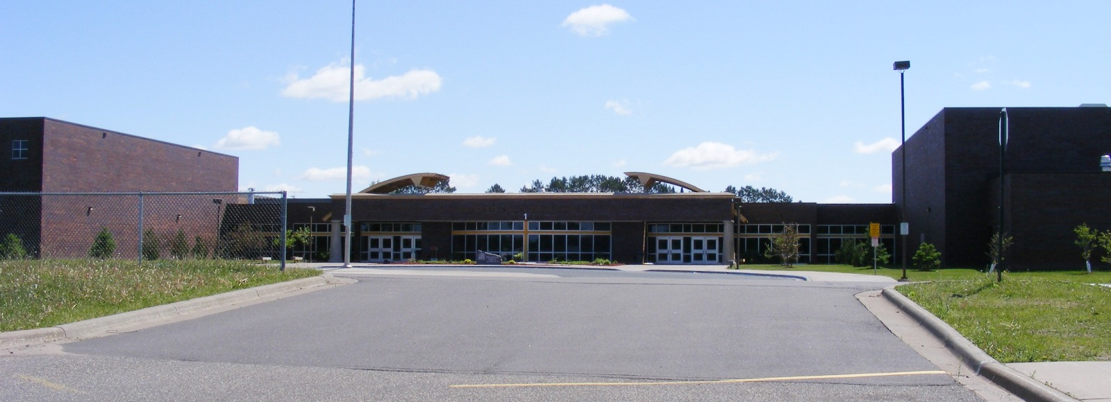
| Braham Area High School 531 Elmhurst Avenue S Braham, MN 55006 Phone: (320) 396-4444
Grades: 7-12
|
 |
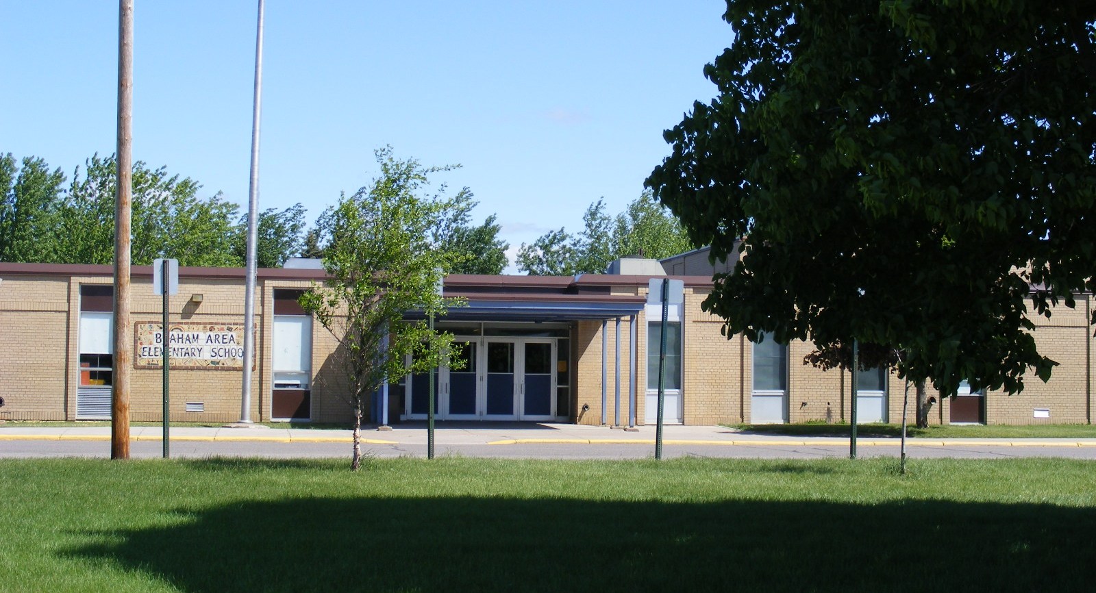
| Braham Area Elementary School 528 8th Street SW Braham, MN 55006 Phone: (320) 396-3316
Grades: PK-6
|
 |
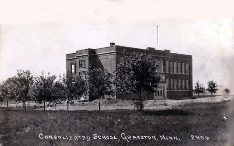 Consolidated School, Grasston Minnesota, 1920s LakesnWoods.com Postcard and Postcard Image Collection - click to enlarge Grasston School History PDF file, Courtesy of Pine City Area History Association |
|
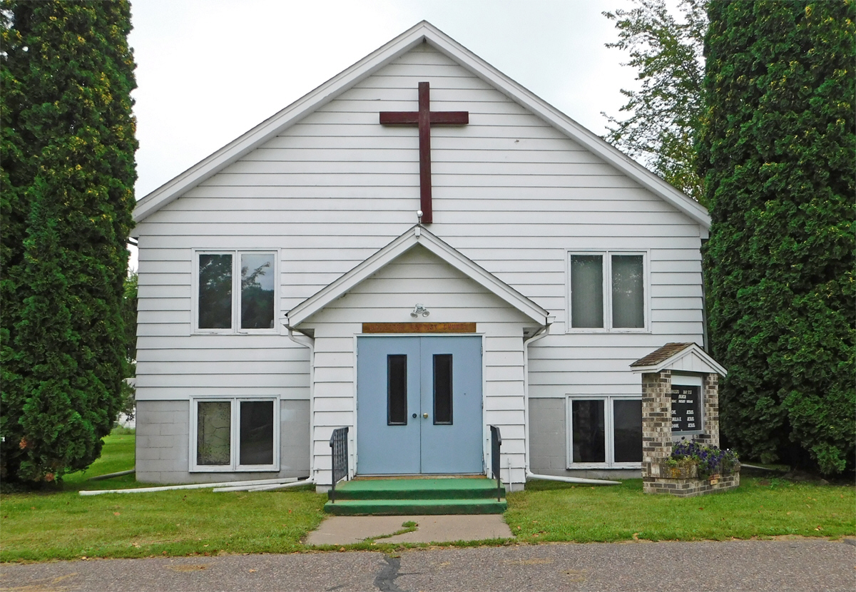
Grasston Baptist Church 402 Oak Street Grasston, MN 55030 Phone: (320) 396-2645 Web: www.grasstonbaptist.org Pastor: n/a
|
 |
|
Henriette Free Methodist Church 21004 State Highway 107 Grasston, MN 55030 Phone: (320) 679-4875 Web: hencomch.wixsite.com/hfmc Pastor:
Marvin Miller
|
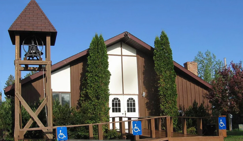 |
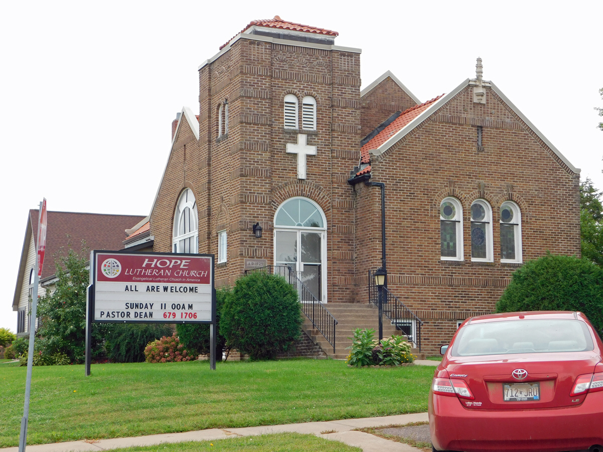
| Hope Lutheran Church
- ELCA 301 Oak Street PO Box 137 Grasston, MN 55030 Phone: (320) 396-3925 Pastor:
Rev. Dean Oelfke
|
 |
|
Open Arms Church 406 Pine Street Grasston, MN 55030 Phone: (320) 396-3373 Web: www.openarmscog.org Pastor: Gene Sherrod
|
 |
|
none |
|
none |
|
none |
|
none |
|
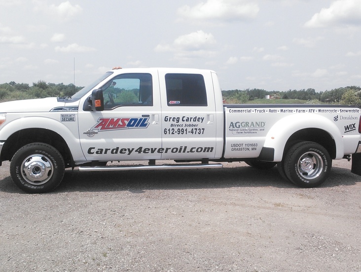
Cardey 4 Ever Oil 1762 Sod Road Grasston, MN 55030 Phone: (612) 991-4737 Web: www.cardey4everoil.com Hello, Lynette and I are Premiere Direct Jobbers interested in helping you not only save money but helping you protect your investment, if it´s in your vehicle that you drive to work or if it´s for your Toys you use for pleasure...How can we help you?We provide custom lubrication solutions to all types of customers. From families to trucking fleets, we have the products and expertise to help you save time and money.
 |
 |
| Eagle Rock Construction LLC 3850 Meadow Lark Curve Grasston, MN 55030 Phone: (320) 679-2688 
|
|
|
East Central Exterminating 9105 Pokegama Lake Road Grasston, MN 55030 Phone: (320) 629-2912 Web: www.eastcentralexterminating.net During the spring and summer months, we see a lot more spiders and ants, and in the fall months, we encounter a lot more wasps, asian beetles, and box elder bugs. If you are having problems with pests in your home – call the experts that can solve your dilemma and guarantee you with quality and expert service! We are a licensed, bonded and certified, locally owned company that will help you to return back to a comfortable, safe and happy lifestyle without pests! 
|
 |
|
Grasston Co-Op Feed Mill 209 Oak Street Grasston, MN 55030 Phone: (320) 396-2497 Web: www.grasstoncoop.com Established in 1919, then re-organized in 1939, the Grasston Co-op Feed Mill continues to serve the agricultural needs of our patrons in east central Minnesota. We are a full service feed mill in the traditional sense. We specialize in providing custom feed batches to suit your particular needs - for horses, cattle, pigs, sheep, goats - you name it !! We proudly carry the Kent line of feed supplements and complete feeds.
|
 |
| Grasston Excavating
and Landscaping 9341 Harvest Road Grasston, MN 55030 Phone: (320) 396-0459 For all your excavating needs - sewers, driveways, basements & backfilling, ponds, digging ditches & culverts and landscaping.
|
 |
| Hydrosun Hydroponics Inc. 1202 Pokegama Lake Road Grasston, MN 55030 Phone: (320) 396-3135 |
|
| K Bar K Ranch 5801 Hereford Drive Grasston, MN 55030 Phone: (320) 679-4540
|
|
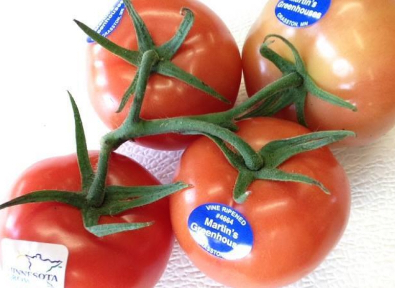
| Martin's Greenhouses 7440 Cabin Drive Grasston, MN 55030 Phone: (320) 396-3031 We are a family-owned and family-operated business in Minnesota. We grow hydroponic tomatoes and cucumbers in greenhouses and sell them to various grocery stores. We take pride in being a family farm and supplying Minnesota with quality produce!
|
 |
| Nordahl Marine 13108 Canalville Lane Grasston, MN 55030 Phone: (320) 629-2647 |
|
|
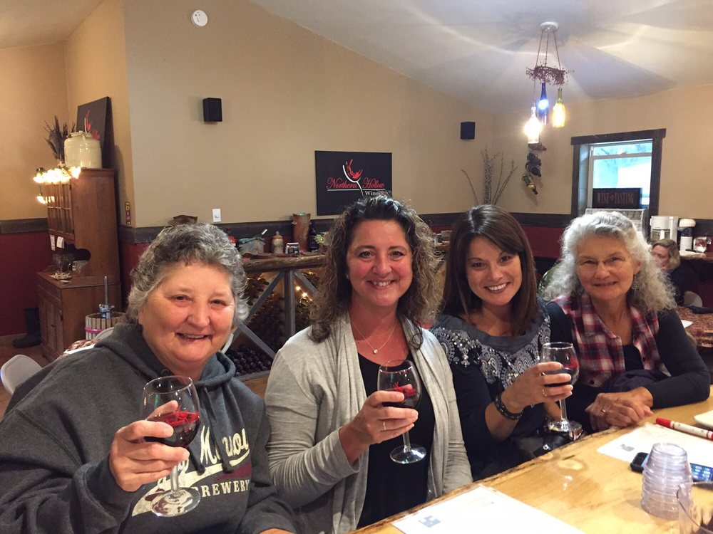
Northern Hollow
Winery 6916 Canary Road Grasston, MN 55030 Phone: (320) 266-8691 Web: www.northernhollowwinery.com Fans of good wines, local music, gourmet pizza and eclectic artwork are happy that Jim Truehart sees failure as a challenge to be understood and overcome. When his wife Deanna bought him a winemaking kit nearly a decade ago, nobody foresaw that it would be the first step to becoming owners of an award-winning winery located in Grasston.

|
 |
| Ostrom's Auto Parts 1527 Union Street Grasston, MN 55030 Phone: (320) 396-2567 We are a pull your own parts and auto salvage yard that has been in business since 1952. Our stock consists of old and new.
|
 |
|
Pokegama Pines Self Storage 9773 Birchview Road Grasston, MN 55030 Phone: (612) 418-5184 Web: www.pinecitystorage.com Pokegama Pines Self Storage is a locally owned and operated self storage business. We offer convenient indoor storage for cabin and RV owners who frequently travel to the area and points north as well as those locally who need extra space. |
|
| S & L Masonry 4036 W Birchview Road Grasston, MN 55030 Phone: (320) 679-5551
|
|
| Ted's Complete Appliance 4614 Hawk Ridge Road Grasston, MN 55030 Phone: (763) 689-1889
|
|
|
US
Post Office 200 Pine Street Grasston, MN 55030-9743 Phone:(320) 396-2065 Toll Free: (800) ASK-USPS Web: www.usps.com
|
|
|
Vannelli's Landing 13646 Muffies Lane Grasston, MN 55030 Phone: (320) 629-9979 Web: www.vannellislanding.com Vannellis Landing combines a great casual atmosphere with just a bit of elegance for those special times or occasions. Our restaurant offers a great view of Pokegama Lake to enjoy along with the company of your family and friends, our innovative food and beverages.
|
|
|
|
|
© 2004-2025 LakesnWoods LLC All Rights Reserved |
|
|
|
|||