|
|
|
|
|
|
Navigation LakesnWoods.com
© 2004-2025 DCMA, Defamation, Copyright and Trademark Infingement Policy
|
|
||||||||||||||||||||||||||||||||||||||||||||||||||||||||||||||||||||||||||||||||||||||||||||||||||||||||||||||||||||||||||||||||||||||||||||||||||||||||||||||||||||||||||||||||||||||||||||||||||||||||||||||||||||||||||||||||||||||||||||||||||||||||||||||||||||||||||||||||||||||||||||||||||||||||||||||||||||||||||||||||||||||||||||||||||||||||||
 |
|
| Garfield (city) | 1970 | 1980 | 1990 | 2000 | 2010 | 2000-2010 Change | |
|---|---|---|---|---|---|---|---|
| Actual | Percent | ||||||
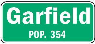
| Population | 198 | 284 | 203 | 281 | 354 | +73 | +25.98 |
| Land Area (sq. mile) | 0.50 | 0.79 | 0.70 | 0.77 | 0.77 | 0 | 0.00 |
| Density (persons per sq. mile) | 396.00 | 359.49 | 290.00 | 364.60 | 459.74 | +95.14 | +26.09 |
| Housing Units | 80 | 120 | 89 | 121 | 158 | +37 | +30.58 |
| Households | -- | 111 | 79 | 111 | 142 | +31 | +27.93 |
| Persons Per Household | -- | 2.56 | 2.57 | 2.53 | 2.49 | -0.04 | -1.58 |
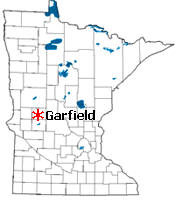
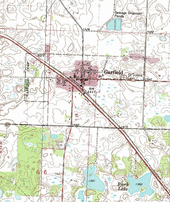
Garfield is a city in Douglas County, Minnesota. County Roads 12, 22, 40 and 82 are major routes in the community. According to the United States Census Bureau, the city has a total area of 0.78 square miles (2.02 km2), of which 0.77 square miles (1.99 km2) is land and 0.01 square miles (0.03 km2) is water. The elevation is 1,421 ft (433 m) above sea level.
From Wikipedia, the free encyclopedia.
As of the census of 2010, there were 354 people, 142 households, and 94 families residing in the city. The population density was 459.7 inhabitants per square mile (177.5/km2). There were 158 housing units at an average density of 205.2 per square mile (79.2/km2). The racial makeup of the city was 96.3% White, 0.3% African American, 0.3% from other races, and 3.1% from two or more races. Hispanic or Latino of any race were 0.8% of the population.
There were 142 households of which 38.0% had children under the age of 18 living with them, 43.7% were married couples living together, 12.7% had a female householder with no husband present, 9.9% had a male householder with no wife present, and 33.8% were non-families. 25.4% of all households were made up of individuals and 9.1% had someone living alone who was 65 years of age or older. The average household size was 2.49 and the average family size was 2.95.
The median age in the city was 33.3 years. 28.2% of residents were under the age of 18; 7.3% were between the ages of 18 and 24; 29.6% were from 25 to 44; 25.4% were from 45 to 64; and 9.3% were 65 years of age or older. The gender makeup of the city was 48.6% male and 51.4% female.
Visit The
Minnesota History Shop! |
GARFIELD, a city of Ida Township, section 32, platted February 17, 1882, incorporated August 28, 1905, was named in honor of President James A. Garfield, who was shot July 2, 1881, by the assassin Charles J. Guiteau, and died at Elberon, N.J., our second martyred president, September 19, a few months before this village was founded. The post office began in 1880; it had a station of the Great Northern Railway.
Courtesy Minnesota Historical Society
 Main Street, Garfield Minnesota, 1908 LakesnWoods.com Postcard and Postcard Image Collection - click to enlarge Visit The Garfield Photo Gallery for more recent and historic area photos |
|
Garfield City Hall 101 Sanstead Street E PO Box 51 Garfield, MN 56332 Phone: (320) 834-2238 Fax: (320) 834-3147 Regular Business Hours: Monday - Thursday 8:00 am - 4:00 pm City Council Meetings: 2nd Monday of the month at 6:00 pm 


 |
 |
|||
| Title | Term Ends | Name and Address | Phone | |
| Mayor | 12/31/2022 | John C Nienaber Jr 216 State Street N Garfield, MN 56332 |
(320) 460-0520 (320) 834-3210 |
|
| Clerk/Treasurer | appointed | Paulynn Terhark PO Box 51 Garfield, MN 56332 |
|
(320) 834-2238 |
| Council Member | 12/31/2022 | Trent Ziegelman 507 Hunter Lane - PO Box 61 Garfield, MN 56332 |
(320) 760-7308 | |
| Council Member | 12/31/2022 | Ryan Holverson 301 Ida Street E - PO Box 174 Garfield, MN 56332 |
(320) 766-4305 | |
| Council Member | 12/31/2024 | Troy Mills 506 Hunter Lane Garfield, MN 56332 |
(320) 834-2743 | |
| Council Member | 12/31/2024 | Jason M. Uhde 510 W Sanstead Street Garfield, MN 56332 |
(320) 834-3933 (320) 766-0145 |
|
|
US Post Office 104 State Street S Garfield, MN 56332-4500 Phone: (320) 834-2276 Toll Free: (800) ASK-USPS
Regular Business Hours:
|
|
| Utility Type | Utility Name | Utility Phone |
| Electricity | Otter Tail Power Company | (800) 257-4044 |
| Natural Gas | n/a | -- |
| Wastewater | City of Garfield | (320) 834-2238 |
| Water | City of Garfield | (320) 834-2238 |
| Telephone | Gardonville Cooperative Telephone Association | (320) 834-5151 |
| Cable TV | Gardonville Cooperative Telephone Association | (320) 834-5151 |
| Employer | Products/Services | Employees |
| GCI - Lifting Solutions | All Other Misc. General Purpose Machinery Mfg. | 22 |
| Garfield Truss Systems Inc. | Truss Mfg. | 11 |
| E. Arthur Brown Company Inc. | Small Arms Mfg. | 7 |
| Reprocessed Plastics Inc. | All Other Plastics Prod. Mfg. | 7 |
Minnesota State
Highway Map of the Garfield Minnesota area
|
none |
Check Out
The Minnesota
History Shop! Good Goods and
Great Gifts! |
|
none |
|
Central Lakes
Trail An amenity that was recently paved from Garfield to Osakis is the Central Lakes Trail, the old Burlington Northern rail bed converted to a year-round recreational trail. The trail runs from Fergus Falls to Osakis, where it connects with the Lake Wobegon Trail on the same rail bed that runs all the way to St. Cloud. This trail offers biking, hiking, and rollerblading in the summer and snowmobiling during the winter. |
 |
|
Park-A-While Gardens City Park It contains several shelters with picnic tables and an abundant amount of space for a family gathering or a place to relax. A new feature added to the park during the summer months is a unisex portapot. |
| Lake Name | Size (acres) |
Lake info | Lake Map | Rec Map | Topo Map |
|---|---|---|---|---|---|
| Chippewa | 1186 |
|
|
|
|
| Ida | 4426 |
|
|
|
|
| Lobster | 1308 |
|
|
|
|
| Louise | 214 |
|
|
|
|
| Mina | 411 |
|
|
|
|
|
none - served by Alexandria hospitals and clinics |
|
Garfield Elementary School Grades: K-6 |
|
Moe Lutheran Church 3531 E Moe Road NW Garfield, MN 56332 Phone: (320) 834-2255 Web: www.moelutheranparish.org Pastor: Donald Clifford |
 |
| St. John's Lutheran Church 401 Park Street Garfield, MN 56332 Phone: (320) 834-2248 Pastor: Rev.
Shawn Ethridge |
|
|
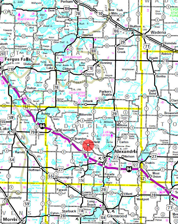
St. Luke's Church 201 Elda Street PO Box 50 Garfield, MN 56332 Phone: (320) 834-2285 Web: www.stlukeschurchgarfield.org Pastor: David
L. Gran |
|
none - served by Alexandria media |
|
none - see Alexandria |
|
none - see Alexandria |
|
Oak Park
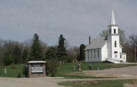
Campground 9561 County Road 8 NW Garfield, MN 56332 Phone: (320) 834-2345 Web: www.oakparkcampground.com Oak Park Campground is 43 acres of beautiful park-like rolling hills with three ponds and mature trees. We have 59 RV sites to offer. Facilities/Activities include swimming pool, playground equipment, softball field, horseshoe pit, and a pavilion with restrooms and kitchen facilities. |
 |
| Alex Semi Wrecker Service 5227 Halvorson Road NW Garfield, MN 56332 Phone: (320) 762-8542 |
|
| Alexandria Jaycees 105 Sanstead Street W Garfield, MN 56332 Phone: (320) 834-3030 |
|
| Alexandria Sanitary Service 3703 Centennial Drive NW Garfield, MN 56332 Phone: (320) 763-7493 |
|
| Anderson Brothers Farm 8808 Pleasant Grove NW Garfield, MN 56332 Phone: (320) 834-2461 |
|
|
Bayside
Rentals 111 State Street Garfield, MN 56332 Phone: (320) 834-3990 Web: www.baysiderentalsalexandria.com |
|
| Blanshan Construction
Services Inc 12261 County Road 8 NW Garfield, MN 56332 Phone: (320) 766-4167 |
|
|
Blue River Kennel 5291 Halvorson Road Garfield, MN 56332 Phone: (320) 219-2081 Web: www.bluerivergundogs.com Field bred English Springer Spaniels, are our passion. Our gun dogs are raised with a strong emphasis on temperament, natural hunting ability, bird finding, soft mouths, and drive in the field. With a good looking build, and a willingness to please. We utilize the most up to date health screening we can find, to produce the soundest dog we can. We are located in the Alexandria MN Lakes area. Providing quality gun dogs for 18 years. Offering field bred, English Springer Spaniel puppies, and an occasional started dog, on a limited basis. |
 |
|
Bosek Masonry Construction 3321 County Road 40 NW Garfield, MN 56332 Phone: (320) 200-4870 |
|
|
Bower Useful Products
Inc. It’s what the archery industry has been waiting for... A high quality backstop that is lightweight and portable, while gentle on the arrows. No more broken arrows or damaged fletchings. Removal is effortless! Our products are guaranteed for 30 days. If for any reason within 30 days you are not satisfied with any of your BUP Sports products you may return it for a full refund of you purchase price less actual shipping cost. |
|
| Brad Olson Barn & Shop 13871 Century Road NW Garfield, MN 56332 Phone: (320) 834-3276 |
|
| Brentwood Garage 6 11902 County Road 12 NW Garfield, MN 56332 Phone: (320) 834-2089 |
|
|
Cenex Convenience Store 301 County Road 40 NW Garfield, MN 56332 Phone: (320) 834-2224 Web: www.cenex.com |
 |
|
Common Threads Quilt Shop 101 Sanstead Street E Garfield, MN 56332 Phone: (320) 834-2563 Web: www.commonthreadsquilt.com We are a full service quilt shop, with thousands of fabrics, patterns, books, and notions. We specialize in 30s, Thimbleberries, Civil War, Moda, flannel, and batik prints along with many more designer fabrics. We are continually adding samples and kits to our ever growing lines of fabrics to give you the best examples possible of our wide array of fabric and pattern selections. |
 |
| Curt's Electric 11224 County Road 12 NW Garfield, MN 56332 Phone: (320) 834-2490 |
|
| Custom Woodcrafts 9700 Limb Road NW Garfield, MN 56332 Phone: (320) 834-2582 |
|
| Diedrich Seed 6218 County Road 12 NW Garfield, MN 56332 Phone: (320) 834-2869 |
|
|
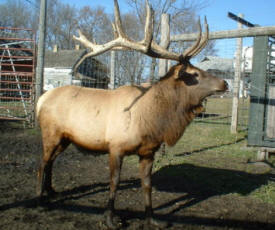
Doraisamy
Elk and Lamb Farm 1090 County Road 7 NW Garfield, MN 56332 Phone: (320) 524-2513 Web: mnelkcom.ipower.com/Doraisamy/ These BULLS ARE GOOD EATING. They are not fed anything unnatural for the growth of their antlers. For the best eating meat, we recommend they be harvested in early September before they go into rut or after the first of the year when they're over the rut. Doraisamy Farm has a small herd of JACOB SHEEP - an old hardy breed which may go back to Biblical times. These Jacob lambs are raised on grassy pastures and are supplemented only with NON Genetically Engineered corn and grains grown on the farm, and some purchased mineral supplement. The lambs are also raised ASH Free - NO Antibiotics, Steroids, or Hormones. |
 |
|
Dorman Auto
Repair 414 County Road 82 NW Garfield, MN 56332 Phone: (320) 834-2014 Web: www.dormanautorepair.info At Dorman Auto Repair, our main goal is to provide you and your business with exceptional quality welding services in Garfield, MN backed by years of hands-on experience. Our top priorities are job site safety, service, reliability, and unrivalled welding excellence. Our work ethic is second to none, and we always strive to go above and beyond for our clients. |
|
|
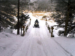
Douglas Area Trails
Association 1298 Centennial Lane NW Garfield, MN 56332 Phone: (320) 834-2033 Web: www.douglasareatrails.com Located midway between the Twin Cities and Fargo-Moorhead, the Douglas Area Trails Association maintains 370 miles of snowmobile trails in west central Minnesota’s Hardwood Hills and River Prairie landscapes. Dotted with numerous lakes, Douglas County’s DATA Trails offer a real combination of open flatlands to heavily wooded and often hilly riding. |
 |
| Douglas County Electric 3003 N Oaks Lane NW Garfield, MN 56332 Phone: (320) 834-2350 |
|
|
Dynamic Landscapes
and Hydroseeding 4547 Fox Crossing NW Garfield, MN 56332 Phone: (320) 815-2776 Web: www.dynamichydroseed.com Dynamic Landscapes & Hydroseeding offers complete landscaping and hydroseeding services in the Garfield, MN area. Our highly trained specialists provide quality residential and commercial workmanship at reasonable rates. |
 |
|
E Arthur Brown Company 650 County Road 40 NW Garfield, MN 56332 Phone: (320) 834-3000 Web: www.eabco.com Maker and supplier of accurate guns, barrels, riflescopes, reloading, and accessories. |
 |
| F & S Concrete Paving Inc 5227 Halvorson Road NW Garfield, MN 56332 Phone: (320) 834-4578 |
|
|
Fire Station Bar & Grill 203 Sanstead Street W Garfield, MN 56332 Phone: (320) 834-3250 Web: www.firestationbarandgrillmn.com Fire Station Bar & Grill of Garfield, MN is the place to be for great food and an even greater experience. Indulge in our dishes and specials and treat yourself to our fully stocked bar while listening to a local or regional band’s good music. We guarantee quality food made from the freshest and finest ingredients and courteous, dependable services because these are what our name stands for. With us, your satisfaction is guaranteed. |
 |
|
Friends
Forever Retreat 904 County Road 56 NW Garfield, MN 56332 Phone: (612) 363-5099 Web: www.friendsforeverretreat.com Friends Forever Retreat is your "Home Away From Home". It was designed to bring family and friends together in a relaxing atmosphere to getaway from today's busy lifestyles. Spend quality time preserving memories: scrapbook, stamp, quilt, bead or any other craft that you may enjoy. We have all the comforts of home with some added extras to help you relax and take time for yourself. We think this an indulgence well deserved. |
 |
| Garfield City Hall 116 Sanstead Street W Garfield, MN 56332 Phone: (320) 834-2238 |
|
|
Garfield Diner 107 State Street S Garfield, MN 56332 Phone: (320) 834-2660 Web: www.restaurantgarfieldmn.com Garfield Diner of Garfield, MN offers and takes pride in delicious food and excellent customer service for a great dining experience. We serve the Garfield and Alexandria area. Our mission is to put a smile on your face. We make our food fresh and made from scratch just like it is at home. Owned by Dan Soden, a.k.a. “Chef Dano,” who has over 40 years of experience, we assure to give you great food and the best customer service. |
 |
| Garfield Processing 7236 County Road 82 NW Garfield, MN 56332 Phone: (320) 834-3144 |
|
| Garfield Pub 101 Sanstead Street W Garfield, MN 56332 Phone: (320) 834-2273 |
|
| Garfield Truss Systems Inc 4063 County Road 40 NW Garfield, MN 56332 Phone: (320) 834-2201 |
|
|
GCI 4179 County Road 40 NW Phone: (320) 834-2211 Web: www.gcilift.com GCI is a custom designer and manufacturer of industrial manipulators, assembly fixtures, torque reaction systems, and material handling equipment including automated, powered and manual movement for use in a wide variety of manufacturing or assembly needs. From sophisticated automation applications to simple hoist suspended tooling, GCI can design and build the machines you need to help with the ergonomic lifting and torque reaction issues faced in today’s manufacturing arena. |
 |
|
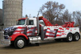
Glenn's Towing & Trucking 5227 Halvorson Road NW Garfield, MN 56332 Phone: (320) 834-4462 Web: www.glenstowingandrepairmn.com For all your towing and repair needs, contact Glenn's Towing and Repair of Garfield, MN. Owned and operated by Glenn Peterson, we deal with towing, full auto repair services, and more. With our experienced professionals, you will definitely get the prompt auto service you deserve. |
 |
|
Healthy Alternatives Inc 10458 Moe Hall Road NW Garfield, MN 56332 Phone: (320) 834-2188 Web: www.healthyalternativesinc.com HEALTHY ALTERNATIVES INC™ is dedicated to the idea that everyone is entitled to the healthiest and most energetic lifestyle they are capable of attaining. With the combination of good nutrition, moderate exercise, and enzyme supplementation, you can enjoy the tremendous benefits of life: improved digestion, increased energy, weight loss, stronger immune system, improved elimination, healthier skin, better sleep, lower cholesterol, less inflammation. |
 |
| Hensen's Deer Processing 15811 County Road 6 NW Garfield, MN 56332 Phone: (218) 267-2894 |
|
| Hillside Styling Center Garfield, MN 56332 Phone: (320) 834-4007 |
|
|
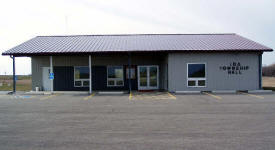
Ida Township Office 4700 County Road 6 NW Garfield, MN 56332 Phone: (320) 834-3377 Web: www.idatownship.com Ida Township lies in Douglas County, Minnesota. It was organized in 1870. The township includes approximately 23,040 acres. The 2010 federal census population of the township was 1,228, the April 2010 Minnesota State Demographer population is 1,228 with 512 estimated households. |
 |
| J C Construction 7133 Clear View Road NW Garfield, MN 56332 Phone: (320) 834-2682 |
|
| J D Construction 10201 Limb Road NW Garfield, MN 56332 Phone: (320) 834-2552 |
|
| Lakes Area Seamless Gutters 12685 County Road 56 NW Garfield, MN 56332 Phone: (320) 834-6250 |
|
|
Leader Supply and
Buildings PO Box 161 Garfield, MN 56332 Phone: (320) 834-2270 Web: www.leadersupply.com Leader's core business is providing Post Frame building packages and many accessories for buildings. Years of planning and experience in the construction and Post Frame industries assure you'll get the expertise you need for your project. |
 |
| Leaf Valley Creamery 5562 County Road 5 NW Garfield, MN 56332 Phone: (218) 267-2051 |
|
| Leaf Valley Mercantile Bar 15233 County Road 6 NW Garfield, MN 56332 Phone: (218) 267-2726 |
|
| Leaf Valley Storage 13466 County Road 6 NW Garfield, MN 56332 Phone: (320) 219-1947 |
|
|
LRP Construction
Services 3251 70th Street NW Garfield, MN 56332 Phone: (320) 834-2968 Fax: (320) 834-3303 Web: www.vikinglandbuilders.com |
 |
| M & O Radiator Repair 5921 County Road 22 NW Garfield, MN 56332 Phone: (320) 834-3522 |
|
|
Morical Brothers Gravel 2468 E Moe Road NW Garfield, MN 56332 Phone: (320) 834-2008 Web: www.moricalbrothers.com Are you looking for something to accent your landscape or gardens? Do you need to pave your road, but would like an alternative to regular pavement? How about rock? Morical Brothers Inc. produces a wide variety of aggregate materials for both residential and commercial purposes. Your landscapes can be beautifully accented with natural stones, and your new road can be paved with rock. |
 |
|
Nat's Totally E Fit 609 County Road 82 NW Garfield, MN 56332 Phone: (320) 834-2700 Web: www.natstotalefit.com |
|
|
Oak Park
Campground 9561 County Road 8 NW Garfield, MN 56332 Phone: (320) 834-2345 Web: www.oakparkcampground.com Oak Park Campground is 43 acres of beautiful park-like rolling hills with three ponds and mature trees. We have 59 RV sites to offer. Facilities/Activities include swimming pool, playground equipment, softball field, horseshoe pit, and a pavilion with restrooms and kitchen facilities. |
|
|
Oberg Construction LLC
5807 Kaycee Lane NW Garfield, MN 56332 Phone: (320) 760-2355 Web: www.obergconst.com Oberg Construction of Alexandria Minnesota is a licensed and insured construction company that serves Central Minnesota communities. Every home, including yours, is important to us because we realize it is important to you. Your home is possibly the best and largest investment of your life and we want to help you ensure that it is as enjoyable and as efficient as possible. |
 |
| Okerlund Graveling 4551 County Road 22 NW Garfield, MN 56332 Phone: (320) 834-2418 |
|
| On-Stage DJ & Karaoke 7141 County Road 60 NW Garfield, MN 56332 Phone: (320) 876-2181 |
|
| Penny Wise Handyman 414 County Road 82 NW Garfield, MN 56332 Phone: (320) 766-6059 |
|
| Point of View Glass Art PO Box 33 Garfield, MN 56332 Phone: (320) 762-6569 |
|
|
Pro-Ag Farmers Coop 204 Sanstead Street W Garfield, MN 56332 Phone: (320) 834-2271 Web: www.proagfarmers.com |
 |
|
Recycled Plastics Inc 609 County Road 82 NW Garfield, MN 56332 Phone: (320) 834-2293 Fax: (320) 834-2290 Web: www.gipo-rpi.com Reprocessed Plastics Inc. fabricates plastic components and parts for marine, agriculture, building, and many other industries. In addition to components, RPI custom manufactures and has stock plastic sheets and lineal plastic lumber. We offer Fast Turnaround, Engineering and Design Assistance, and Auto CAD |
 |
| Rosengren Construction 2338 Centennial Lane NW Garfield, MN 56332 Phone: (320) 834-2672 |
|
|
Sid's Electric Inc 3850 Centennial Drive NW Garfield, MN 56332 Phone: (320) 763-7944 Web: www.sidselectric.com Sid's Electric, Inc. offers residential and commercial electric services in the Garfield MN area. Our licensed, bonded, and insured company will take care of all your electrical needs at very reasonable cost. We are proudly serving Alexandria and surrounding areas. |
 |
|
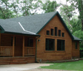
Spirit Cove Lodge 7458 39th Avenue NW Garfield, MN 56332 Phone: (320) 834-7250 Web: www.spiritcovelodge.com |
|
|
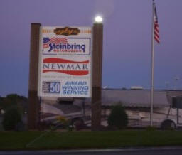
Steinbring Motorcoach 7390 County Road 82 NW Garfield, MN 56332 Phone: (320) 834-6333 Web: www.steinbring.com Steinbring Motorcoach offers new and used Newmar motorhomes for sale along with pre-owned coaches from popular brands such as Winnebago, Itasca, Tiffin, Fleetwood and Monaco along with consignments. Whether you are looking for a Class A, Class B, Class C, a diesel pusher, gas or a toy hauler, your sure to find your next RV at Steinbring’s. |
 |
| Superior Auto Body 420 County Road 82 NW Garfield, MN 56332 Phone: (320) 834-2778 |
|
| Taylor Machining Solutions 3989 County Road 40 NW Garfield, MN 56332 Phone: (320) 834-2254 |
|
| TFC Roofing 5981 Utopia Drive NW Garfield, MN 56332 Phone: (320) 760-6159 |
|
|
Ultimate
Landscapes and Design 2808 Deer Run NW Garfield, MN 56332 Phone: (320) 808-3645 Web: www.ultimatelandscapesmn.com Ultimate Landscapes & Design is your most reliable landscaping service in the area. With experience in commercial, residential and lakeshore landscaping we can help you create your dream landscape! We specialize in a broad range of landscaping techniques. It is important to me that your project is unique and personalized to fit your needs! |
 |
|
US Post Office PO Box 9998 Garfield, MN 56332-4500 Phone: (320) 834-2276 Toll Free: (800) ASK-USPS Web: www.usps.com |
|
|
Utopia Tours Inc 4422 Utopia Drive NW Garfield, MN 56332 Phone: (320) 834-2153 Web: www.utopiatours.com Our motorcoach tours travel all across the United States & Canada and range from 2 days to over 3 weeks in length. Contact us for a brochure, or follow links to see the day-to-day information on-line. Most tours have pick-up and drop-off locations available on I-94 from Fargo to Minneapolis, and along route of tour. |
|
| Valley Creamery Association 5562 County Road 5 NW Garfield, MN 56332 Phone: (320) 834-2535 |
|
| West Central Electric 13466 County Road 6 NW Garfield, MN 56332 Phone: (320) 834-2556 |
|
| West Central Lakes Blinds 8950 Blue Jay Way NW Garfield, MN 56332 Phone: (320) 834-2667 |
|
|
|
|
|
© 2004-2025 LakesnWoods LLC All Rights Reserved |
|
|
|
||