|
|
|
|
|
|
Navigation LakesnWoods.com
© 2004-2025 DCMA, Defamation, Copyright and Trademark Infingement Policy
|
|
|||||||||||||||||||||||||||||||||||||||||||||||||||||||||||||||||||||||||||||||||||||||||||||||||||||||||||||||||||||||||||||||||||||||||||||||||||||||||||||||||||||||||||||||||
 |
|
| Forada (city) | 1970 | 1980 | 1990 | 2000 | 2010 | 2000-2010 Change | |
|---|---|---|---|---|---|---|---|
| Actual | Percent | ||||||
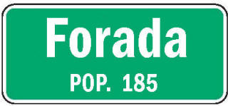
| Population | 158 | 191 | 171 | 197 | 185 | -12 | -6.09 |
| Land Area (sq. mile) | 0.70 | 0.59 | 0.53 | 0.53 | 0.53 | 0 | 0.00 |
| Density (persons per sq. mile) | 225.71 | 323.73 | 322.64 | 370.51 | 349.06 | -21.45 | -5.79 |
| Housing Units | 77 | 110 | 105 | 118 | 125 | +7 | +5.93 |
| Households | -- | 67 | 66 | 82 | 82 | 0 | 0.00 |
| Persons Per Household | -- | 2.85 | 2.59 | 2.40 | 2.26 | -0.14 | -5.83 |
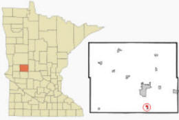
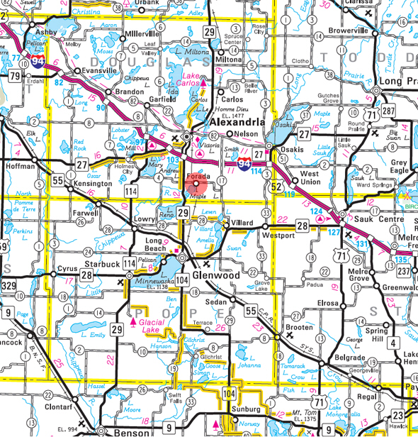
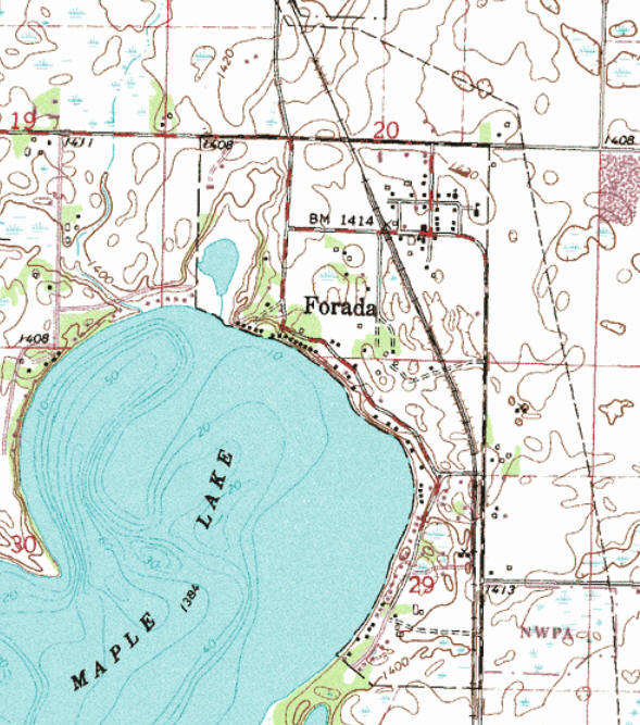
Forada is a city in Douglas County, Minnesota. According to the United States Census Bureau, the city has a total area of 0.55 square miles (1.42 km2), of which 0.54 square miles (1.40 km2) is land and 0.01 square miles (0.03 km2) is water. County Highway 4 and Minnesota Highway 29 are two of the main routes in the community. The elevation is 1,417 ft (432 m) above sea level.
From Wikipedia, the free encyclopedia.
As of the census of 2010, there were 185 people, 82 households, and 58 families residing in the city. The population density was 342.6 inhabitants per square mile (132.3/km2). There were 125 housing units at an average density of 231.5 per square mile (89.4/km2). The racial makeup of the city was 97.8% White, 0.5% Asian, and 1.6% from two or more races. Hispanic or Latino of any race were 1.1% of the population.
There were 82 households of which 23.2% had children under the age of 18 living with them, 56.1% were married couples living together, 12.2% had a female householder with no husband present, 2.4% had a male householder with no wife present, and 29.3% were non-families. 19.5% of all households were made up of individuals and 6.1% had someone living alone who was 65 years of age or older. The average household size was 2.26 and the average family size was 2.52.
The median age in the city was 50.8 years. 17.3% of residents were under the age of 18; 4.3% were between the ages of 18 and 24; 21.1% were from 25 to 44; 31.4% were from 45 to 64; and 25.9% were 65 years of age or older. The gender makeup of the city was 49.2% male and 50.8% female.
Visit The
Minnesota History Shop! |
FORADA, a city in Hudson Township, section 20, platted in July 1903 by Cyrus A. Campbell of Parker's Prairie, Otter Tail County, incorporated July 20, 1905, has the first name of Mrs. Campbell, Ada; but that name was already widely known as the county seat of Norman County, and therefore it received the prefixed syllable. The city had a station of the Soo Line and a post office, 1904-54.
Courtesy Minnesota Historical Society
|
Forada City Hall 10991 Tobys Avenue SE Alexandria, MN 56308 Phone: (320) 762-9772 Regular Business Hours: not available City Council Meetings: 1st Monday after the 1st Tuesday at 7:00 pm 


 |
||||
| Title | Term Ends | Name and Address | Phone | |
| Mayor | 12/31/2022 | David Reller 11745 Forada Beach Road SE Alexandria, MN 56308 |
(701) 212-7487 | |
| Clerk/Treasurer | 12/31/2022 | Jo Kluver 11985 Forada Beach Road SE Alexandria, MN 56308 |
|
(320) 762-9772 (320) 219-9036 |
| Council Member | 12/31/2022 | Scott W. Erickson 11240 County Road 87 SE Alexandria, MN 56308 |
(320) 763-7099 (320) 808-8697 |
|
| Council Member | 12/31/2024 | Mitch Critz 11570 Forada Beach Road SE Alexandria, MN 56308 |
(320) 760-7214 | |
| Council Member | 12/31/2024 | Bob Verkinderen 12028 Forada Beach Road SE Alexandria, MN 56308 |
(320) 766-5075 | |
|
US Post Office 519 Elm Street Alexandria, MN 56308-1312 Phone: (320) 763-3432 Toll Free: (800) ASK-USPS Fax: (320) 763-9695 Regular
Business Hours:
|
 |
| Utility Type | Utility Name | Utility Phone |
| Electricity | Otter Tail Power Company | (218) 739-8200 |
| Natural Gas | n/a | -- |
| Wastewater | n/a | -- |
| Water | n/a | -- |
| Telephone | Centurylink | (888) 723-8010 |
| Cable TV | n/a | -- |
| Employer | Products/Services | Employees |
|
n/a |
||
|
1st weekend in August |
Check Out
The Minnesota
History Shop! Good Goods and
Great Gifts! |
| none |
| none |
| Lake Name | Size (acres) |
Lake info | Lake Map | Rec Map | Topo Map |
|---|---|---|---|---|---|
| Maple | 831 |
|
|
|
|
| none - see Alexandria |
| none |
| none |
| none - see Alexandria |
| none |
|
Sunset Beach Resort |
| none |
| ABC Upholstery 10937 Maple Springs Drive SE Alexandria, MN 56308 Phone: (320) 763-7409 |
|
|
Alex Air Apparatus 11897 County Road 87 SE Alexandria, MN 56308 Phone: (320) 763-7803 Web: www.alexairapparatus.com |
|
| Blue Collar Bob's 1753 County Road 4 SE Alexandria, MN 56308 Phone: (320) 808-6777 |
|
|
Chlian
Construction LLC 11377 Maple Springs Drive SE Alexandria, MN 56308 Phone: (320) 808-3450 Web: www.chlianconstruction.com |
|
| Forada City Hall 10991 Tobys Ave SE Alexandria, MN 56308 Phone: n/a |
|
| Forada Liquor Bar & Grill
1531 4th Street SE Alexandria, MN 56308 Phone: (320) 762-0428 Forada Bar & Grill located in downtown Forada serves up some of the best homemade food one can get. With a full menu of burgers, sandwiches, soups, salads and specialty dinners. Plus they are home to Tony’s famous barbequed ribs and this area’s best homemade, handtossed pizza’s. Their pizza’s are available for dine in or carry out. Forada Bar and Grill is perfect for relaxing with friends or dining out with the family. They are also home to some of the best blues shows in this area. Check out their facebook page for upcoming blues shows. Come out and see why it’s simply more fun in Forada only at Forada Bar and Grill. |
|
|
Forada Supper Club 1380 County Road 4 SE Alexandria, MN 56308 Phone: (320) 763-4400 Web: www.foradasupperclub.com A family-owned supper club located in Forada, Minnesota. Call us for your special event, dinner party, or wedding, and stop by for our golden fried chicken |
|
| Forada Volunteer Fire Department 11914 Kluver Addition Road SE Alexandria, MN 56308 Phone: (320) 762-8632 |
|
| Hometown Community Bank 10635 Tobys Avenue SE Alexandria, MN 56308 Phone: (320) 763-7400 |
|
| Muddy Boot 11070 Tobys Avenue SE Alexandria, MN 56308 Phone: (320) 762-1635 |
|
| Sunset Beach Resort 11876 Forada Beach Road SE Alexandria, MN 56308 Phone: (320) 763-7466 |
|
|
|
|
© 2004-2025 LakesnWoods LLC All Rights Reserved |
|
|
|
||