|
|
|
|
|
|
Navigation LakesnWoods.com
© 2004-2024 DCMA, Defamation, Copyright and Trademark Infingement Policy
|
|
|||||||||||||||||||||||||||||||||||||||||||||||||||||||||||||||||||||||||||||||||||||||||||||||||||||||||||||||||||||||||||||||||||||||||||||||||||||||||||||||||||||||||||||||||||||||||||||||||||||||||||||||||||||||||||||||||||||||||||||||||||||||||||||||||||||||||||||||||||||||||||||||||||||||||||||||||||||||||||||||||||||||||||||||||||||||||||||||||||||||||||||||||||
|
|
|
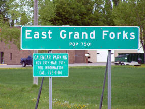
| East Grand Forks (city) | 1970 | 1980 | 1990 | 2000 | 2010 | 2000-2010 Change | |
|---|---|---|---|---|---|---|---|
| Actual | Percent | ||||||
| Population | 7,607 | 8,537 | 8,658 | 7,501 | 8,601 | +1,100 | +14.66 |
| Land Area (sq. mile) | 2.50 | 4.37 | 4.43 | 5.00 | n/a | -- | -- |
| Density (persons per sq. mile) | 3,042.80 | 1,953.55 | 1,954.40 | 1,501.46 | n/a | -- | -- |
| Housing Units | 2,279 | 3,471 | 3,500 | 3,108 | 3.626 | +518 | +16.67 |
| Households | -- | 3,025 | 3,159 | 2,929 | 3,488 | +559 | +19.09 |
| Persons Per Household | -- | 2.78 | 2.69 | 2.54 | 2.47 | -0.07 | -2.76 |
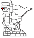
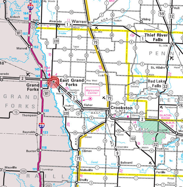
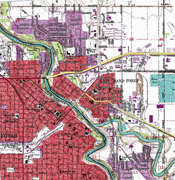
East Grand Forks is located in the fertile Red River Valley. The area around East Grand Forks is prime for agricultural uses. The Red River Valley used to be a part of glacial Lake Agassiz. This made the land fertile and very flat.
The Red Lake River divides East Grand Forks into two main sections. The main part of town, located north of the river, is the home of the downtown area as well as several residential neighborhoods. The area south of the river is known as "The Point." This is because the land forms a narrow point shape (almost peninsular) where the Red and Red Lake rivers meet. "The Point" contains more residential development.
Four-lane U.S. Route 2; U.S. 2 Business Route; and Minnesota Highway 220 are three of the main routes in the city. Other nearby routes in the Grand Forks-East Grand Forks area include Interstate Highway 29, to the west of Grand Forks' downtown, and U.S. Highway 81.According to the United States Census Bureau, the city has a total area of 5.91 square miles (15.31 km2), all land. The elevation is 833 feet (254 m).
From Wikipedia, the free encyclopedia.
As of the census of 2010, there were 8,601 people, 3,488 households, and 2,258 families residing in the city. The population density was 1,455.3 inhabitants per square mile (561.9/km2). There were 3,626 housing units at an average density of 613.5 per square mile (236.9/km2). The racial makeup of the city was 91.1% White, 1.3% African American, 1.8% Native American, 0.6% Asian, 2.4% from other races, and 2.9% from two or more races. Hispanic or Latino of any race were 6.5% of the population.
There were 3,488 households of which 33.8% had children under the age of 18 living with them, 49.3% were married couples living together, 11.8% had a female householder with no husband present, 3.7% had a male householder with no wife present, and 35.3% were non-families. 28.7% of all households were made up of individuals and 12% had someone living alone who was 65 years of age or older. The average household size was 2.45 and the average family size was 3.03.
The median age in the city was 35 years. 25.8% of residents were under the age of 18; 10.5% were between the ages of 18 and 24; 25.8% were from 25 to 44; 24.8% were from 45 to 64; and 13.3% were 65 years of age or older. The gender makeup of the city was 49.2% male and 50.8% female.
Visit The
Minnesota History Shop! |
EAST GRAND FORKS, a city in Grand Forks and Rhinehart Townships, incorporated as a city March 7, 1887, is on the east side of the Red River, opposite the city of Grand Forks, N.D., where the confluence of the large Red Lake River with the upper part of the Red River presents two navigable courses or forks for ascending boats. The city began after the Civil War as a trading center and stopping-off place for Red River cart teamsters going between St. Paul and Winnipeg; the St. Paul, Minneapolis and Manitoba Railroad came in 1880. The city was first known as Nashville when the post office opened in 1874, for William C. Nash, fur trader and government mail carrier between Abercrombie and Pembina; the name changed to East Grand Forks in 1883. Nash was born in Pennsylvania and came to the area in 1863, securing the mail contract in 1864, and was postmaster of Tillia, 1872-73. Regular flooding of the rivers has caused difficulties for the community. After a devastating flood in 1997, the U.S. Army Corps of Engineers built levees along the Red River to protect the cities of Grand Forks and East Grand Forks; the land between the levees was designated as the Greenway, to be developed as a recreational area. In 2000, the Minnesota legislature established the Red River State Recreation Area on the state-managed portion of Greenway lands.
Courtesy Minnesota Historical Society
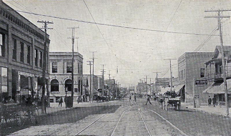 Demers Avenue looking west, East Grand Forks Minnesota, 1907 LakesnWoods.com Postcard and Postcard Image Collection- click image to enlarge Visit The East Grand Forks Photo Gallery for more recent and historic area photos |
|
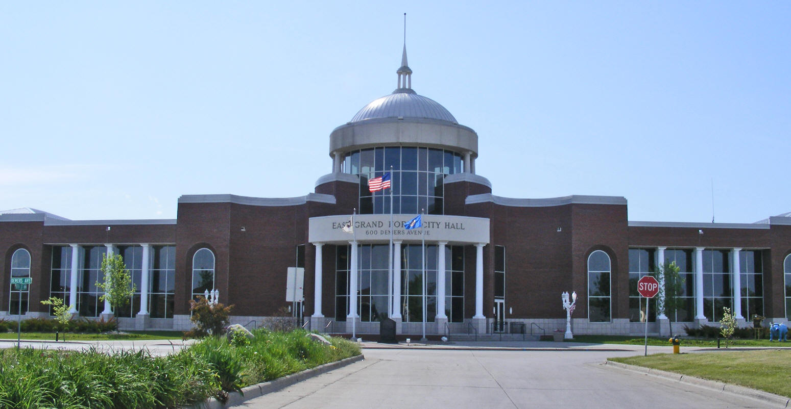
East Grand Forks City Hall 600 Demers Avenue East Grand Forks, MN 56721 Phone: (218) 773-2483 Fax: (218) 773-9728 


|
 |
|||
| Title | Term Ends | Name and Address | Phone | |
| Mayor | 12/31/2024 | Steve Gander 2223 8th Street SE East Grand Forks, MN 56721 |
|
(218) 773-2987 |
| City Administrator | appointed | David Murphy 600 Demers Avenue East Grand Forks, MN 56721 |
|
(218) 773-2483 |
| Council Member - Ward 1 | 12/31/2024 | Clarence Vetter 1024 Sherlock Circle SE East Grand Forks, MN 56721 |
|
(218) 773-2867 |
| Council Member - Ward 2 | 12/31/2022 | Dale Helms 613 2nd Avenue SE East Grand Forks, MN 56721 |
|
(701) 741-8084 |
| Council Member - Ward 3 | 12/31/2024 | Tim Riopelle 2131 Pioneer Court East Grand Forks, MN 56721 |
|
(218) 779-9770 |
| Council Member - Ward 4 | 12/31/2022 | Tim Johnson 704 10th Street NW East Grand Forks, MN 56721 |
|
(218) 773-8552 |
| Council Member - Ward 5 | 12/31/2024 | Mark Olstad 1712 20th Street NW East Grand Forks, MN 56721 |
|
(218) 791-5122 |
| Council Member - At Large | 12/31/2022 | Marc DeMers 1514 12th Avenue SE East Grand Forks, MN 56721 |
|
(701) 740-7000 |
| Council Member - At Large | 12/31/2024 | Brian Larson 1400 Laurel Drive SE East Grand Forks, MN 56721 |
|
(701) 213-3016 |
|
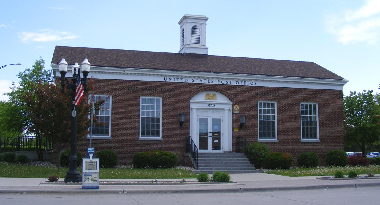
US Post Office 306 3rd Street NW East Grand Forks, MN 56721 Phone: (218) 773-7643 Toll Free: (800) ASK-USPS Fax: (218) 773-6801 Regular
Business Hours:
|
 |
| Utility Type | Utility Name | Utility Phone |
| Electricity | East Grand Forks Water & Light | (218) 773-1163 |
| Natural Gas | Xcel Energy | (701) 795-5000 |
| Wastewater | East Grand Forks Sewage Dept | (218) 773-2442 |
| Water | East Grand Forks Water & Light | (218) 773-1511 |
| Telephone | CenturyLink Communications | (800) 491-0118 |
| Cable TV | Midcontinent Communications | (701) 746-1345 |
| Employer | Products/Services | Employees |
| American Crystal Sugar Company | Sugar & Confectionary Product Manufacturing | 420 |
| East Grand Forks Public Schools | Elementary & Secondary Schools | 340 |
| City of East Grand Forks | Executive, Legislative, & Other Gen. Govt. Support | 190 |
| Vigen Construction, Inc. | Nonresidential Building Construction | 125 |
| Hugo's Family Marketplace | Grocery Stores | 115 |
| Northwest Technical College | Technical & Trade Schools | 107 |
| Cabela's | Sporting Goods, Hobby, & Musical Instrument Stores | 100 |
| R. J. Zavoral & Sons, Inc. | Site Prep. Contractors | 80 |
| McDonalds | Limited-Service Eating Places | 65 |
| Lumber Mart Inc. | Lumber & Other Const. Materials Merchant Wholesalers | 35 |
| Mayo Manufacturing, Inc. | Industrial Machinery Manufacturing | 35 |
| Valley Truck Parts & Service | Automotive Parts, Accessories, & Tire Stores | 25 |
Check Out
The Minnesota
History Shop! Good Goods and
Great Gifts! |
|
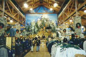
Cabela's 210 DeMers Avenue East Grand Forks, MN 56721 Phone: (218) 773-0282 Downtown East Grand Forks is home to Cabela's fifth largest retail store. The design of this 60,000 square foot building includes a 35-foot high "mountain" with wild game mounts, a firearms library and a huge aquarium with live bass, pike and many other fish. |
 |
|
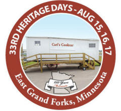
Heritage Village Highway 220 N & 20th Street NE East Grand Forks, MN 56721 Phone: (218) 773-3952 This historic village serves as an instrument preserving the history of the Northern Red River Valley. During Heritage Days, the third week of every August, steam engine threshing machines, museum displays, demonstrations and much more await your visit. Weekend tours are available. Facilities are available for class and family reunions. Special group tours welcome. |
 |
| Folson Park 25 acres, Large open area for passive recreational pursuits |
|
| LaFave Park 51.2 acres, boat ramp, fishing, campground and other passive uses |
|
| O'Leary Park 42 acres with year round facilities, the VFW Arena is adjacent to the park. |
|
|
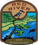
Red River State Recreation Area This 1,200-acre recreation area located in the Greenway features 72 campsites, including 48 electric sites with full hookups, along with shower and bathroom facilities. In addition, you'll find trails for walking and biking, areas for picnicking and a river for fishing and boating. The urban area setting also offers visitors access to shopping and dining facilities within walking distance of one another. |
 |
| Lake Name | Size (acres) |
Lake info | Lake Map | Rec Map | Topo Map |
|---|---|---|---|---|---|
|
none in the immediate area |
|||||
|
Meritcare Health System 929 Central Avenue NW East Grand Forks, MN 56721 Phone: (218) 773-1948 |
 |
|
Riverview Clinic 1428 Central Avenue NE East Grand Forks, MN 56721 Phone: (218) 773-1390 Fax: (218) 773-1762 Web: www.riverviewhealth.org |
 |
|
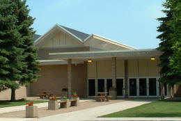
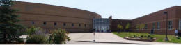
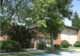
East Grand Forks Public
Schools Independent School District 595 1420 4th Avenue NW East Grand Forks MN 56721 Phone: (218) 773-3494 Fax: (218) 773-7408 Web: www.egf.k12.mn.us |
|||||||||
|
|||||||||
|
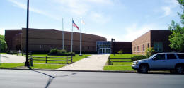
Sacred Heart High School 122 3rd Street NW East Grand Forks, MN 56721 Phone: (218) 773-0230 |
 |
||||||||
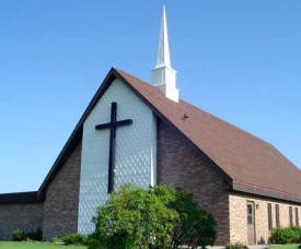
| Bethany
Lutheran Church 10321 State Highway 220 NW East Grand Forks, MN 56721 Phone: (218) 773-1501 |
|
| Bygland
Lutheran Church 24616 425th Avenue SW East Grand Forks, MN 56721 Phone: (218) 893-4243 |
|
| Christ the King Free
Lutheran Church 1913 3rd Avenue Northwest, East Grand Forks, MN 56721 Phone: (218) 773-2357
Pastor: n/a |
|
|
Family of God Lutheran Church 327 5th Avenue SE East Grand Forks, MN 56721 Phone: (218) 773-1433 Web: www.familyofgodlutheran.org Pastor: Jo A. Gast |
 |
|
First Lutheran Church 16 James Circle SE East Grand Forks, MN 56721 Phone: (218) 773-8775 Pastor: n/a |
|
|
First Lutheran Church 203 5th Street NW East Grand Forks, MN 56721 Phone: (218) 773-0181 Pastor: n/a |
 |
|
Jehovah's Witnesses 2311 River Road NW East Grand Forks, MN 56721 Phone: (218) 773-3185 |
|
|
Kongsvinger Lutheran Church 2143 7th Avenue NW East Grand Forks, MN 56721 Phone: (218) 773-2720 |
|
|
Mendenhall Presbyterian Church 528 10th Street NW East Grand Forks, MN 56721 Phone: (218) 773-2469 Fax: (218) 773-2460 Web: www.mendenhallchurch.org Pastor: Rev. Keri Shelton |
 |
|
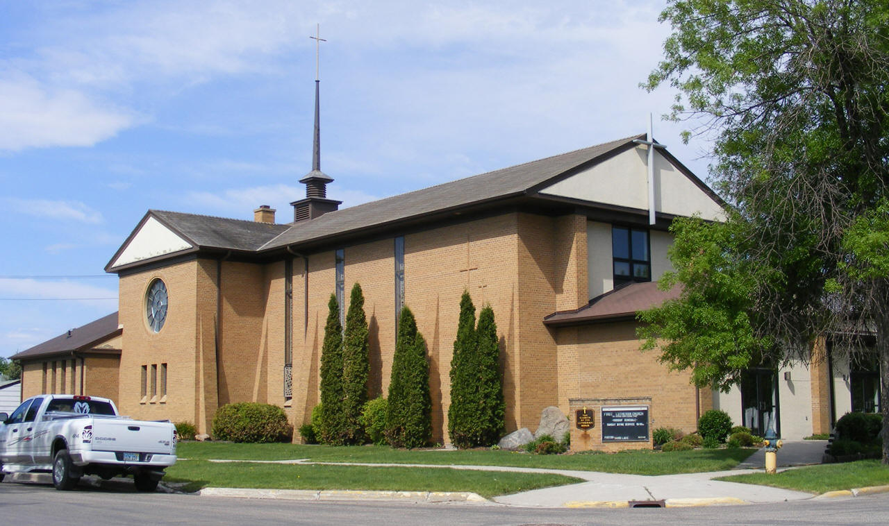
Our Savior's Lutheran Church 1515 5th Avenue NW East Grand Forks, MN 56721 Phone: (218) 773-8449 Fax: (218) 773-8440 Pastor: Rev. Keri Shelton Sunday Worship: 9:00am & 11:00am |
|
|
River Heights Lutheran Church 2214 10th Avenue NW East Grand Forks, MN 56721 Phone: (218) 773-1744 Web: www.riverheightslutheran.com Pastor: Rev. Nile Merseth |
 |
|
Sacred Heart Catholic Community 200 3rd Street NW East Grand Forks, MN 56721 Phone: (218) 773-0877 Web: www.sacredheartegf.net Pastor: Fr. Larry Delaney |
 |
|
Newspapers |
||
| Weekly | ||
| Daily | ||
| Weekly | ||
|
Radio |
||
| 740 |
KVOX - "The Fan" - Sports
Radio 1020 S 25th Street Fargo, ND 58103 Phone: (701) 237-5346 Fax: (701) 235-4042 Web: www.740thefan.com |
 |
| 790 |
KFGO - "The Mighty 790" -
News/Talk 1020 S 25th Street Fargo, ND 58103 Phone: (701) 237-5346 Fax: (701) 237-0980 Web: www.kfgo.com |
 |
| 970 |
WDAY-AM - "News/Talk
970" 301 8 St S Fargo, ND 58103 Phone: (701) 237-6500 Web: www.wday.com/radio |
 |
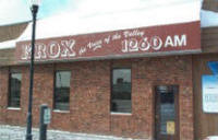
| 1260 |
KROX - "The Voice of the
Valley" 208 S Main Street Crookston, MN 55716 Phone: (218) 281-1140 Fax: (218) 281-5036 Web: www.kroxam.com |
 |
| 1310 |
KNOX - "Talk Radio 1310" Old Belmont Road South Grand Forks, ND 58208 Phone: (701) 775-4611 Fax: (701) 772-0540 Web: www.knoxradio.com |
 |
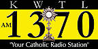
| 1370 |
KWTL - "Your Catholic
Radio Station" Grand Forks, ND 58208 Phone: (701) 795-0122 Web: www.youram1370.com |
 |
| 1440 |
KKXL
- "The Fan" - Sports 1716 Drees Drive Grand Forks, ND 58201 Phone: (701) 746-9393 Web: www.1440kkxl.com |
 |
| 1520 |
KMAV - ESPN 1000 Third Street SW Mayville, ND58257 Phone: (701) 786-2335 Fax: (701) 786-2268 Web: www.kmavradio.com |
|
| 1590 |
KCNN - The Rooster
1590 - Classic Country Old Belmont Road South PO Box 13638 Grand Forks, ND 58208-3638 Phone: (701) 775-4611 Fax: (701) 772-0540 Web: www.1590therooster.com |
 |
| 89.3 |
KUND - Prairie
Public/NPR PO Box 8117 Grand Forks, ND 58202 Phone: (701) 241-6900 Web: www.prairiepublic.org |
 |
| 90.1 |
KSRQ -
Pioneer 90.1 1101 Highway One E Thief River Falls, MN 56701 Phone: (218) 683-8800 Toll Free: (800) 959-6282 Fax: (218) 683-8980 Web: www.northlandcollege.edu/pioneer90 |
|
| 90.7 |
KFJM - Prairie
Public/NPR PO Box 8196 Grand Forks, ND 58202 Phone: (701) 241-6900 Web: www.prairiepublic.org |
|
| 91.5 |
KQMN -
Minnesota Public Radio/NPR |
 |
| 92.9 |
KKXL-FM - XL93 - Top 40 Web: www.xl93.com |
 |
| 94.7 |
KNOX-FM - Power 94.7
- Classic Rock 1185 9th Street NE Thompson ND 58278 Phone: (701) 775-9595 Fax: (701) 772-0540 Web: www.power947rocks.com |
 |
| 96.1 |
KQHT - The Fox - Classic
Hits Phone: ( Fax: (701) 746-1410 Web: www.961thefox.com |
 |
| 97.1 |
KYCK - Kyck FM - Country PO Box 13638 Grand Forks, ND 58208 Phone: (701) 775-4611 Fax: (701) 772-0540 Web: www.97kyck.com |
 |
| 100.3 |
KSNR - Cat Country Web: www.thecatfm.com |
 |
| 102.7 | KNTN - News - Minnesota Public Radio |
|
| 104.3 |
KZLT - Lite Rock 104.3 Web: www.literock1043.com |
 |
| 104.9 | K285BG - Today's Christian Music! |
 |
| 107.5 |
KJKJ - KJ108 - Active Rock Web: www.kjkj.com |
 |
|
Television |
||
| 2 | KGFE |
 |
| 4 |
KXJB TV - CBS -
Channel 4 1350 21st Avenue S Fargo, ND 58103 Phone: (701) 282-0444 Web: www.valleynewslive.tv |
|
| 8 | WDAZ | |
| 10 | KBRR - Fox | |
| 11 |
KVLY-TV - NBC -
Channel 11 1350 21st Avenue S Fargo, ND 58103 Phone: (701) 237-5211 Web: www.valleynewslive.tv |
|
| 12 | KNRR - Fox | |
|
East Grand Inn 606 Gateway Drive NE East Grand Forks, MN 56721 Phone: (218) 773-9822 Web: www.eastgrandinn.com |
 |
|
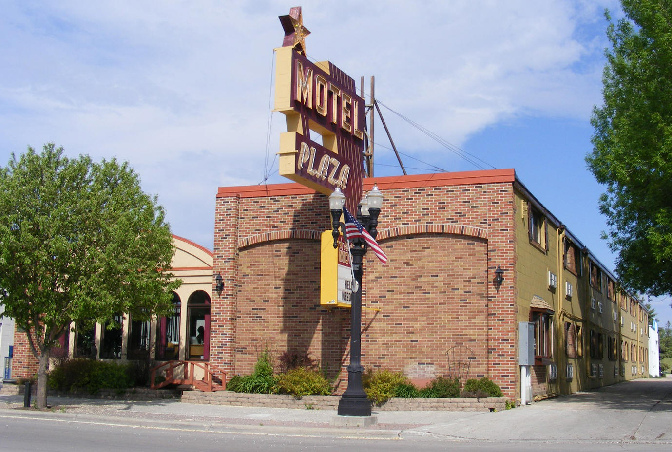
Plaza Motel 309 Demers Avenue East Grand Forks, MN 56721 Phone: (218) 773-1179 Locally owned motel with clean, quiet and comfortable accommodations. Within walking distance of several restaurants and the world-renowned Cabela's. A number of other shopping and entertainment venues also close by. |
 |
|
none |
|
Red River State Recreation Area Included in this greenway area is a new campground that features 72 campsites including 48 electric sites that have full hookups (sewer and water). The new recreation area also includes trails for walking and biking, areas for picnicking and rivers for fishing and boating. |
Area
View Larger Map
Downtown
View Larger Map
|
|
|
|
© 2004-2024 Lakeweb1 Internet Services All Rights Reserved |
|
|
|
||