|
|
|
|
|
|
Navigation LakesnWoods.com
© 2004-2024 DCMA, Defamation, Copyright and Trademark Infingement Policy
|
|
||||||||||||||||||||||||||||||||||||||||||||||||||||||||||||||||||||||||||||||||||||||||||||||||||||||||||||||||||||||||||||||||||||||||||||||||||||||||||||||||||||||||||||||||||||||||||||||||||||||||||||||||||||||||||||||||||||||||||||||||||||||||||||||||||||||||||||||||||||||||||||||||||||||||||||||||||||||||||||
 |
 |
| Carver (city) | 1970 | 1980 | 1990 | 2000 | 2010 | 2000-2010 Change | |
|---|---|---|---|---|---|---|---|
| Actual | Percent | ||||||
| Population | 669 | 642 | 744 | 1,266 | 3,724 | +2,458 | +194.15 |
| Land Area (sq. mile) | 3.70 | 4.01 | 3.85 | 3.85 | 4.00 | +0.15 | +3.90 |
| Density (persons per sq. mile) | 180.81 | 160.10 | 193.25 | 328.62 | 931.00 | +602.38 | +183.31 |
| Housing Units | 186 | 220 | 270 | 467 | 1,236 | +769 | +164.67 |
| Households | -- | 218 | 262 | 458 | 1,182 | +724 | +158.08 |
| Persons Per Household | -- | 2.94 | 2.84 | 2.76 | 3.15 | +0.41 | +14.86 |
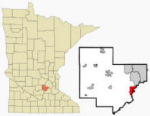
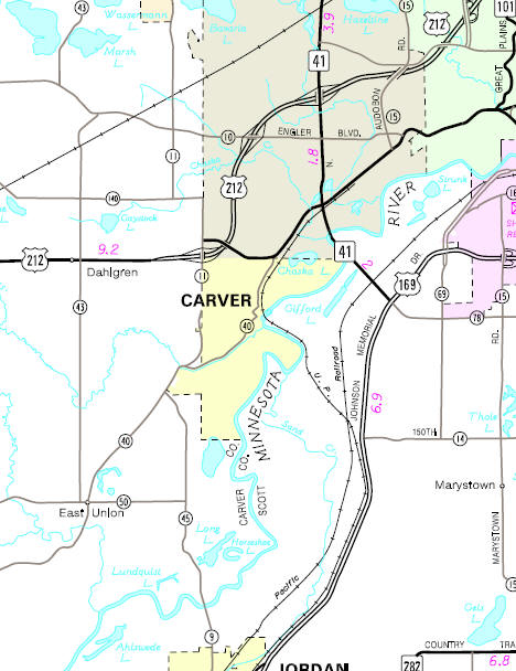
Carver is a city in Carver County, Minnesota. U.S. Highway 212 serves as a main route for the community. According to the United States Census Bureau, the city has a total area of 4.18 square miles (10.83 km2), of which, 4.00 square miles (10.36 km2) is land and 0.18 square miles (0.47 km2) is water. The elevation is 732 ft (223 m).
From Wikipedia, the free encyclopedia.
As of the census of 2010, there were 3,724 people, 1,182 households, and 984 families residing in the city. The population density was 931.0 inhabitants per square mile (359.5/km2). There were 1,236 housing units at an average density of 309.0 per square mile (119.3/km2). The racial makeup of the city was 89.8% White, 1.0% African American, 0.2% Native American, 6.3% Asian, 0.4% from other races, and 2.3% from two or more races. Hispanic or Latino of any race were 2.0% of the population.
There were 1,182 households of which 55.8% had children under the age of 18 living with them, 72.9% were married couples living together, 5.4% had a female householder with no husband present, 4.9% had a male householder with no wife present, and 16.8% were non-families. 11.8% of all households were made up of individuals and 1.2% had someone living alone who was 65 years of age or older. The average household size was 3.15 and the average family size was 3.46.
The median age in the city was 31.7 years. 36.1% of residents were under the age of 18; 5.3% were between the ages of 18 and 24; 36.1% were from 25 to 44; 19.1% were from 45 to 64; and 3.5% were 65 years of age or older. The gender makeup of the city was 50.5% male and 49.5% female.
Visit The
Minnesota History Shop! |
Courtesy Minnesota Historical Society
More Carver History Carver Historic District Walking Tour
 Railroad Depot, Carver Minnesota, 1910s LakesnWoods.com Postcard and Postcard Image Collection- click image to enlarge Visit The Carver Photo Gallery for more recent and historic area photos |
|
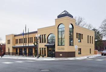
Carver City Hall 316 Broadway Carver, MN 55315 Phone: (952) 448-5353 Regular Business Hours: Monday - Friday 8:00 am - 4:30 pm City Council Meetings: 1st and 3rd Monday of the month at 7:00 pm 


 |
 |
|||
| Title | Term Ends | Name and Address | Phone | |
| Mayor | 12/31/2022 |
Courtney Johnson 413 High Street Carver, MN 55315 |
|
(612) 702-7703 |
| City Manager | appointed |
Brent Mareck 316 Broadway Carver, MN 55315 |
|
(952) 448-8737 |
| Council Member | 12/31/2022 |
Laurie Sayre 1005 Sunny Ridge Drive Carver, MN 55315 |
|
(952) 270-2523 |
| Council Member | 12/31/2022 |
Glen Henry 320 6th Street W Carver, MN 55315 |
|
(952) 361-9834 |
| Council Member | 12/31/2024 |
Joy McKnight 204 Carver Creek Place Carver, MN 55315 |
|
(952) 484-5284 |
| Council Member | 12/31/2024 | Kristy Mock 112 3rd Street E Carver, MN 55315 |
|
(952) 500-3972 |
|
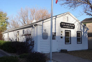
US Post Office 317 Broadway Carver, MN 55315-2103 Phone: (952) 448-6363 Toll Free: (800) ASK-USPS
Regular Business Hours: |
 |
| Utility Type | Utility Name | Utility Phone |
| Electricity | Xcel Energy | (800) 895-4999 |
| Electricity | Minnesota Valley Electrical Cooperative | (952) 492-2313 |
| Natural Gas | CenterPoint Energy | (612) 372-4727 |
| Wastewater | City of Carver | (952) 448-5353 |
| Water | City of Carver | (952) 448-5353 |
| Telephone | Centurylink Communications | (855) 234-1903 |
| Telephone | Frontier Communications | (800) 435-1504 |
| Cable TV | Comcast | (800) 934-6489 |
| Employer | Products/Services | Employees |
| n/a | ||
|
|
Minnesota State
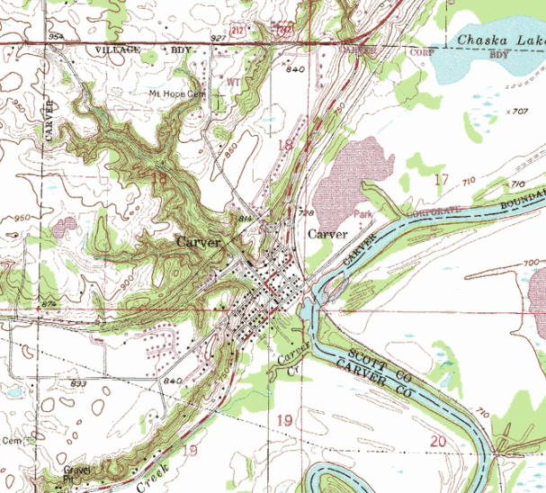
Highway Map of the Carver Minnesota area
| none |
Check Out
The Minnesota
History Shop! Good Goods and
Great Gifts! |
| none |
|
Minnesota Valley National Wildlife Refuge 15850 Rapids Lake Road Carver, MN 55315 Phone: (952) 368-7096 Minnesota Valley National Wildlife Refuge has two visitor and education centers, access areas to more than 14,000 acres of land dedicated to wildlife and wildlife-dependent recreation. To get a glimpse of the multiple habitats within the refuge, visit either center or any of the refuge units. Hours of operation vary seasonally.
|
 |
| Lake Name | Size (acres) |
Lake info | Lake Map | Rec Map | Topo Map |
|---|---|---|---|---|---|
| none | |||||
|
Eastern Carver County
Schools Independent School District #112 11 Peavey Road Chaska, MN 55318 Phone: (952) 556-6100 Fax: (952) 556-6109 Grades: PK-12 Students: 9,800


|
 |
|
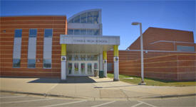
Chaska High School
545 Pioneer Trail Chaska, MN 55318 Phone: (952) 556-7100 Grades: 9-12 Students: 1,500
|
 |
|
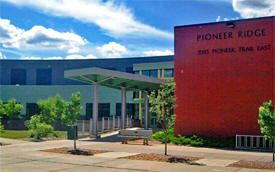
Pioneer Ridge Middle
School 1085 Pioneer Trail East Chaska, MN 55318 Phone: (952) 556-7800 Grades: 6-8 Students: 500
|
 |
|
Carver Elementary
School 1717 Ironwood Drive Carver, MN 55315 Phone: (952) 556-1900 Grades: PK-5 Students: 650
|
 |
|
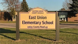
East Union Elementary
School 15655 County Road 43 Carver, MN 55315 Phone: (952) 556-6800 Grades: PK-5 Students: 125
|
 |
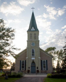
| East Union Lutheran Church 15180 County Road 40 Carver, MN 55315 Phone: (952) 448-3450 Pastor: Sarah Bunge Sunday Service: 9:00 am
|
 |
|
St. Nicholas Catholic Church 412 4th Street W Carver, MN 55315 Phone: (952) 448-2345 Pastor: Rev. Bill Deziel Sunday Service: 9:15 am

|
 |
|
Trinity Lutheran Church - LCMS 417 Oak Street Carver, MN 55315 Phone: (952) 448-3628 Pastor: David Jander Sunday Service: 10:00 am (9:00 am June - August)
|
 |
|
Carver Current Carver, MN 55315 Online and weekly email newsletter |
|
|
Villager
Tower Carver, MN 55315 Phone: (952) 448-5126 Monthly newsletter devoted local Carver news
|
| none - see Shakopee or Chanhassen |
| none |
| none |
| A-1 Stripes 8175 County Road 50 Carver, MN 55315 Phone: (952) 466-2608
|
|
| Aerial Company Beauty Salon 15820 Lundstead Road Carver, MN 55315 Phone: (952) 448-9435 |
|
|
Auto Inspirations 1223 Vernon Drive Carver, MN 55315 Phone: (952) 486-8222 Auto Inspirations is a company founded out of our love of automobiles to provide fun or inspiring products as well as some of the industries best products for the home, office or garage. Swisstrax Modular Flooring, PitStop Furniture, C3 Coolers and Graphic Image Flooring Mats are just the start of both utilitarian and fun products.
|
 |
| Barbara Swanson Realty 212 Broadway PO Box 290 Carver, MN 55315 Phone: (952) 448-4580 Barb has been a lifelong resident of Carver County and has been active in the Financial Industry as an owner of an Independent Insurance Agency and Real Estate Broker since 1988. Helping families find homes where their dreams can come alive has become an important and very interesting part of her life and business activity, Being an avid historian, she lives in a historic home with her husband Darrel and has raised three children within it's beauty and comfortable walls. She has been a charter member of Carver-on-the Minnesota, inc., a group dedicated to preserving the history and heritage of one of the oldest cities in the State of Minn nestled on the banks of the Minnesota River.
|
|
| Barclay Floor Covering 118 Carver Creek Circle Carver, MN 55315 Phone: (952) 448-7306 We do all pre finished hardwood floors, all tile, all vinyl flooring, and commercial carpet around the metro area
|
|
|
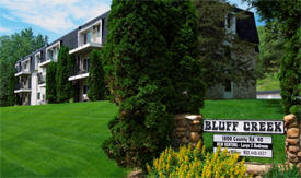
Bluff Creek
Apartments 1800 County Road 40 Carver, MN 55315 Phone: (952) 368-3308 Bluff Creek Apartments is located at 1800 Main St Carver, MN and is managed by Carver County HRA, a reputable property management company with verified listings on RENTCafe. Bluff Creek Apartments offers 1 to 2 bedroom apartments ranging in size from 875 to 1025 sq.ft. Amenities include BBQ/Picnic Area, Controlled Access/Gated, Dishwasher, Garage, Large Closets and more.
|
 |
| Boylan Group 1310 Lylewood Parkway Carver, MN 55315 Phone: (952) 445-7854 |
|
|
Carver Automotive 220 3rd Street E Carver, MN 55315 Phone: (952) 448-2075
|
|
|
Carver City Hall 801 Jonathan Carver Parkway PO Box 147 Carver, MN 55315 Phone: (952) 448-5353 Regular Business Hours: Monday - Friday 8:00 am - 4:30 pm City Council Meetings: 1st and 3rd Monday of the month at 7:00 pm
|
|
|
Carver
Crossing Apartments 1593 Hartwell Drive Carver, MN 55315 Phone: (952) 361-8770 Rent is high throughout the Twin Cities. Carver Crossing is an exception to this rule. This is because of an affordable housing program that Carver Crossing participates in. With this program household incomes are limited, there are also rules regarding student status.
|
|
|
Carver Dental 4725 Dahlgren Road Carver, MN 55315 Phone: (952) 960-9060 At Carver Dental we strive to be your dental home. The ability to treat the youngest patients and those approaching triple digits is challenging but also extremely rewarding; which is why we strive to form personal relationships that will last decades. We opened our doors on June 26th 2017 and have been proudly serving Carver, Chaska, Cologne, Jordan, and Belle Plaine ever since.

|
 |
|
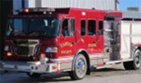
Carver Fire Department 801 County Road 147 Carver, MN 55315 Phone: (952) 448-2290 The Carver Fire Department provides service to the City of Carver, Dahlgren Township, and San Francisco Township. There is one Fire Station on Jonathan Carver Parkway and averages about 110 calls per year.
|
 |
|
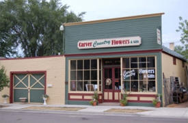
Carver Flowers 109 3rd Street E Carver, MN 55315 Phone: (952) 448-0078 Since January, 2009, Carver Flowers (renamed in 2014) has become a full-time, full-service floral studio located inside our 145-year old historic building in downtown Carver. In our retail space you'll find loose flowers and arrangements in the cooler, flowering and green plants in the flower cart, silk floral wreaths on the walls, greeting cards on the rack, candles in the cupboards and other unique vintage/cottage home decor and gift items on display.
|
 |
| Carver Hair Salon 221 Broadway Carver, MN 55315 Phone: (952) 361-6780 |
|
|
Carver Insurance Group 212 Broadway Carver, MN 55315 Phone: (952) 448-4580 Carver Insurance Group is a leading insurance agency operating in the state of Minnesota. At Carver Insurance Group, we offer many different insurance products, including niche products like Farm, Flood and classic car insurance. If you own something that you want to have insured, whatever it is, we can help. These are the types of insurance policies that we at Carver Insurance Group write in Minnesota.
|
 |
|
Carver Junk Company 206 N Chestnut Street Carver, MN 55315 Phone: (612) 615-0071 Our Chaska Store is open every Thursday – Sunday, and sells a unique variety of professionally-refinished furniture and handmade decor & accessories.
|
 |
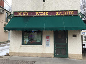
| Carver Liquor 309 Broadway Carver, MN 55315 Phone: (952) 448-9862 Liquor store located in beautiful Carver, Minnesota in the Historical City District. We have an assortment of beer, wine, and tobacco for all needs.
|
 |
| Carver Public Works 801 County Road 147 Carver, MN 55315 Phone: (952) 448-2290 |
|
|
Carver Tax
Service 221 Broadway Carver, MN 55315 Phone: (952) 368-6059 I provide the Carver, MN area with a complete range of tax services. My highly-trained professionals have been hand-picked from among the best in the industry. I am trained to provide you with the solutions you need as well as the quality you deserve.
|
|
|
Casey's General Store 300 County Road 40 Carver, MN 55315 Phone: (952) 448-6163 Through the years, Casey's success has been attributed to our clean stores and friendly employees who pride themselves in customer service. Casey's customers have come to know us for our helpful employees, clean stores and wide selection of freshly prepared food items.
|
|
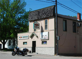
| Doghouse Bar 313 Broadway Carver, MN 55315 Phone: (952) 368-4800 A small town bar where everyone feels comfortable and welcome!
|
 |
| Don Wherley Masonry Inc. 441 Diedrich Drive Carver, MN 55315 Phone: (952) 448-7037 Don Wherley Masonry is a full service concrete company including exposed aggregate, driveways, steps, sidewalks, colored concrete, aprons, foundations, patios, blockwork, stoops and also bobcat work.
|
|
| Elmgren Sales 1110 Lorraine Court Carver, MN 55315 Phone: (952) 448-1818 |
|
|
Encore Heating
and Air 15625 Halsey Avenue Carver, MN 55315 Phone: (952) 529-5409 Encore Heating and Air Conditioning provides world class service with highly trained and professional technicians. We have been servicing HVAC, furnace, and boiler systems in both residential and commercial environments for over 10 years. We also offer first class 24/7 emergency services.
|
 |
|
Essig's Tree and Landscape 16040 Hayes Avenue Carver, MN 55315 Phone: (952) 448-2472 Essig’s Tree & Landscape Inc. has been providing creative & functional landscaping since 1986. Let us make your property beautiful and create an outdoor living space to enjoy for years to come.
|
 |
|
Expressive Color
LLC 1550 Sumac Circle Carver, MN 55315 Phone: (612) 849-4172 Trying to grow your business and build brand awareness? Vehicle wraps are great way to effectively generate thousands of customer impressions daily. Whether you're hauling, delivering or driving, truck, van and trailer wraps are an effective way to make your business more visible.
|
 |
|
Fleet Farm 1935 Levi Griffin Road Carver, MN 55315 Phone: (952) 361-0986 Save Time and Money and Buy Online, Pick Up In store. Shop Our Low Prices Today! Shop Our Weekly Deals. Gear Up for Hunting. 50+ years in Midwest. Low prices. Stores Located Near You. Top brands. In Store Pickup. Free store pick up. Seasonal Decor. Serving WI, MN, IA, ND.
|
 |
|
Gardeneer
Landscape 10123 Halsey Avenue Carver, MN 55315 Phone: (952) 361-5502 Gardeneer, Inc, established in 1971, is a Full Service Residential and Commercial Landscape Company. We specialize in residential site development, commercial landscape construction, and landscape grounds maintenance. Our experienced landscape professionals will work with you to create, construct, enhance, and even maintain your outdoor environment. Our goal is to deliver an outstanding finished product, within your budget, and on your schedule.
|
 |
|
Graphic
Image Flooring 1223 Vernon Drive Carver, MN 55315 Phone: (952) 314-9369 We provide G-Floor custom vinyl floor and Swisstrax modular flooring throughout North America. We turn boring floors into conversation pieces. We proudly serve the Event & Trade Shows, Retail, Residential & Commercial markets.

|
 |
| Harvey's Bar 220 Broadway Carver, MN 55315 Phone: (952) 448-2289 Welcome to Harvey's Bar & Grill! New Hours: Bar and Restaurant will not open till 11am Monday-Friday. Located in historic Carver, MN, Harvey's was established in 1937.

|
 |
| Integrated Body Therapy 6265 Forest Glen Lane Carver, MN 55315 Phone: (952) 448-7760
|
|
|
Jellison's Best Blacktop 7625 County Road 50 Carver, MN 55315 Phone: (952) 361-4330 Founded in 1947 by Dale Griepp’s father, Best Blacktop has been a Griepp family operated business up until 2008. The Jellison family continues the tradition of focus, strong integrity and a passionate crew.
|
 |
|
Jet Black 627 Carver Bluffs Parkway Carver, MN 55315 Phone: (952) 448-9959 Jet-Black is the national leader in asphalt (black-top) sealcoating and repair. All Jet-Black locations are locally owned and operated by a member of your community. Services include seal coating, crack repair, joint repair, power cleaning, oil treatment, sunken asphalt repair, apron repairs, saw cut repairs, line striping, infrared repair, and more asphalt maintenance services. Residential sealcoating (driveway sealing) and black-top maintenance, as well as commercial (parking lot, roads, townhomes, etc.) sealcoating and asphalt repair are provided by your local Jet Black dealer.
|
 |
| Joe's Trailer Service Inc. 17185 Koepp Drive Carver, MN 55315 Phone: (952) 873-6718
|
|
|
Ken Worm
Construction Service LLC 17930 Kelly Lake Road Carver, MN 55315 Phone: (952) 873-6736 Ken Worm Construction has been serving the twin cities southwest metro area for over 15 years. We pride ourselves on quality workmanship, as well as total customer satisfaction. We specialize in the design and construction of decks & porches, homes & additions, as well as garages. We also offer services for door & window replacement, remodeling, basement finishing, concrete and roofing.
|
 |
| Land
Design Associates, Inc. 124 Carver Creek Circle Carver, MN 55315 Phone: (952) 448-9879 Land Design is a full service landscape design/build practice. We work with customers in Minneapolis and its suburbs to create inviting and usable outdoor living environments. Our Twin Cities landscaping services covers all types of landscape design and construction projects, including Backyard and Frontyard landscape design, Paver Driveways, Patios, Decks, Pathways, Retaining Walls, Ponds, Drainage corrections and more.
|
 |
| Lee's Garage Door Service 437 Diedrich Drive Carver, MN 55315 Phone: (952) 448-1798
|
|
| Lisa's Place 205 Broadway Carver, MN 55315 Phone: (952) 448-7622
|
 |
| Mammut USA 420 Oak Street Carver, MN 55315 Phone: (952) 448-1935
|
|
|
Master
Sprinkler Systems 790 Riesgraf Road Carver, MN 55315 Phone: (952) 479-7551 Master Sprinkler Systems Is a family owned and operated company since 1996. Call today to see how we can help with your sprinkler and lawn care needs.
|
 |
| Michael Drew Entertainment Inc. 429 Diedrich Drive Carver, MN 55315 Phone: (952) 448-4449
|
|
|
Michel Masonry Construction 5475 Carmel Lane Carver, MN 55315 Phone: (952) 361-0560
|
|
|
Minnesota Topsoil 17455 Kelly Lake Road Carver, MN 55315 Phone: (952) 217-8143 Minnesota Topsoil creates nutrient-rich organic fertilizers that are used for gardening, farming, landscaping, and more. We recycle organic's such as yard waste, woody vegatative materials and manure from residential, commercial, and municipal customers. Those materials are processed and crafted into custom soil blends that are available for retail and wholesale.
|
 |
|
Minnesota Valley
Concrete LLC 15930 Carver Highlands Drive Carver, MN 55315 Phone: (612) 221-2181 We are a Minneapolis / St. Paul based concrete company, serving the greater Twin Cities metro area. Our focus is on providing a lasting name in the custom designed, colored decorative stamped concrete industry. Minnesota Valley Concrete is the Twin Cities #1 choice for decorative stamped concrete. We are a full service concrete and masonry concrete company with the means of providing and building anything you have seen or imagined. Projects small or large are always a welcome addition to our fine collection of projects. We are experienced in providing design consultations for modern, rustic, contemporary, and craftsman residences. We are known for being budget conscious, design oriented, knowledgeable and experienced. Light commercial work & residental areas of service available.
|
 |
|
Minnesota Valley National Wildlife Refuge 15850 Rapids Lake Road Carver, MN 55315 Phone: (952) 368-7096 Minnesota Valley National Wildlife Refuge has two visitor and education centers, access areas to more than 14,000 acres of land dedicated to wildlife and wildlife-dependent recreation. To get a glimpse of the multiple habitats within the refuge, visit either center or any of the refuge units. Hours of operation vary seasonally.
|
|
|
Mosquito Squad 15645 Green Meadow Circle Carver, MN 55315 Phone: (952) 260-3998 Mosquito Squad of South Metro Minnesota is ready to eliminate all types of mosquitoes and ticks to keep you and your family safe. Our team of licensed and professional technicians offer mosquito control, tick control, and general elimination of all biting bugs in Eagan and Burnsville. With our treatment services, homeowners can enjoy their yards without the nuisance of bloodsucking bugs or the risk of disease.
|
 |
|
My Taxi Carver 116 Main Street E Carver, MN 55315 Phone: (952) 994-7938 For a reliable transportation to the Airport or other location. Minnesota Licensed and Commercially Insured (copy supplied upon request). Serving Carver, Chaska, Chanhassen, Cologne, Victoria and Waconia. Limited service in Norwood Young America
|
 |
| NHA Heating and Air Conditioning 13980 Kristin Lane Carver, MN 55315 Phone: (952) 448-5343
|
|
|
Party Crashers Photography 200 3rd Street E Carver, MN 55315 Phone: (952) 368-1941 Family and senior photography in Carver, serving Carver, Chaska, Chanhassen, Eden Prairie and the surrounding areas.
|
 |
|
Promotion Graphics 15781 County Road 40 Carver, MN 55315 Phone: (952) 368-3052 PROmotion Graphics provides custom signage and vehicle graphics that enhance the professional image of small to medium size businesses and government entities.
|
 |
| R G Modeen Inc. 6500 Nathan Road Carver, MN 55315 Phone: (952) 361-6070 |
|
|
Renewable Energy Development LLC 201 Butternut Circle Carver, MN 55315 Phone: (952) 463-8661 A sales, assessment and systems support company for renewable energy in the geothermal, solar and wind energy for farmers, homeowners, business owners and manufacturers in the Midwest.
|
 |
|
Rescom Electric Inc. 760 Main Street W Carver, MN 55315 Phone: (952) 448-5923
|
 |
|
River Valley
Ranch Inc. 16480 Jonathan Carver Parkway Carver, MN 55315 Phone: (952) 361-3361 Trail Rides, Group Trail Rides, Pasture Boarding and Horseback Riding Lessons situated in the Picturesque Minnesota River Valley. We have the right horse for you!
|
 |
|
Robbs Electric
Inc. 505 Broadway Carver, MN 55315 Phone: (952) 448-4030 Providing complete electrical services to the Twin Cities metro area. Robb's Electric, Inc. has been satisfying customers since 1964 with projects of all sizes. With over 50 years of service in residential, commercial, and industrial areas, we have the experience needed to help get the job done right the first time!!!
|
 |
|
Ryan Homes 201 Carver Creek Place Carver, MN 55315 Phone: (952) 368-4415 Ryan Homes, Inc. is the company you need for a successful custom home, remodel, addition, or restoration project. From beginning to end, we provide the needed expertise for your project.
|
 |
|
Sparkleen
Services 16800 Halsey Avenue Carver, MN 55315 Phone: (952) 361-0842 We're a 100% hot water mobile/on-site power washing company. We proudly serve the Western Suburbs and the entire Metro area. You'll always come first when you choose us. From your patios and driveways to your decks and sidewalks, we offer you an affordable power washing service that is second to none.
|
 |
|
Steve's Heavy Equipment and Diesel 15830 Carver Highlands Drive Carver, MN 55315 Phone: (952) 448-2429
|
|
| Sufka Plumbing and Water Conditioning 15680 Maria Lake Road Carver, MN 55315 Phone: (952) 473-9228 Sufka Plumbing has been supporting customers for over 25 years!
|
 |
| Theis Construction Company 6270 Forest Glen Lane Carver, MN 55315 Phone: (952) 448-5887
|
|
|
Twin Cities Rose Club 9075 County Road 52 Carver, MN 55315 Phone: (763) 425-5982 The Twin Cities Rose Club (TCRC) is a nonprofit organization and an affiliate member of the American Rose Society. Devoted to the promotion of our national flower, the rose, we accomplish our mission through educational programs, informative meetings and an annual rose show which is free of charge and open to the public. We hold an annual sale of roses and companion plants at great discounts and sell rose related products (like cocoa bean hull mulch) to rose growers once a year in April to supplement our low membership dues.
|
 |
| Wayne Dauwalter Plumbing 15525 Green Meadow Circle Carver, MN 55315 Phone: (952) 448-4763
|
|
| Westco Recognition Advertising 119 Carver Creek Circle Carver, MN 55315 Phone: (952) 556-5500
|
|
|
WKP LLC 104 6th Street W Carver, MN 55315 Phone: (952) 448-6000
|
|
| Woodside Quality Solutions 623 Carver Bluffs Parkway Carver, MN 55315 Phone: (952) 361-5518 |
|
| Youth Enrichment League 343 Bluff Road Carver, MN 55315 Phone: (952) 361-6882
|
|
|
|
|
© 2004-2024 LakesnWoods LLC All Rights Reserved |
|
|
|
||