|
Navigation
LakesnWoods.com
Home
Page
Contact Us
Privacy
Minnesota History Shop
Visit The Minnesota History Shop
www.minnesotahistoryshop.com
Historic maps
Historic books
Historic framed art
Historic
postcards
Clothing with historic
images
And much more!!! |
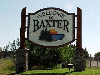
Baxter Guide:
Photo Gallery
Location
Geography
Demographics
History
Government
Post Office
News
Weather
Street Map
Events
Attractions
Recreation
Lakes
Health Care
Schools
Churches
Media
Motels
Resorts
Campgrounds
Businesses
Aerial Photo
Topographic Map © 2004-2024
LakesnWoods LLC
All Rights Reserved
DCMA, Defamation, Copyright and Trademark Infingement Policy
|
WANTED! Do you have photos, historical accounts or
other items pertaining to the Baxter area? Would you like to
share this historical information with the world?
LakesnWoods.com would like to publish your Baxter photos
(current or historical) or historical accounts on this website.
Original materials can be returned and your privacy will be
respected.
Contact us |
|
Baxter Minnesota Community Guide
Location:
Population:
| Baxter (city) |
1970 |
1980 |
1990 |
2000 |
2010 |
1990-2000
Change |
| Actual |
Percent |
| Population |
1,556 |
2,625 |
3,695 |
5,555 |
7,610 |
+2,055 |
+36.99 |
| Land Area (sq. mile) |
18.30 |
19.41 |
0.00 |
17.32 |
18.39 |
+1.07 |
+6.18 |
| Density (persons per sq. mile) |
85.03 |
135.24 |
-- |
320.73 |
413.8 |
+93.07 |
+29.02 |
| Housing Units |
433 |
874 |
1,257 |
1,979 |
3,176 |
+1,197 |
+60.49 |
| Households |
-- |
804 |
1,200 |
1,921 |
2,963 |
+1,042 |
+54.24 |
| Persons Per Household |
-- |
3.26 |
3.07 |
2.87 |
2.57 |
-0.30 |
-10.45 |
Geography:
Baxter is located just north of the
geographical center of Minnesota, in a terminal moraine
area created by the Superior Lobe of the Labradorian ice
sheet. The city is home to numerous lakes and ponds.
Baxter is bordered on the west by Cass County and on the
east by Brainerd. The Mississippi River marks the
current southern border but expansion both north and
south is possible.
Along with the rest of Crow Wing County and parts of the
adjoining counties, Baxter is part of the so-called
Brainerd Lakes Area. Many residents of Baxter work in
Brainerd or consider themselves Brainerd residents.
Minnesota State Highways 210 and 371 are two of the main
routes in the city. According to the United States
Census Bureau, the city has a total area of 20.62 square
miles (53.41 km2), of which 18.39 square miles (47.63
km2) is land and 2.23 square miles (5.78 km2) is water.
The elevation is 1,207 feet (368 m).
From Wikipedia, the free encyclopedia
Demographics:
As of the census of 2010, there were 7,610 people, 2,963
households, and 2,110 families residing in the city. The population
density was 413.8 inhabitants per square mile (159.8/km2). There were
3,176 housing units at an average density of 172.7 per square mile
(66.7/km2). The racial makeup of the city was 96.5% White, 0.5% African
American, 0.5% Native American, 0.9% Asian, 0.1% Pacific Islander, 0.2%
from other races, and 1.4% from two or more races. Hispanic or Latino of
any race were 1.1% of the population.
There were 2,963 households of which 35.8% had children under the age
of 18 living with them, 59.5% were married couples living together, 7.6%
had a female householder with no husband present, 4.1% had a male
householder with no wife present, and 28.8% were non-families. 23.8% of
all households were made up of individuals and 11.8% had someone living
alone who was 65 years of age or older. The average household size was
2.55 and the average family size was 3.02.
The median age in the city was 38.7 years. 27% of residents were
under the age of 18; 7.7% were between the ages of 18 and 24; 23.8% were
from 25 to 44; 25.6% were from 45 to 64; and 15.8% were 65 years of age
or older. The gender makeup of the city was 48.3% male and 51.7% female.
History:
A suburb of nearby Brainerd, Baxter owes its existence
to the Northern Pacific Railroad, which operated a large
tie-treating plant, since closed, in the area during the
1920s. Farming was also an important early industry.
Baxter was incorporated on May 25, 1939.
The town is named after Luther Baxter, an attorney for
the railroad who served in the Minnesota Legislature and
as a colonel in the Civil War. Tourism and various service industries
have become Baxter's biggest employers, and numerous
housing subdivisions have been developed in the wooded
area west of Highway 371, which passes through the town.
Owing to the amount of unused land in the area,
commercial development along the highway itself has also
increased in recent years, though it has tended to
conform to the pattern of urban sprawl.
Courtesy
Minnesota Historical Society
Government:
Post Office:
Utilities:
Major
Employers:
News:
Weather:
Map:
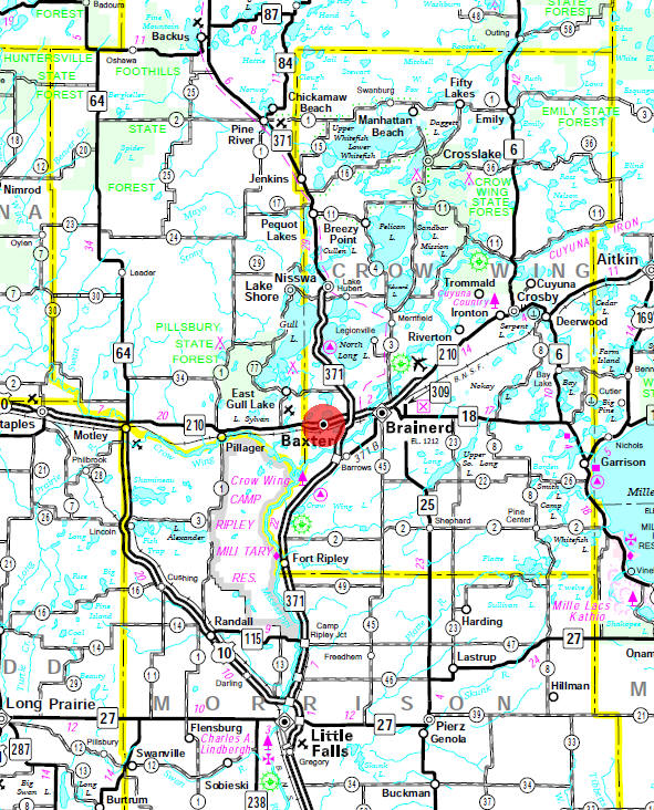
Minnesota State
Highway Map of the Baxter Minnesota area
Events:
Attractions:
Recreation:
|
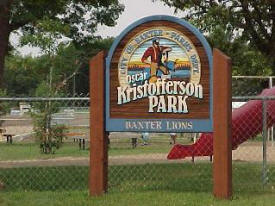
Oscar Kristofferson (Baxter) Park Oscar
Kristofferson Park is located at 5672 Baxter Lions Rd (behind
Baxter Elementary School)and is also called Baxter City Park.
There is a Pavilion with kitchen for picnic use that may be used
and reserved by calling Baxter City Hall at 218-454-5100 or by
filling out the form below. The Park contains four ball fields,
hockey and open skating rink. |
 |
Lakes:
|
Lake Name |
Size
(acres) |
Lake info |
Lake Map |
Rec Map |
Topo Map |
| Bass |
n/a |
|
|
 |
|
| Gull |
|
|
|
|
|
| Hardy |
n/a |
|
|
|
|
| Island |
n/a |
|
|
|
|
| Mile |
n/a |
|
|
|
|
| Moberg |
n/a |
|
|
|
|
| Mud |
n/a |
|
|
|
|
| North Long Lake |
5998 |
|
|
|
|
| Perch |
270 |
|
|
|
|
| Red Sand |
502 |
|
|
|
|
| Round |
n/a |
|
|
|
|
|
Sylvan |
n/a |
|
|
|
|
| Whipple |
410 |
|
|
|
|
| White Sand |
368 |
|
|
|
|
Health
Care:
Brainerd Lakes Surgery Center
13114 Isle Drive
Baxter, MN 56425
Phone: (218) 822-2400
Toll Free: (866) 863-2400
Fax: (218) 822-2401 |
|
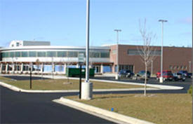
Schools:
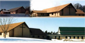
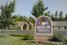
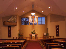
Churches:
Media:
|
Newspapers |
| Daily |
Brainerd Dispatch
506 James Street
PO Box 974
Brainerd, MN 56401
Phone: (218) 829-4705
Fax: (218) 829-7735
Web:
www.brainerddispatch.com
Published six days a week, the Brainerd
dispatch has a Monday through Friday circulation of 13,578
and a Sunday circulation of 18,576. |
 |
|
Radio |
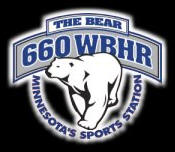
| 660
Listen |
WBHR-AM - "660 The Bear"
1010 2nd Street N
PO Box 366
Sauk Rapids, MN 56379
Phone: (320) 257-6403
Web: www.660wbhr.com
Power: Day: 10,000 watts Night: 500 watts
Format: Sports
Affiliations: ESPN Radio, Cubs |
 |
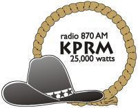
| 870 |
KPRM-AM - "Clear
Channel 870"
PO Box 49
Highway 34 East
Park Rapids, MN
Phone:
(218) 732-3306
Fax: (218) 732-3307
Web:
www.kkradionetwork.com
Power: Day: 25,000 watts Night:
1,000 wattsFormat: Country,
Talk
Affiliations: CBS/LFN, R Limbaugh 11a-2p, Vikings |
 |
| 930 |
KKIN-AM - "Music of Your
Life"
PO Box 140
Aitkin, MN 56431
Phone: (218) 927-2100
Fax: (218) 927-4090
Web: www.kkinradio.com
Power: Day: 2500 watts Night: 360 watts
Format: Soft Oldies
Affiliations: AP/MNN, Dial Global Adult Standards
format (local 6-9 a.m.), Twins |
 |
| 960
Listen |
KLTF-AM - "AM 960"
70 1st Avenue NE
Little Falls, MN 56345
Phone: (320) 632-5414
Fax: (320) 632-2571
Web: www.fallsradio.com
Power: Day: 5000 watts Night: 38 watts
Format: News/Talk/Sports
Affiliations: SRN/MNN/LFN, C Swindoll 5-6a, D
Prager 11a-Noon & 1-2p, S Hannity 2-4p, M Medved 5-8p, H
Hewitt 8-9p, M Levin 9-11p, FOX Sports 11p-5a |
 |
| 1070 |
KVKK-AM - "True
1070" - Country
PO Box 49
Park Rapids, MN 56470 (licensed to Verndale)
Phone: (218) 732-3306
Web:
www.kkradionetwork.com
Power: Day: 10,000 watts Night:
5,000 wattsFormat: Country,
Talk
Affiliations: CBS, Dial Global True Country format, R
Limbaugh 11a-2p |
 |
| 1270 |
WWWI-AM - "3WI - Radio
For Your Brain"
305 W Washington Street
Brainerd, MN 56401 (licensed to Baxter)
Phone: (218) 828-9994
Fax: (218) 828-8327
Web: www.3wiradio.com
Power: Day: 5000 watts Night: 5000 watts
Format: News/Talk
Affiliations: CBS, Dr. Laura 9-11a & 5p, R Limbaugh
11a-2p, E Schultz 2-5p, J Lewis 6-9p, J Doyle 9p-Mid,
Coast-to-Coast Mid-6a, Twins, Timberwolves, Gophers |
 |
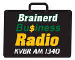
| 1340 |
KVBR-AM -
"Brainerd Business Radio"
PO Box 980
Brainerd, MN 56401
Phone: (218) 829-2853
Fax: (218) 829-6983
Web:
www.brainerdradio.net/kvbr
Power: Day: 1000 watts Night: 1000 watts
Format: News/Talk
Affiliations: IRN-USA |
 |
| 1380 |
KLIZ-AM - "The
Fan"
602 Laurel Street
Brainerd, MN 56401
Phone: (218) 829-2853
Fax: (218) 829-6983
Web:
www.brainerdradio.net/fan
Power: Day: 5000 watts Night: 5000 watts
Format: Sports
Affiliations: FAN Network 6a-7p, Sporting News Radio,
Twins |
 |
| 88.3
Listen |
KBPN-FM - "MPR News"
PO Box 7011
Collegeville, MN 56321
Phone: (320) 363-7702
Fax: (320) 363-4948
Web:
minnesota.publicradio.org
Power: 5,000 wattsFormat: News/Talk
Affiliations: NPR, MPR News/Talk network: ME 4-9a,
TOTN 1p, ATC 3-6:30p, Marketplace 6:30p, The World 7p, Fresh
Air 8p, As It Happens 10p, BBC 11p-4a |
 |
| 88.9
Listen |
KNSR-FM - "MPR News"
PO Box 7011
Collegeville, MN 56321
Phone: (320) 363-7702
Fax: (320) 363-4948
Web:
minnesota.publicradio.org
Power: 100,000 wattsFormat:
News/Talk
Affiliations: NPR, MPR News/Talk network: ME 4-9a,
TOTN 1p, ATC 3-6:30p, Marketplace 6:30p, The World 7p, Fresh
Air 8p, As It Happens 10p, BBC 11p-4a |
|
| 89.3
Listen |
KOPJ-FM - "Lifetalk Radio"
200 Main Avenue S
Park Rapids, MN 56470
Phone: (218) 237-4673
Web: www.kopj.org
Power: 100,000 wattsFormat:
Christian
Affiliations: LifeTalk Radio Network |
 |
| 89.9
Listen |
KAXE-FM - "Northern Community
Radio"
260 NE 2nd Street
Grand Rapids, MN 55744
Phone: (218) 326-1234
Fax: (218) 326-1235
Web: www.kaxe.org
Power: 115 watts (low power translator station)
Format: News, Blues, Folk, Jazz
Affiliations: NPR, Morning Edition 5-9a, World Cafe
1-3p & 1-3a, All Things Considered 4-5:30p, As It Happens
5:30p |
 |
| 90.1
Listen |
KSJR-FM - MPR Classical
PO Box 7011
Collegeville, MN 56321
Phone: (320) 363-7702
Fax: (320) 363-4948
Web:
minnesota.publicradio.org
Power: 100,000 wattsFormat:
Classical
Affiliations: NPR, MPR Classical network |
|
| 90.7
Listen |
KBPR-FM - MPR Classical
PO Box 7011
Collegeville, MN 56321
Phone: (320) 363-7702
Fax: (320) 363-4948
Web:
minnesota.publicradio.org
Power: 34,000 wattsFormat: Classical
Affiliations: NPR, MPR Classical network |
|
| 91.1
Listen |
WJRF-FM - Refuge Radio
4604 Airpark Blvd
Duluth, MN 55811-5751
Phone: (218) 722-3017
Toll Free: (866) 722-3017
Web:
www.refugeradio.com
Power: 140 watts (low power translator station)
Format: Contemporary Christian
Affiliations: n/a |
 |
| 93.3 |
KBLB-FM - "B93.3"
13225 Dogwood Drive
Baxter, MN 56425 (licensed to Nisswa, MN)
Phone: (218) 828-1244
Fax: (218) 828-1119
Web:
www.todaysbestcountry.com
Power: 100,000 wattsFormat:
Country
Affiliations: ABCi, Vikings |
 |
| 93.7
Listen |
KDNW-FM - "Radio For
Life"
3003 N Snelling Avenue
St. Paul, MN 55113
Phone: (218) 722-6700
Fax: (218) 722-1092
Web: kdnw.nwc.edu
Power: 27 watts (low power translator station)
Format: Adult Contemporary Christian
Affiliations: Northwestern College Radio Network |
 |
| 94.3 |
KKIN-FM - "K94-3 FM"
PO Box 140
Aitkin, MN 56431
Phone: (218) 927-2100
Fax: (218) 927-4090
Web: www.kkinradio.com
Power: 14,200 wattsFormat: Classic
Country
Affiliations: AP/MNN, Dial Global Classic Country
format, Vikings, Twins |
|
| 94.7
Listen |
KSKK-FM -
"Continuous Soft Hits"
PO Box 49
Highway 34 East
Park Rapids, MN 56470 (licensed to Staples MN)
Phone: (218) 631-3441
Fax: (218) 631-3414
Web:
www.kkradionetwork.com
Power: 50,000 wattsFormat: Adult
Contemporary
Affiliations: CBS, Dial Global Adult Contemporary
format, Vikings |
 |
| 95.9
Listen |
WWWI-AM - "3WI - Radio
For Your Brain"
305 W Washington Street
Brainerd, MN 56401 (licensed to Pillager)
Phone: (218) 828-9994
Fax: (218) 828-8327
Web: www.3wiradio.com
Power: 6,000 wattsFormat: News/Talk
Affiliations: CBS, Duke & Doctor 9a, L Ingraham 10a, G
Beck 11a-1p, D Ramsey 1-2p, J Soucheray 2-5p, M Savage 5-8p,
D Miller 8-9p, J Doyle 9p-Mid, Coast-to-Coast Mid-6a |
|
| 96.7
Listen |
KZRV-FM - "Modern Rock Revolution"
640 SE Lincoln Avenue
St. Cloud, MN 56304
Studio line: (320) 258-3REV (3738)
Office line: (320) 251-4422
Web: www.rev967.com
Power: 50,000 wattsFormat:
Modern Rock
Affiliations: n/a |
 |
| 98.1
Listen |
WWJO-FM - "98 Country"
640 SE Lincoln Avenue
St. Cloud, MN 56304
Studio line: (320) 252-9897
Office line: (320) 251-4422
Web:
www.98country.com
Power: 97,000 wattsFormat:
Country
Affiliations: ABCe/MNN |
 |
| 100.1
Listen |
WZFJ-FM - "The Pulse"
PO Box 409
Pequot Lakes, MN 56472
Phone: (218) 568-6872
Web:
www.100thepulse.org
Power: 5,200 wattsFormat: Christian
Hits
Affiliations: SRN |
 |
| 101.5 |
KFGI-FM - "KQ
101.5"
510 D Street NE
Brainerd, MN 56401
Phone: (800) 409-1015
Web:
www.kkinradio.com/ncfm.html
Power: 25,000 wattsFormat: Classic
Rock
Affiliations: n/a |
|
| 102.7
Listen |
KTIG-FM - "Making a
Difference"
PO Box 409
Pequot Lakes, MN 56472
Phone: (218) 568-6872
Web: www.ktig.org
Power: 40,000 wattsFormat: Christian
Affiliations: Minnesota Christian Broadcasters Inc. |
 |
| 103.5 |
KUAL-FM - "Good Time
Oldies"
13225 Dogwood Drive
Baxter, MN 56425 (licensed to Nisswa, MN)
Phone: (218) 828-1244
Fax: (218) 828-1119
Web:
www.cool1035.com
Power: 100,000 wattsFormat:
Oldies
Affiliations: ABCi |
 |
| 104.3
Listen |
KLKS-FM - "Radio for the
Lakes Area"
PO Box 300
Breezy Point, MN 56472
Phone: (218) 562-4884
Fax: (218) 562-4058
Web: www.klks.com
Power: 50,000 wattsFormat: Easy
Listening/Big Band/Swing
Affiliations: CNN |
 |
| 104.7
Listen |
KCLD-FM - "Today's Hit
Music"
619 W St. Germain
Street
St. Cloud, MN 56302
Studio Line: (320)
251-1047
Business Line: (320)
251-1450
Fax: (320)
251-8952
Web: www.1047kcld.com
Power: 100,000 wattsFormat:
Affiliations: |
 |
| 105.9 |
KKWS-FM -
"Superstation K106"
201 1/2 S Jefferson Street
PO Box 551
Wadena, MN 56482
Phone: (218) 631-1903
Fax: (218) 631-4557
Web:
www.superstationk106.com
Power: 100,000 wattsFormat:
Country
Affiliations: ABCe/RRFN |
 |
| 106.7 |
WJJY-FM - "The Best
Variety of the 80s, 90s and Today"
13225 Dogwood Drive
Baxter, MN 56425
Phone: (218) 828-1244
Fax: (218) 828-1119
Web:
www.1067wjjy.com
Power: 100,000 wattsFormat:
Adult Contemporary
Affiliations: ABCi |
 |
| 107.5 |
KLIZ-FM - "The Power Loon"
13225 Dogwood Drive
Baxter, MN 56425
Phone: (218) 828-1244
Fax: (218) 828-1119
Web:
www.theloon.com
Power: 100,000 wattsFormat:
Rock
Affiliations: ABCi |
 |
|
Television |
| 12.1 |
KCCW-TV
Simulcasts WCCO-TV
90 S 11th Street
Minneapolis, MN 55403
Phone: (612) 339-4444
Toll Free: (800) 444-WCCO
Web:
www.wcco.com |
 |
| 22.1 |
KAWB-TV -
PBS
422 NW 3rd Street
Brainerd, MN 56401
Phone: (218) 855-0022
Toll Free: (888) 292-0922
Fax: (218) 855-00024
Web: www.lptv.org |
 |
Motels:
Country Inn
and Suites
15058 Dellwood Drive
Baxter, MN 56425
Phone: (218) 828-2161
Toll Free: (800) 456-4000
Fax: (218) 825-8419
Web:
www.countryinns.com
With its charming décor and comfortable
amenities, the Baxter Hotel, conveniently located in Baxter
close to shopping and dining, provides a warm and welcoming
atmosphere sure to please business and leisure travelers alike. |
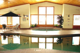 |
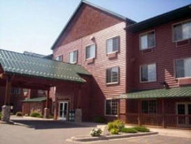
Hawthorn Inn & Suites
7208 Fairview Road
Baxter, MN 56425
Phone: (218) 822-1133
Toll Free: (800) 527-1133
Fax: (218) 822-3923
Web:
www.hawthorn.com
Amenities available at the hotel include an
indoor pool, whirlpool, kiddie pool and sauna. Overlooking the
pool you will find our fitness room. You can also relax on our
outdoor poolside patio equipped with gas grills. |
 |
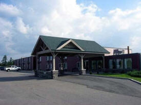
Holiday Inn Express Hotel &
Suites
15739 Audubon Way
Baxter, MN 56425
Phone: (218) 824-3232 ·
Toll Free: (888) 824-3232
Fax: (218) 828-2003
Web:
www.brainerdhi.com
Brainerd-Baxter Lakes Area - Holiday Inn
Express Hotel & Suites features the
Three
Bear Waterpark all of our 98 hotel rooms are tastefully
decorated around an "up-North" feel - From microwaves and
refrigerators to our granite counter tops in every room, we have
gone out of our way to be the most comfortable hotel away from
home! |

 |
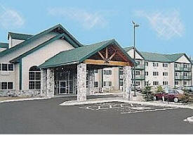
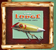
Lodge at Brainerd
Lakes
6967 Lake Forest Road
Baxter, MN 56425
(218) 822-5634
(877) THE-LODGE
Fax: (218) 822-4044
Web:
www.lodgehotelsbrainerd.com
The Lodge at Brainerd Lakes in northern
Minnesota offers a natural rustic style in the four-story,
102-room modern luxury lodge and resort. Our Brainerd hotel is
home to the Paul Bunyan Water Park and the Rockwoods Grill. Plan
your stay with us whether you're looking for a family vacation,
romantic getaway, or traveling for business or having a
conference. |
 |
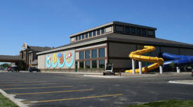
Rapid River Lodge -
Comfort Suites
7376 Woida Road
Baxter, MN 56425
Phone: (218) 825-7234
Toll Free: (877) 543-8938
Fax: (218) 829-3738
Web:
www.rapidriverlodge.com
Northern
Minnesota's most unique hotel. A huge indoor water park boast
two 240 foot waterslides and a lazy river complete with a
waterfall and rapids. The kiddy pool is a spectacular array of
slides, water features, and even a tree fort that children are
simply enchanted with. An indoor/outdoor whirlpool, sauna, and
video arcade will compliment your experience. Their exercise
rooms include new Life Fitness and Precor treadmills, their
recumbent bike and elliptical walker. Business guests will
appreciate free, high-speed internet in all rooms.
|

 |
Rodeway Inn
7836 Fairview Road
Baxter, MN 56425
Phone: (218) 829-0391
Toll Free: (800) 4CHOICE
Web:
www.rodewayinn.com
Come and enjoy one of our clean and
comfortable rooms. Each comes with cable television and work
desks. We also have fax and copy service available. Kids stay
free with an adult, free local phone calls and Complimentary
Continental Breakfast. |
 |
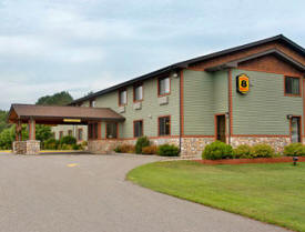
Super 8 Motel
14341 Edgewood Drive
Baxter, MN 56425
Phone: (218) 828-4288
Toll Free: (800) 800-8000
Fax: (218) 825-0857
Web:
www.super8.com
Super 8 National Award Winner. Great breakfast
with make-your-own waffles and more. Pets Allowed. Microwave,
refrigerator, and coffee pots. Highspeed internet. Large truck
parking, outside outlets. |
 |
Resorts:
|
none in Baxter - see
Brainerd for area
resort listings |
Campgrounds:
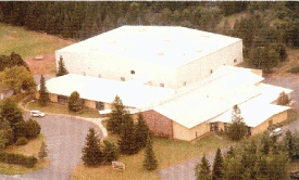
Businesses:
|
Brainerd/Baxter Business Guide is Coming Soon!
|
Aerial Photo:
Topographic Map:
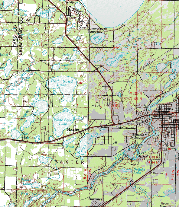
Topographic map is courtesy of the Minnesota DNR
-
click map to zoom or enlarge |
|